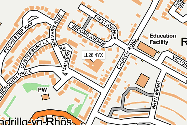
LL28 4YX is located in the Llandrillo-yn-Rhos electoral ward, within the unitary authority of Conwy and the Welsh Parliamentary constituency of Clwyd West. The Local Health Board is Betsi Cadwaladr University and the police force is North Wales. This postcode has been in use since June 1997.


GetTheData
Source: OS OpenMap – Local (Ordnance Survey)
Source: OS VectorMap District (Ordnance Survey)
Licence: Open Government Licence (requires attribution)
| Easting | 283367 |
| Northing | 380749 |
| Latitude | 53.310794 |
| Longitude | -3.752012 |
GetTheData
Source: Open Postcode Geo
Licence: Open Government Licence
| Country | Wales |
| Postcode District | LL28 |
➜ See where LL28 is on a map ➜ Where is Colwyn Bay? | |
GetTheData
Source: Land Registry Price Paid Data
Licence: Open Government Licence
Elevation or altitude of LL28 4YX as distance above sea level:
| Metres | Feet | |
|---|---|---|
| Elevation | 20m | 66ft |
Elevation is measured from the approximate centre of the postcode, to the nearest point on an OS contour line from OS Terrain 50, which has contour spacing of ten vertical metres.
➜ How high above sea level am I? Find the elevation of your current position using your device's GPS.
GetTheData
Source: Open Postcode Elevation
Licence: Open Government Licence
| Ward | Llandrillo-yn-rhos |
| Constituency | Clwyd West |
GetTheData
Source: ONS Postcode Database
Licence: Open Government Licence
| Church Road Middle (Church Road) | Llandrillo-yn-rhos | 100m |
| School (Church Road) | Llandrillo-yn-rhos | 104m |
| Ship Hotel (Church Road) | Llandrillo-yn-rhos | 163m |
| Ship Hotel (Church Road) | Llandrillo-yn-rhos | 185m |
| Ship Hotel (Llandudno Road) | Llandrillo-yn-rhos | 217m |
| Colwyn Bay Station | 2.4km |
| Llandudno Junction Station | 4.8km |
| Llandudno Station | 5.1km |
GetTheData
Source: NaPTAN
Licence: Open Government Licence
GetTheData
Source: ONS Postcode Database
Licence: Open Government Licence


➜ Get more ratings from the Food Standards Agency
GetTheData
Source: Food Standards Agency
Licence: FSA terms & conditions
| Last Collection | |||
|---|---|---|---|
| Location | Mon-Fri | Sat | Distance |
| Whitehall Road | 17:20 | 11:30 | 655m |
| Foreshore Park | 17:00 | 12:00 | 702m |
| Llandrillo Yn Rhos | 17:20 | 12:00 | 863m |
GetTheData
Source: Dracos
Licence: Creative Commons Attribution-ShareAlike
The below table lists the International Territorial Level (ITL) codes (formerly Nomenclature of Territorial Units for Statistics (NUTS) codes) and Local Administrative Units (LAU) codes for LL28 4YX:
| ITL 1 Code | Name |
|---|---|
| TLL | Wales |
| ITL 2 Code | Name |
| TLL1 | West Wales and The Valleys |
| ITL 3 Code | Name |
| TLL13 | Conwy and Denbighshire |
| LAU 1 Code | Name |
| W06000003 | Conwy |
GetTheData
Source: ONS Postcode Directory
Licence: Open Government Licence
The below table lists the Census Output Area (OA), Lower Layer Super Output Area (LSOA), and Middle Layer Super Output Area (MSOA) for LL28 4YX:
| Code | Name | |
|---|---|---|
| OA | W00000826 | |
| LSOA | W01000158 | Conwy 004D |
| MSOA | W02000030 | Conwy 004 |
GetTheData
Source: ONS Postcode Directory
Licence: Open Government Licence
| LL28 4YS | Church Road | 71m |
| LL28 4LZ | Second Avenue | 72m |
| LL28 4RQ | Marlborough Drive | 87m |
| LL28 4RX | Malvern Rise | 117m |
| LL28 4DQ | First Avenue | 133m |
| LL28 4BJ | Maes Glas | 151m |
| LL28 4RJ | Marlborough Drive | 183m |
| LL28 4YU | Bryn Eglwys | 199m |
| LL28 4UD | Llandudno Road | 210m |
| LL28 4RZ | Canterbury Lane | 218m |
GetTheData
Source: Open Postcode Geo; Land Registry Price Paid Data
Licence: Open Government Licence