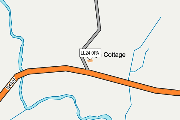
LL24 0PA is located in the Uwch Conwy electoral ward, within the unitary authority of Conwy and the Welsh Parliamentary constituency of Aberconwy. The Local Health Board is Betsi Cadwaladr University and the police force is North Wales. This postcode has been in use since January 1980.


GetTheData
Source: OS OpenMap – Local (Ordnance Survey)
Source: OS VectorMap District (Ordnance Survey)
Licence: Open Government Licence (requires attribution)
| Easting | 278096 |
| Northing | 344658 |
| Latitude | 52.985351 |
| Longitude | -3.817334 |
GetTheData
Source: Open Postcode Geo
Licence: Open Government Licence
| Country | Wales |
| Postcode District | LL24 |
➜ See where LL24 is on a map | |
GetTheData
Source: Land Registry Price Paid Data
Licence: Open Government Licence
Elevation or altitude of LL24 0PA as distance above sea level:
| Metres | Feet | |
|---|---|---|
| Elevation | 440m | 1,444ft |
Elevation is measured from the approximate centre of the postcode, to the nearest point on an OS contour line from OS Terrain 50, which has contour spacing of ten vertical metres.
➜ How high above sea level am I? Find the elevation of your current position using your device's GPS.
GetTheData
Source: Open Postcode Elevation
Licence: Open Government Licence
| Ward | Uwch Conwy |
| Constituency | Aberconwy |
GetTheData
Source: ONS Postcode Database
Licence: Open Government Licence
| Percentage of properties with Next Generation Access | 0.0% |
| Percentage of properties with Superfast Broadband | 0.0% |
| Percentage of properties with Ultrafast Broadband | 0.0% |
| Percentage of properties with Full Fibre Broadband | 0.0% |
Superfast Broadband is between 30Mbps and 300Mbps
Ultrafast Broadband is > 300Mbps
| Percentage of properties unable to receive 2Mbps | 0.0% |
| Percentage of properties unable to receive 5Mbps | 0.0% |
| Percentage of properties unable to receive 10Mbps | 0.0% |
| Percentage of properties unable to receive 30Mbps | 0.0% |
GetTheData
Source: Ofcom
Licence: Ofcom Terms of Use (requires attribution)
GetTheData
Source: ONS Postcode Database
Licence: Open Government Licence
| Last Collection | |||
|---|---|---|---|
| Location | Mon-Fri | Sat | Distance |
| Cwm | 10:00 | 10:00 | 3,715m |
GetTheData
Source: Dracos
Licence: Creative Commons Attribution-ShareAlike
The below table lists the International Territorial Level (ITL) codes (formerly Nomenclature of Territorial Units for Statistics (NUTS) codes) and Local Administrative Units (LAU) codes for LL24 0PA:
| ITL 1 Code | Name |
|---|---|
| TLL | Wales |
| ITL 2 Code | Name |
| TLL1 | West Wales and The Valleys |
| ITL 3 Code | Name |
| TLL13 | Conwy and Denbighshire |
| LAU 1 Code | Name |
| W06000003 | Conwy |
GetTheData
Source: ONS Postcode Directory
Licence: Open Government Licence
The below table lists the Census Output Area (OA), Lower Layer Super Output Area (LSOA), and Middle Layer Super Output Area (MSOA) for LL24 0PA:
| Code | Name | |
|---|---|---|
| OA | W00001011 | |
| LSOA | W01000189 | Conwy 015F |
| MSOA | W02000041 | Conwy 015 |
GetTheData
Source: ONS Postcode Directory
Licence: Open Government Licence
| LL24 0RE | Carrog Terrace | 3410m |
| LL24 0RD | Beniarth Terrace | 3460m |
| LL24 0RG | 3597m | |
| LL24 0RH | Dyfnant Terrace | 3707m |
| LL24 0RB | 3729m | |
| LL24 0RT | Bryn | 3769m |
| LL24 0RS | 3783m | |
| LL24 0RL | 3794m | |
| LL24 0RN | 3839m | |
| LL24 0RP | Ddol Terrace | 3847m |
GetTheData
Source: Open Postcode Geo; Land Registry Price Paid Data
Licence: Open Government Licence