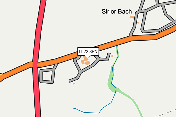
LL22 8PN is located in the Betws-yn-Rhos electoral ward, within the unitary authority of Conwy and the Welsh Parliamentary constituency of Clwyd West. The Local Health Board is Betsi Cadwaladr University and the police force is North Wales. This postcode has been in use since January 1980.


GetTheData
Source: OS OpenMap – Local (Ordnance Survey)
Source: OS VectorMap District (Ordnance Survey)
Licence: Open Government Licence (requires attribution)
| Easting | 293767 |
| Northing | 373984 |
| Latitude | 53.252215 |
| Longitude | -3.593726 |
GetTheData
Source: Open Postcode Geo
Licence: Open Government Licence
| Country | Wales |
| Postcode District | LL22 |
➜ See where LL22 is on a map | |
GetTheData
Source: Land Registry Price Paid Data
Licence: Open Government Licence
Elevation or altitude of LL22 8PN as distance above sea level:
| Metres | Feet | |
|---|---|---|
| Elevation | 160m | 525ft |
Elevation is measured from the approximate centre of the postcode, to the nearest point on an OS contour line from OS Terrain 50, which has contour spacing of ten vertical metres.
➜ How high above sea level am I? Find the elevation of your current position using your device's GPS.
GetTheData
Source: Open Postcode Elevation
Licence: Open Government Licence
| Ward | Betws-yn-rhos |
| Constituency | Clwyd West |
GetTheData
Source: ONS Postcode Database
Licence: Open Government Licence
| Sirior Bach Caravan Park (A548) | Moelfre | 174m |
| Sirior Bach Caravan Park (A548) | Moelfre | 180m |
| Ysbyty Abergele (Moelfre Path) | Fforddlas-ganol | 1,727m |
| Abergele & Pensarn Station | 4.8km |
GetTheData
Source: NaPTAN
Licence: Open Government Licence
GetTheData
Source: ONS Postcode Database
Licence: Open Government Licence


➜ Get more ratings from the Food Standards Agency
GetTheData
Source: Food Standards Agency
Licence: FSA terms & conditions
| Last Collection | |||
|---|---|---|---|
| Location | Mon-Fri | Sat | Distance |
| Penrefail | 15:30 | 11:00 | 218m |
| Bryn Castell | 16:45 | 11:00 | 2,686m |
| Lon Dirion | 16:45 | 11:00 | 2,784m |
GetTheData
Source: Dracos
Licence: Creative Commons Attribution-ShareAlike
The below table lists the International Territorial Level (ITL) codes (formerly Nomenclature of Territorial Units for Statistics (NUTS) codes) and Local Administrative Units (LAU) codes for LL22 8PN:
| ITL 1 Code | Name |
|---|---|
| TLL | Wales |
| ITL 2 Code | Name |
| TLL1 | West Wales and The Valleys |
| ITL 3 Code | Name |
| TLL13 | Conwy and Denbighshire |
| LAU 1 Code | Name |
| W06000003 | Conwy |
GetTheData
Source: ONS Postcode Directory
Licence: Open Government Licence
The below table lists the Census Output Area (OA), Lower Layer Super Output Area (LSOA), and Middle Layer Super Output Area (MSOA) for LL22 8PN:
| Code | Name | |
|---|---|---|
| OA | W00000646 | |
| LSOA | W01000122 | Conwy 014A |
| MSOA | W02000040 | Conwy 014 |
GetTheData
Source: ONS Postcode Directory
Licence: Open Government Licence
| LL22 8PB | Llanfair Road | 536m |
| LL22 9RE | 906m | |
| LL22 8PD | Llanfair Road | 1019m |
| LL22 8AB | 1146m | |
| LL22 8PL | 1193m | |
| LL22 9PY | 1568m | |
| LL22 8DW | Llanfair Road | 1654m |
| LL22 9RF | 1659m | |
| LL22 9RH | 1687m | |
| LL22 8EF | Y Nentydd | 1751m |
GetTheData
Source: Open Postcode Geo; Land Registry Price Paid Data
Licence: Open Government Licence