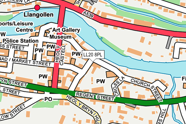
LL20 8PL is located in the Llangollen electoral ward, within the unitary authority of Denbighshire and the Welsh Parliamentary constituency of Clwyd South. The Local Health Board is Betsi Cadwaladr University and the police force is North Wales. This postcode has been in use since January 1980.


GetTheData
Source: OS OpenMap – Local (Ordnance Survey)
Source: OS VectorMap District (Ordnance Survey)
Licence: Open Government Licence (requires attribution)
| Easting | 321614 |
| Northing | 342015 |
| Latitude | 52.969739 |
| Longitude | -3.168636 |
GetTheData
Source: Open Postcode Geo
Licence: Open Government Licence
| Country | Wales |
| Postcode District | LL20 |
➜ See where LL20 is on a map ➜ Where is Llangollen? | |
GetTheData
Source: Land Registry Price Paid Data
Licence: Open Government Licence
Elevation or altitude of LL20 8PL as distance above sea level:
| Metres | Feet | |
|---|---|---|
| Elevation | 80m | 262ft |
Elevation is measured from the approximate centre of the postcode, to the nearest point on an OS contour line from OS Terrain 50, which has contour spacing of ten vertical metres.
➜ How high above sea level am I? Find the elevation of your current position using your device's GPS.
GetTheData
Source: Open Postcode Elevation
Licence: Open Government Licence
| Ward | Llangollen |
| Constituency | Clwyd South |
GetTheData
Source: ONS Postcode Database
Licence: Open Government Licence
| War Memorial (Castle Street) | Llangollen | 119m |
| Royal Hotel (Castle Street) | Llangollen | 149m |
| Parade Street | Llangollen | 154m |
| Parade Street | Llangollen | 166m |
| Bridge End Hotel (A542) | Llangollen | 169m |
| Llangollen (Llangollen Railway) | Llangollen | 266m |
GetTheData
Source: NaPTAN
Licence: Open Government Licence
GetTheData
Source: ONS Postcode Database
Licence: Open Government Licence


➜ Get more ratings from the Food Standards Agency
GetTheData
Source: Food Standards Agency
Licence: FSA terms & conditions
| Last Collection | |||
|---|---|---|---|
| Location | Mon-Fri | Sat | Distance |
| Chapel Street | 17:15 | 11:30 | 125m |
| Castle Street | 17:15 | 11:30 | 132m |
| Llangollen Post Office | 17:30 | 12:00 | 142m |
GetTheData
Source: Dracos
Licence: Creative Commons Attribution-ShareAlike
The below table lists the International Territorial Level (ITL) codes (formerly Nomenclature of Territorial Units for Statistics (NUTS) codes) and Local Administrative Units (LAU) codes for LL20 8PL:
| ITL 1 Code | Name |
|---|---|
| TLL | Wales |
| ITL 2 Code | Name |
| TLL1 | West Wales and The Valleys |
| ITL 3 Code | Name |
| TLL13 | Conwy and Denbighshire |
| LAU 1 Code | Name |
| W06000004 | Denbighshire |
GetTheData
Source: ONS Postcode Directory
Licence: Open Government Licence
The below table lists the Census Output Area (OA), Lower Layer Super Output Area (LSOA), and Middle Layer Super Output Area (MSOA) for LL20 8PL:
| Code | Name | |
|---|---|---|
| OA | W00001114 | |
| LSOA | W01000208 | Denbighshire 016C |
| MSOA | W02000057 | Denbighshire 016 |
GetTheData
Source: ONS Postcode Directory
Licence: Open Government Licence
| LL20 8NW | Chapel Street | 14m |
| LL20 8PF | Bridge Street | 52m |
| LL20 8NR | Oak Street | 82m |
| LL20 8NN | Chapel Street | 85m |
| LL20 8NP | Chapel Street Square | 86m |
| LL20 8NS | Gwalia Terrace | 91m |
| LL20 8HL | Regent Street | 92m |
| LL20 8NY | Castle Street | 107m |
| LL20 8PG | Bridge Street | 121m |
| LL20 8RU | Castle Street | 122m |
GetTheData
Source: Open Postcode Geo; Land Registry Price Paid Data
Licence: Open Government Licence