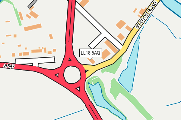
LL18 5AQ is located in the Rhuddlan electoral ward, within the unitary authority of Denbighshire and the Welsh Parliamentary constituency of Vale of Clwyd. The Local Health Board is Betsi Cadwaladr University and the police force is North Wales. This postcode has been in use since January 2010.


GetTheData
Source: OS OpenMap – Local (Ordnance Survey)
Source: OS VectorMap District (Ordnance Survey)
Licence: Open Government Licence (requires attribution)
| Easting | 301953 |
| Northing | 377876 |
| Latitude | 53.288765 |
| Longitude | -3.472277 |
GetTheData
Source: Open Postcode Geo
Licence: Open Government Licence
| Country | Wales |
| Postcode District | LL18 |
➜ See where LL18 is on a map ➜ Where is Rhuddlan? | |
GetTheData
Source: Land Registry Price Paid Data
Licence: Open Government Licence
Elevation or altitude of LL18 5AQ as distance above sea level:
| Metres | Feet | |
|---|---|---|
| Elevation | 10m | 33ft |
Elevation is measured from the approximate centre of the postcode, to the nearest point on an OS contour line from OS Terrain 50, which has contour spacing of ten vertical metres.
➜ How high above sea level am I? Find the elevation of your current position using your device's GPS.
GetTheData
Source: Open Postcode Elevation
Licence: Open Government Licence
| Ward | Rhuddlan |
| Constituency | Vale Of Clwyd |
GetTheData
Source: ONS Postcode Database
Licence: Open Government Licence
| Marsh Warden (Station Road) | Rhuddlan | 129m |
| Marsh Warden (Station Road) | Rhuddlan | 144m |
| Parliament House (Station Road) | Rhuddlan | 360m |
| Kings Head (Princes Road) | Rhuddlan | 585m |
| Vicarage Lane (Rhyl Road) | Rhuddlan | 624m |
| Rhyl Station | 3.5km |
GetTheData
Source: NaPTAN
Licence: Open Government Licence
GetTheData
Source: ONS Postcode Database
Licence: Open Government Licence


➜ Get more ratings from the Food Standards Agency
GetTheData
Source: Food Standards Agency
Licence: FSA terms & conditions
| Last Collection | |||
|---|---|---|---|
| Location | Mon-Fri | Sat | Distance |
| St Margarets Drive | 17:15 | 11:00 | 751m |
| Cwm Road | 17:15 | 09:00 | 3,908m |
| St Asaph Business Park | 16:45 | 10:30 | 3,941m |
GetTheData
Source: Dracos
Licence: Creative Commons Attribution-ShareAlike
The below table lists the International Territorial Level (ITL) codes (formerly Nomenclature of Territorial Units for Statistics (NUTS) codes) and Local Administrative Units (LAU) codes for LL18 5AQ:
| ITL 1 Code | Name |
|---|---|
| TLL | Wales |
| ITL 2 Code | Name |
| TLL1 | West Wales and The Valleys |
| ITL 3 Code | Name |
| TLL13 | Conwy and Denbighshire |
| LAU 1 Code | Name |
| W06000004 | Denbighshire |
GetTheData
Source: ONS Postcode Directory
Licence: Open Government Licence
The below table lists the Census Output Area (OA), Lower Layer Super Output Area (LSOA), and Middle Layer Super Output Area (MSOA) for LL18 5AQ:
| Code | Name | |
|---|---|---|
| OA | W00001202 | |
| LSOA | W01000223 | Denbighshire 009B |
| MSOA | W02000050 | Denbighshire 009 |
GetTheData
Source: ONS Postcode Directory
Licence: Open Government Licence
| LL18 5UB | Marsh Road | 114m |
| LL18 5UA | Station Road | 165m |
| LL18 2UU | Tan Yr Eglwys Road | 326m |
| LL18 2UY | Pen Y Bont | 352m |
| LL18 2UD | Vale View | 364m |
| LL18 2UT | Tan Yr Eglwys Road | 368m |
| LL18 2YA | Church Street | 379m |
| LL18 2UB | High Street | 416m |
| LL18 2TY | High Street | 419m |
| LL18 5AB | Castle Street | 421m |
GetTheData
Source: Open Postcode Geo; Land Registry Price Paid Data
Licence: Open Government Licence