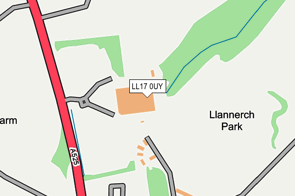
LL17 0UY is located in the Trefnant electoral ward, within the unitary authority of Denbighshire and the Welsh Parliamentary constituency of Vale of Clwyd. The Local Health Board is Betsi Cadwaladr University and the police force is North Wales. This postcode has been in use since June 1997.


GetTheData
Source: OS OpenMap – Local (Ordnance Survey)
Source: OS VectorMap District (Ordnance Survey)
Licence: Open Government Licence (requires attribution)
| Easting | 304751 |
| Northing | 371936 |
| Latitude | 53.235899 |
| Longitude | -3.428538 |
GetTheData
Source: Open Postcode Geo
Licence: Open Government Licence
| Country | Wales |
| Postcode District | LL17 |
➜ See where LL17 is on a map | |
GetTheData
Source: Land Registry Price Paid Data
Licence: Open Government Licence
Elevation or altitude of LL17 0UY as distance above sea level:
| Metres | Feet | |
|---|---|---|
| Elevation | 50m | 164ft |
Elevation is measured from the approximate centre of the postcode, to the nearest point on an OS contour line from OS Terrain 50, which has contour spacing of ten vertical metres.
➜ How high above sea level am I? Find the elevation of your current position using your device's GPS.
GetTheData
Source: Open Postcode Elevation
Licence: Open Government Licence
| Ward | Trefnant |
| Constituency | Vale Of Clwyd |
GetTheData
Source: ONS Postcode Database
Licence: Open Government Licence
| Tweedmill Shopping Outlet (Grounds) | Hafod-y-green | 69m |
| Thatched Cottage (St Asaph Road) | Hafod-y-green | 194m |
| Llannerch Equestrian Centre (A525) | Hafod-y-green | 301m |
| Thatched Cottage (St Asaph Road) | Hafod-y-green | 339m |
| Bryn Polyn (St Asaph Road) | St Asaph | 597m |
GetTheData
Source: NaPTAN
Licence: Open Government Licence
GetTheData
Source: ONS Postcode Database
Licence: Open Government Licence


➜ Get more ratings from the Food Standards Agency
GetTheData
Source: Food Standards Agency
Licence: FSA terms & conditions
| Last Collection | |||
|---|---|---|---|
| Location | Mon-Fri | Sat | Distance |
| Nant Yr Patrick | 16:15 | 08:00 | 643m |
| Eryl | 16:15 | 08:00 | 1,412m |
| Foxtons | 17:00 | 11:00 | 2,502m |
GetTheData
Source: Dracos
Licence: Creative Commons Attribution-ShareAlike
The below table lists the International Territorial Level (ITL) codes (formerly Nomenclature of Territorial Units for Statistics (NUTS) codes) and Local Administrative Units (LAU) codes for LL17 0UY:
| ITL 1 Code | Name |
|---|---|
| TLL | Wales |
| ITL 2 Code | Name |
| TLL1 | West Wales and The Valleys |
| ITL 3 Code | Name |
| TLL13 | Conwy and Denbighshire |
| LAU 1 Code | Name |
| W06000004 | Denbighshire |
GetTheData
Source: ONS Postcode Directory
Licence: Open Government Licence
The below table lists the Census Output Area (OA), Lower Layer Super Output Area (LSOA), and Middle Layer Super Output Area (MSOA) for LL17 0UY:
| Code | Name | |
|---|---|---|
| OA | W00001327 | |
| LSOA | W01000247 | Denbighshire 010C |
| MSOA | W02000051 | Denbighshire 010 |
GetTheData
Source: ONS Postcode Directory
Licence: Open Government Licence
| LL17 0BE | Llannerch Crossing | 297m |
| LL17 0AZ | Llys Llannerch | 316m |
| LL17 0BZ | Llys Cerrig | 362m |
| LL17 0BG | Upper Denbigh Road | 387m |
| LL17 0BJ | Clwydian Park Crescent | 442m |
| LL17 0BL | Clwydian Avenue | 459m |
| LL17 0BX | Clwydian Park View | 522m |
| LL17 0BQ | Clwydian Park Avenue | 550m |
| LL17 0BN | Nant Y Patrick | 645m |
| LL17 0BD | Llannerch Park | 668m |
GetTheData
Source: Open Postcode Geo; Land Registry Price Paid Data
Licence: Open Government Licence