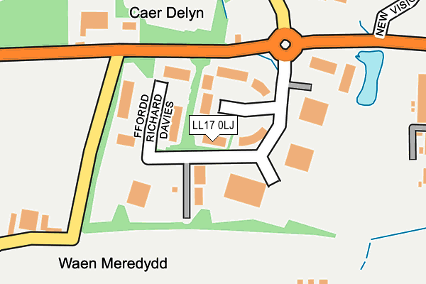
LL17 0LJ is located in the Trefnant electoral ward, within the unitary authority of Denbighshire and the Welsh Parliamentary constituency of Vale of Clwyd. The Local Health Board is Betsi Cadwaladr University and the police force is North Wales. This postcode has been in use since January 1993.


GetTheData
Source: OS OpenMap – Local (Ordnance Survey)
Source: OS VectorMap District (Ordnance Survey)
Licence: Open Government Licence (requires attribution)
| Easting | 301465 |
| Northing | 373790 |
| Latitude | 53.251959 |
| Longitude | -3.478328 |
GetTheData
Source: Open Postcode Geo
Licence: Open Government Licence
| Country | Wales |
| Postcode District | LL17 |
➜ See where LL17 is on a map | |
GetTheData
Source: Land Registry Price Paid Data
Licence: Open Government Licence
Elevation or altitude of LL17 0LJ as distance above sea level:
| Metres | Feet | |
|---|---|---|
| Elevation | 40m | 131ft |
Elevation is measured from the approximate centre of the postcode, to the nearest point on an OS contour line from OS Terrain 50, which has contour spacing of ten vertical metres.
➜ How high above sea level am I? Find the elevation of your current position using your device's GPS.
GetTheData
Source: Open Postcode Elevation
Licence: Open Government Licence
| Ward | Trefnant |
| Constituency | Vale Of Clwyd |
GetTheData
Source: ONS Postcode Database
Licence: Open Government Licence
| Business Park (Ffordd William Morgan) | St Asaph | 206m |
| Business Park (Glascoed Road) | Glascoed | 214m |
| Business Park (Glascoed Road) | Coed Esgob | 416m |
| Business Park (Glascoed Road) | Ty'n-y-ffordd | 417m |
| Bryn Celyn Lodge (Glascoed Road) | Groesffordd Marli | 856m |
GetTheData
Source: NaPTAN
Licence: Open Government Licence
| Median download speed | 80.0Mbps |
| Average download speed | 66.6Mbps |
| Maximum download speed | 80.00Mbps |
| Median upload speed | 20.0Mbps |
| Average upload speed | 17.2Mbps |
| Maximum upload speed | 20.00Mbps |
GetTheData
Source: Ofcom
Licence: Ofcom Terms of Use (requires attribution)
Estimated total energy consumption in LL17 0LJ by fuel type, 2015.
| Consumption (kWh) | 489,630 |
|---|---|
| Meter count | 23 |
| Mean (kWh/meter) | 21,288 |
| Median (kWh/meter) | 15,631 |
GetTheData
Source: Postcode level gas estimates: 2015 (experimental)
Source: Postcode level electricity estimates: 2015 (experimental)
Licence: Open Government Licence
GetTheData
Source: ONS Postcode Database
Licence: Open Government Licence


➜ Get more ratings from the Food Standards Agency
GetTheData
Source: Food Standards Agency
Licence: FSA terms & conditions
| Last Collection | |||
|---|---|---|---|
| Location | Mon-Fri | Sat | Distance |
| St Asaph Business Park | 18:30 | 38m | |
| St Asaph Business Park | 18:30 | 09:00 | 51m |
| St Asaph Business Park | 16:45 | 10:30 | 469m |
GetTheData
Source: Dracos
Licence: Creative Commons Attribution-ShareAlike
The below table lists the International Territorial Level (ITL) codes (formerly Nomenclature of Territorial Units for Statistics (NUTS) codes) and Local Administrative Units (LAU) codes for LL17 0LJ:
| ITL 1 Code | Name |
|---|---|
| TLL | Wales |
| ITL 2 Code | Name |
| TLL1 | West Wales and The Valleys |
| ITL 3 Code | Name |
| TLL13 | Conwy and Denbighshire |
| LAU 1 Code | Name |
| W06000004 | Denbighshire |
GetTheData
Source: ONS Postcode Directory
Licence: Open Government Licence
The below table lists the Census Output Area (OA), Lower Layer Super Output Area (LSOA), and Middle Layer Super Output Area (MSOA) for LL17 0LJ:
| Code | Name | |
|---|---|---|
| OA | W00001325 | |
| LSOA | W01000247 | Denbighshire 010C |
| MSOA | W02000051 | Denbighshire 010 |
GetTheData
Source: ONS Postcode Directory
Licence: Open Government Licence
| LL17 0LG | Glascoed Road | 237m |
| LL17 0JE | Bowen Court | 249m |
| LL22 9DW | Ffordd Glascoed | 856m |
| LL22 9DR | 885m | |
| LL17 0LH | Glascoed Road | 1218m |
| LL17 0LF | Cwttir Lane | 1294m |
| LL17 0HE | 1457m | |
| LL18 5UY | St Asaph Road | 1493m |
| LL17 0HG | 1502m | |
| LL22 9DS | 1539m |
GetTheData
Source: Open Postcode Geo; Land Registry Price Paid Data
Licence: Open Government Licence