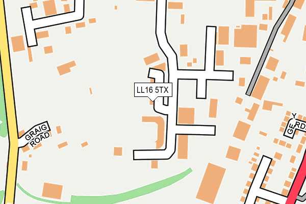
LL16 5TX is located in the Denbigh Lower electoral ward, within the unitary authority of Denbighshire and the Welsh Parliamentary constituency of Vale of Clwyd. The Local Health Board is Betsi Cadwaladr University and the police force is North Wales. This postcode has been in use since June 2000.


GetTheData
Source: OS OpenMap – Local (Ordnance Survey)
Source: OS VectorMap District (Ordnance Survey)
Licence: Open Government Licence (requires attribution)
| Easting | 305625 |
| Northing | 366892 |
| Latitude | 53.190728 |
| Longitude | -3.413954 |
GetTheData
Source: Open Postcode Geo
Licence: Open Government Licence
| Country | Wales |
| Postcode District | LL16 |
➜ See where LL16 is on a map ➜ Where is Denbigh? | |
GetTheData
Source: Land Registry Price Paid Data
Licence: Open Government Licence
Elevation or altitude of LL16 5TX as distance above sea level:
| Metres | Feet | |
|---|---|---|
| Elevation | 70m | 230ft |
Elevation is measured from the approximate centre of the postcode, to the nearest point on an OS contour line from OS Terrain 50, which has contour spacing of ten vertical metres.
➜ How high above sea level am I? Find the elevation of your current position using your device's GPS.
GetTheData
Source: Open Postcode Elevation
Licence: Open Government Licence
| Ward | Denbigh Lower |
| Constituency | Vale Of Clwyd |
GetTheData
Source: ONS Postcode Database
Licence: Open Government Licence
| Kwik Save (Grounds) | Fron | 208m |
| Ysgol Frongoch (Rhyl Road) | Fron | 310m |
| Colomendy Industrial Estate (Estate Road) | Fron | 324m |
| Masons Arms (Rhyl Road) | Fron | 350m |
| Kwiksave Car Park (Grounds) | Denbigh | 404m |
GetTheData
Source: NaPTAN
Licence: Open Government Licence
Estimated total energy consumption in LL16 5TX by fuel type, 2015.
| Consumption (kWh) | 46,967 |
|---|---|
| Meter count | 11 |
| Mean (kWh/meter) | 4,270 |
| Median (kWh/meter) | 1,676 |
GetTheData
Source: Postcode level gas estimates: 2015 (experimental)
Source: Postcode level electricity estimates: 2015 (experimental)
Licence: Open Government Licence
GetTheData
Source: ONS Postcode Database
Licence: Open Government Licence


➜ Get more ratings from the Food Standards Agency
GetTheData
Source: Food Standards Agency
Licence: FSA terms & conditions
| Last Collection | |||
|---|---|---|---|
| Location | Mon-Fri | Sat | Distance |
| Fron | 16:55 | 10:45 | 320m |
| Colomendy Ind Est | 16:45 | 11:00 | 336m |
| Ffordd Colomendy | 16:55 | 10:45 | 469m |
GetTheData
Source: Dracos
Licence: Creative Commons Attribution-ShareAlike
The below table lists the International Territorial Level (ITL) codes (formerly Nomenclature of Territorial Units for Statistics (NUTS) codes) and Local Administrative Units (LAU) codes for LL16 5TX:
| ITL 1 Code | Name |
|---|---|
| TLL | Wales |
| ITL 2 Code | Name |
| TLL1 | West Wales and The Valleys |
| ITL 3 Code | Name |
| TLL13 | Conwy and Denbighshire |
| LAU 1 Code | Name |
| W06000004 | Denbighshire |
GetTheData
Source: ONS Postcode Directory
Licence: Open Government Licence
The below table lists the Census Output Area (OA), Lower Layer Super Output Area (LSOA), and Middle Layer Super Output Area (MSOA) for LL16 5TX:
| Code | Name | |
|---|---|---|
| OA | W00001043 | |
| LSOA | W01000196 | Denbighshire 012B |
| MSOA | W02000053 | Denbighshire 012 |
GetTheData
Source: ONS Postcode Directory
Licence: Open Government Licence
| LL16 3EG | Castle View Estate | 227m |
| LL16 3EF | Albert Terrace | 267m |
| LL16 3DU | Y Gerddi | 279m |
| LL16 5TA | Colomendy Industrial Estate | 282m |
| LL16 3DY | Rhyl Road | 296m |
| LL16 5TQ | Spencer Trading Estate | 304m |
| LL16 3ED | Maes Y Coed Terrace | 311m |
| LL16 5SU | Dyffryn Trading Estate | 325m |
| LL16 3DP | Rhyl Road | 354m |
| LL16 3DS | Rhyl Road | 359m |
GetTheData
Source: Open Postcode Geo; Land Registry Price Paid Data
Licence: Open Government Licence