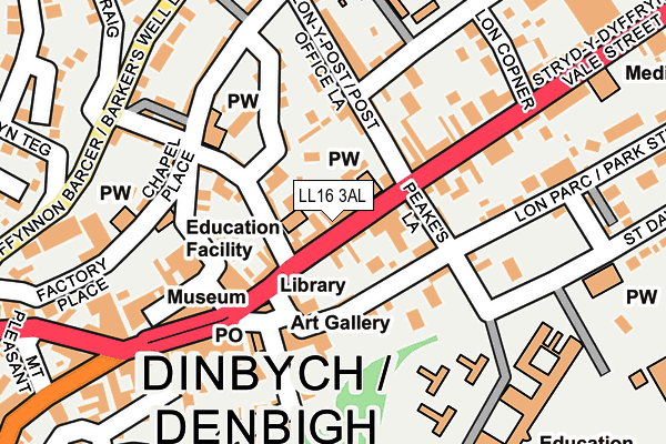
LL16 3AL is located in the Denbigh Lower electoral ward, within the unitary authority of Denbighshire and the Welsh Parliamentary constituency of Vale of Clwyd. The Local Health Board is Betsi Cadwaladr University and the police force is North Wales. This postcode has been in use since March 2017.


GetTheData
Source: OS OpenMap – Local (Ordnance Survey)
Source: OS VectorMap District (Ordnance Survey)
Licence: Open Government Licence (requires attribution)
| Easting | 305738 |
| Northing | 366610 |
| Latitude | 53.188214 |
| Longitude | -3.412180 |
GetTheData
Source: Open Postcode Geo
Licence: Open Government Licence
| Country | Wales |
| Postcode District | LL16 |
➜ See where LL16 is on a map ➜ Where is Denbigh? | |
GetTheData
Source: Land Registry Price Paid Data
Licence: Open Government Licence
| Ward | Denbigh Lower |
| Constituency | Vale Of Clwyd |
GetTheData
Source: ONS Postcode Database
Licence: Open Government Licence
| Kwik Save (Grounds) | Fron | 98m |
| Kwiksave Car Park (Grounds) | Denbigh | 111m |
| Abbey Road (Rhyl Road) | Fron | 114m |
| Masons Arms (Rhyl Road) | Fron | 127m |
| Ysgol Frongoch (Rhyl Road) | Fron | 207m |
GetTheData
Source: NaPTAN
Licence: Open Government Licence
GetTheData
Source: ONS Postcode Database
Licence: Open Government Licence


➜ Get more ratings from the Food Standards Agency
GetTheData
Source: Food Standards Agency
Licence: FSA terms & conditions
| Last Collection | |||
|---|---|---|---|
| Location | Mon-Fri | Sat | Distance |
| Fron | 16:55 | 10:45 | 113m |
| Ruthin Road | 16:35 | 10:15 | 433m |
| Vale Street | 17:20 | 10:00 | 552m |
GetTheData
Source: Dracos
Licence: Creative Commons Attribution-ShareAlike
The below table lists the International Territorial Level (ITL) codes (formerly Nomenclature of Territorial Units for Statistics (NUTS) codes) and Local Administrative Units (LAU) codes for LL16 3AL:
| ITL 1 Code | Name |
|---|---|
| TLL | Wales |
| ITL 2 Code | Name |
| TLL1 | West Wales and The Valleys |
| ITL 3 Code | Name |
| TLL13 | Conwy and Denbighshire |
| LAU 1 Code | Name |
| W06000004 | Denbighshire |
GetTheData
Source: ONS Postcode Directory
Licence: Open Government Licence
The below table lists the Census Output Area (OA), Lower Layer Super Output Area (LSOA), and Middle Layer Super Output Area (MSOA) for LL16 3AL:
| Code | Name | |
|---|---|---|
| OA | W00001043 | |
| LSOA | W01000196 | Denbighshire 012B |
| MSOA | W02000053 | Denbighshire 012 |
GetTheData
Source: ONS Postcode Directory
Licence: Open Government Licence
| LL16 3ED | Maes Y Coed Terrace | 68m |
| LL16 3DT | Rhyl Road | 94m |
| LL16 3DW | Bryntirion Terrace | 123m |
| LL16 3EF | Albert Terrace | 128m |
| LL16 3DN | Rhyl Road | 141m |
| LL16 3DL | Abbey Road | 155m |
| LL16 3YA | Machno Place | 164m |
| LL16 3DF | Vale Road | 164m |
| LL16 3DS | Rhyl Road | 165m |
| LL16 3DA | Station Road | 169m |
GetTheData
Source: Open Postcode Geo; Land Registry Price Paid Data
Licence: Open Government Licence