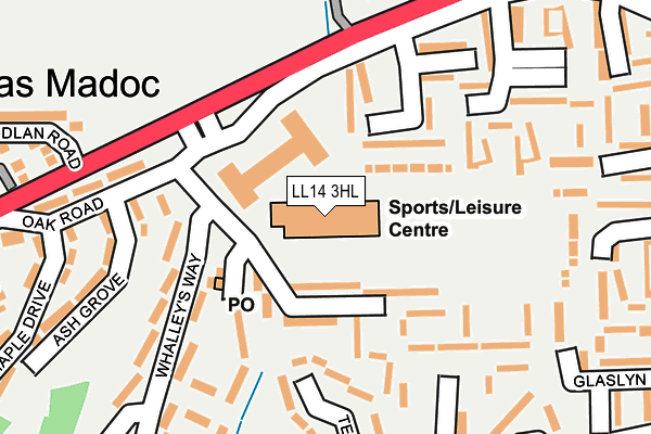
LL14 3HL is located in the Acrefair North electoral ward, within the unitary authority of Wrexham and the Welsh Parliamentary constituency of Clwyd South. The Local Health Board is Betsi Cadwaladr University and the police force is North Wales. This postcode has been in use since January 1980.


GetTheData
Source: OS OpenMap – Local (Ordnance Survey)
Source: OS VectorMap District (Ordnance Survey)
Licence: Open Government Licence (requires attribution)
| Easting | 328750 |
| Northing | 343423 |
| Latitude | 52.983391 |
| Longitude | -3.062710 |
GetTheData
Source: Open Postcode Geo
Licence: Open Government Licence
| Country | Wales |
| Postcode District | LL14 |
➜ See where LL14 is on a map ➜ Where is Plas Madoc? | |
GetTheData
Source: Land Registry Price Paid Data
Licence: Open Government Licence
Elevation or altitude of LL14 3HL as distance above sea level:
| Metres | Feet | |
|---|---|---|
| Elevation | 130m | 427ft |
Elevation is measured from the approximate centre of the postcode, to the nearest point on an OS contour line from OS Terrain 50, which has contour spacing of ten vertical metres.
➜ How high above sea level am I? Find the elevation of your current position using your device's GPS.
GetTheData
Source: Open Postcode Elevation
Licence: Open Government Licence
| Ward | Acrefair North |
| Constituency | Clwyd South |
GetTheData
Source: ONS Postcode Database
Licence: Open Government Licence
| Whalley's Way (Peris) | Cefn-mawr | 138m |
| Clinic (Hampden Way) | Plas Madoc | 142m |
| Clinic (Hampden Way) | Plas Madoc | 156m |
| Plas Madoc Estate (Llangollen Road) | Plas Madoc | 167m |
| Plas Madoc Estate (Llangollen Road) | Plas Madoc | 171m |
| Ruabon Station | 1.4km |
GetTheData
Source: NaPTAN
Licence: Open Government Licence
GetTheData
Source: ONS Postcode Database
Licence: Open Government Licence


➜ Get more ratings from the Food Standards Agency
GetTheData
Source: Food Standards Agency
Licence: FSA terms & conditions
| Last Collection | |||
|---|---|---|---|
| Location | Mon-Fri | Sat | Distance |
| Alwyn | 10:45 | 10:00 | 415m |
| Plas Isa (Rhosymedre) | 16:15 | 10:45 | 573m |
| Rhos Y Medre Post Office | 1,006m | ||
GetTheData
Source: Dracos
Licence: Creative Commons Attribution-ShareAlike
The below table lists the International Territorial Level (ITL) codes (formerly Nomenclature of Territorial Units for Statistics (NUTS) codes) and Local Administrative Units (LAU) codes for LL14 3HL:
| ITL 1 Code | Name |
|---|---|
| TLL | Wales |
| ITL 2 Code | Name |
| TLL2 | East Wales |
| ITL 3 Code | Name |
| TLL23 | Flintshire and Wrexham |
| LAU 1 Code | Name |
| W06000006 | Wrexham |
GetTheData
Source: ONS Postcode Directory
Licence: Open Government Licence
The below table lists the Census Output Area (OA), Lower Layer Super Output Area (LSOA), and Middle Layer Super Output Area (MSOA) for LL14 3HL:
| Code | Name | |
|---|---|---|
| OA | W00002180 | |
| LSOA | W01000409 | Wrexham 017E |
| MSOA | W02000094 | Wrexham 017 |
GetTheData
Source: ONS Postcode Directory
Licence: Open Government Licence
| LL14 3LE | Peris | 97m |
| LL14 3HE | Bodlyn | 132m |
| LL14 3UT | Marlbrook | 194m |
| LL14 3HY | Oak Road | 205m |
| LL14 3HD | Bran | 211m |
| LL14 3HG | Gwynant | 212m |
| LL14 3LG | Tegid | 215m |
| LL14 3LD | Ash Grove | 223m |
| LL14 3UY | Woodwards Walk | 223m |
| LL14 3UU | Marlbrook | 233m |
GetTheData
Source: Open Postcode Geo; Land Registry Price Paid Data
Licence: Open Government Licence