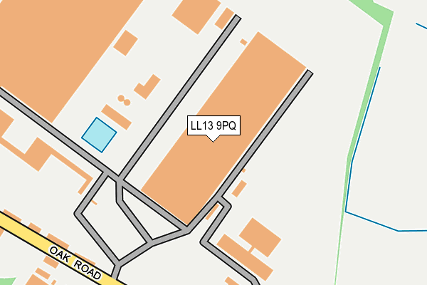
LL13 9PQ is located in the Holt electoral ward, within the unitary authority of Wrexham and the Welsh Parliamentary constituency of Wrexham. The Local Health Board is Betsi Cadwaladr University and the police force is North Wales. This postcode has been in use since May 2005.


GetTheData
Source: OS OpenMap – Local (Ordnance Survey)
Source: OS VectorMap District (Ordnance Survey)
Licence: Open Government Licence (requires attribution)
| Easting | 339313 |
| Northing | 349377 |
| Latitude | 53.038208 |
| Longitude | -2.906520 |
GetTheData
Source: Open Postcode Geo
Licence: Open Government Licence
| Country | Wales |
| Postcode District | LL13 |
➜ See where LL13 is on a map | |
GetTheData
Source: Land Registry Price Paid Data
Licence: Open Government Licence
Elevation or altitude of LL13 9PQ as distance above sea level:
| Metres | Feet | |
|---|---|---|
| Elevation | 30m | 98ft |
Elevation is measured from the approximate centre of the postcode, to the nearest point on an OS contour line from OS Terrain 50, which has contour spacing of ten vertical metres.
➜ How high above sea level am I? Find the elevation of your current position using your device's GPS.
GetTheData
Source: Open Postcode Elevation
Licence: Open Government Licence
| Ward | Holt |
| Constituency | Wrexham |
GetTheData
Source: ONS Postcode Database
Licence: Open Government Licence
| Abbey Road South (Abbey Road) | Bryn | 711m |
| Marlborough Road | Redwither | 826m |
| Redwither Road | Redwither | 870m |
| Redwither Tower (Abbey Road) | Ridley View | 1,080m |
| Bridge Road North | Redwither | 1,131m |
GetTheData
Source: NaPTAN
Licence: Open Government Licence
GetTheData
Source: ONS Postcode Database
Licence: Open Government Licence


➜ Get more ratings from the Food Standards Agency
GetTheData
Source: Food Standards Agency
Licence: FSA terms & conditions
| Last Collection | |||
|---|---|---|---|
| Location | Mon-Fri | Sat | Distance |
| Bowling Bank | 09:30 | 08:45 | 931m |
| Wrexham Industrial Estate | 18:30 | 1,266m | |
| Cross Lanes | 09:45 | 09:00 | 2,686m |
GetTheData
Source: Dracos
Licence: Creative Commons Attribution-ShareAlike
The below table lists the International Territorial Level (ITL) codes (formerly Nomenclature of Territorial Units for Statistics (NUTS) codes) and Local Administrative Units (LAU) codes for LL13 9PQ:
| ITL 1 Code | Name |
|---|---|
| TLL | Wales |
| ITL 2 Code | Name |
| TLL2 | East Wales |
| ITL 3 Code | Name |
| TLL23 | Flintshire and Wrexham |
| LAU 1 Code | Name |
| W06000006 | Wrexham |
GetTheData
Source: ONS Postcode Directory
Licence: Open Government Licence
The below table lists the Census Output Area (OA), Lower Layer Super Output Area (LSOA), and Middle Layer Super Output Area (MSOA) for LL13 9PQ:
| Code | Name | |
|---|---|---|
| OA | W00002049 | |
| LSOA | W01000383 | Wrexham 020A |
| MSOA | W02000420 | Wrexham 020 |
GetTheData
Source: ONS Postcode Directory
Licence: Open Government Licence
| LL13 9RG | Oak Road | 248m |
| LL13 9UU | Bryn Cottages | 533m |
| LL13 9UY | Bryn Lane | 581m |
| LL13 9RL | 737m | |
| LL13 9RH | 997m | |
| LL13 9RD | Redwither Road | 1034m |
| LL13 9RN | 1122m | |
| LL13 9UT | Bryn Lane | 1223m |
| LL13 9QA | Spectrum Business Park | 1248m |
| LL13 9RW | Sun Lane | 1357m |
GetTheData
Source: Open Postcode Geo; Land Registry Price Paid Data
Licence: Open Government Licence