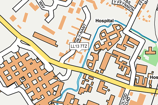
LL13 7TZ is located in the Brynyffynnon electoral ward, within the unitary authority of Wrexham and the Welsh Parliamentary constituency of Wrexham. The Local Health Board is Betsi Cadwaladr University and the police force is North Wales. This postcode has been in use since January 1992.


GetTheData
Source: OS OpenMap – Local (Ordnance Survey)
Source: OS VectorMap District (Ordnance Survey)
Licence: Open Government Licence (requires attribution)
| Easting | 332533 |
| Northing | 350513 |
| Latitude | 53.047604 |
| Longitude | -3.007857 |
GetTheData
Source: Open Postcode Geo
Licence: Open Government Licence
| Country | Wales |
| Postcode District | LL13 |
➜ See where LL13 is on a map ➜ Where is Wrexham? | |
GetTheData
Source: Land Registry Price Paid Data
Licence: Open Government Licence
Elevation or altitude of LL13 7TZ as distance above sea level:
| Metres | Feet | |
|---|---|---|
| Elevation | 90m | 295ft |
Elevation is measured from the approximate centre of the postcode, to the nearest point on an OS contour line from OS Terrain 50, which has contour spacing of ten vertical metres.
➜ How high above sea level am I? Find the elevation of your current position using your device's GPS.
GetTheData
Source: Open Postcode Elevation
Licence: Open Government Licence
| Ward | Brynyffynnon |
| Constituency | Wrexham |
GetTheData
Source: ONS Postcode Database
Licence: Open Government Licence
| Maelor Hospital (Watery Road) | Bryn Offa | 58m |
| Maelor Hospital (Croes Newydd Road) | Bryn Offa | 67m |
| Bron-y-nant (Croes Newydd Road) | Bryn Offa | 112m |
| Maelor Hospital Grounds (Grounds) | Bryn Offa | 233m |
| Medical Institute (Croes Newydd Road) | Bryn Offa | 247m |
| Wrexham General Station | 0.5km |
| Wrexham Central Station | 0.6km |
| Gwersyllt Station | 2.9km |
GetTheData
Source: NaPTAN
Licence: Open Government Licence
| Percentage of properties with Next Generation Access | 100.0% |
| Percentage of properties with Superfast Broadband | 100.0% |
| Percentage of properties with Ultrafast Broadband | 0.0% |
| Percentage of properties with Full Fibre Broadband | 0.0% |
Superfast Broadband is between 30Mbps and 300Mbps
Ultrafast Broadband is > 300Mbps
| Percentage of properties unable to receive 2Mbps | 0.0% |
| Percentage of properties unable to receive 5Mbps | 0.0% |
| Percentage of properties unable to receive 10Mbps | 0.0% |
| Percentage of properties unable to receive 30Mbps | 0.0% |
GetTheData
Source: Ofcom
Licence: Ofcom Terms of Use (requires attribution)
GetTheData
Source: ONS Postcode Database
Licence: Open Government Licence


➜ Get more ratings from the Food Standards Agency
GetTheData
Source: Food Standards Agency
Licence: FSA terms & conditions
| Last Collection | |||
|---|---|---|---|
| Location | Mon-Fri | Sat | Distance |
| Turf Hotel | 16:00 | 11:30 | 457m |
| Wrexham Sorting Office | 18:30 | 13:30 | 465m |
| Wrexham Delivery Office | 18:30 | 13:30 | 516m |
GetTheData
Source: Dracos
Licence: Creative Commons Attribution-ShareAlike
The below table lists the International Territorial Level (ITL) codes (formerly Nomenclature of Territorial Units for Statistics (NUTS) codes) and Local Administrative Units (LAU) codes for LL13 7TZ:
| ITL 1 Code | Name |
|---|---|
| TLL | Wales |
| ITL 2 Code | Name |
| TLL2 | East Wales |
| ITL 3 Code | Name |
| TLL23 | Flintshire and Wrexham |
| LAU 1 Code | Name |
| W06000006 | Wrexham |
GetTheData
Source: ONS Postcode Directory
Licence: Open Government Licence
The below table lists the Census Output Area (OA), Lower Layer Super Output Area (LSOA), and Middle Layer Super Output Area (MSOA) for LL13 7TZ:
| Code | Name | |
|---|---|---|
| OA | W00010041 | |
| LSOA | W01000350 | Wrexham 011B |
| MSOA | W02000088 | Wrexham 011 |
GetTheData
Source: ONS Postcode Directory
Licence: Open Government Licence
| LL13 7YT | Ellice Way | 188m |
| LL13 7TE | Dolydd Road | 222m |
| LL11 2AY | Plas Y Ffynnon | 231m |
| LL11 2AQ | Primrose Way | 277m |
| LL13 7TB | Croesnewydd Road | 319m |
| LL11 2AP | Maesgwyn Road | 343m |
| LL11 2BB | Lilac Way | 378m |
| LL11 2AT | Primrose Way | 390m |
| LL13 7TN | Bright Street | 435m |
| LL13 7TH | Cobden Road | 438m |
GetTheData
Source: Open Postcode Geo; Land Registry Price Paid Data
Licence: Open Government Licence