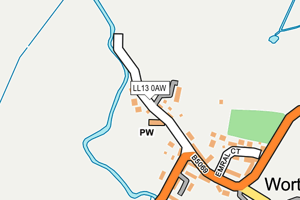
LL13 0AW is in Worthenbury, Wrexham. LL13 0AW is located in the Bangor Is-y-Coed electoral ward, within the unitary authority of Wrexham and the Welsh Parliamentary constituency of Clwyd South. The Local Health Board is Betsi Cadwaladr University and the police force is North Wales. This postcode has been in use since January 1980.


GetTheData
Source: OS OpenMap – Local (Ordnance Survey)
Source: OS VectorMap District (Ordnance Survey)
Licence: Open Government Licence (requires attribution)
| Easting | 341900 |
| Northing | 346259 |
| Latitude | 53.010487 |
| Longitude | -2.867380 |
GetTheData
Source: Open Postcode Geo
Licence: Open Government Licence
| Locality | Worthenbury |
| Town/City | Wrexham |
| Country | Wales |
| Postcode District | LL13 |
➜ See where LL13 is on a map ➜ Where is Worthenbury? | |
GetTheData
Source: Land Registry Price Paid Data
Licence: Open Government Licence
Elevation or altitude of LL13 0AW as distance above sea level:
| Metres | Feet | |
|---|---|---|
| Elevation | 10m | 33ft |
Elevation is measured from the approximate centre of the postcode, to the nearest point on an OS contour line from OS Terrain 50, which has contour spacing of ten vertical metres.
➜ How high above sea level am I? Find the elevation of your current position using your device's GPS.
GetTheData
Source: Open Postcode Elevation
Licence: Open Government Licence
| Ward | Bangor Is-y-coed |
| Constituency | Clwyd South |
GetTheData
Source: ONS Postcode Database
Licence: Open Government Licence
| Percentage of properties with Next Generation Access | 98.2% |
| Percentage of properties with Superfast Broadband | 77.2% |
| Percentage of properties with Ultrafast Broadband | 77.2% |
| Percentage of properties with Full Fibre Broadband | 77.2% |
Superfast Broadband is between 30Mbps and 300Mbps
Ultrafast Broadband is > 300Mbps
| Median download speed | 8.0Mbps |
| Average download speed | 7.5Mbps |
| Maximum download speed | 14.30Mbps |
| Median upload speed | 0.9Mbps |
| Average upload speed | 0.8Mbps |
| Maximum upload speed | 1.27Mbps |
| Percentage of properties unable to receive 2Mbps | 0.0% |
| Percentage of properties unable to receive 5Mbps | 1.8% |
| Percentage of properties unable to receive 10Mbps | 12.3% |
| Percentage of properties unable to receive 30Mbps | 22.8% |
GetTheData
Source: Ofcom
Licence: Ofcom Terms of Use (requires attribution)
Estimated total energy consumption in LL13 0AW by fuel type, 2015.
| Consumption (kWh) | 300,545 |
|---|---|
| Meter count | 61 |
| Mean (kWh/meter) | 4,927 |
| Median (kWh/meter) | 3,931 |
GetTheData
Source: Postcode level gas estimates: 2015 (experimental)
Source: Postcode level electricity estimates: 2015 (experimental)
Licence: Open Government Licence
GetTheData
Source: ONS Postcode Database
Licence: Open Government Licence
| Last Collection | |||
|---|---|---|---|
| Location | Mon-Fri | Sat | Distance |
| Sarn Bank | 16:45 | 10:00 | 2,597m |
| Bowling Bank | 09:30 | 08:45 | 3,122m |
| Tallarn Green Post Office | 16:30 | 09:45 | 3,316m |
GetTheData
Source: Dracos
Licence: Creative Commons Attribution-ShareAlike
The below table lists the International Territorial Level (ITL) codes (formerly Nomenclature of Territorial Units for Statistics (NUTS) codes) and Local Administrative Units (LAU) codes for LL13 0AW:
| ITL 1 Code | Name |
|---|---|
| TLL | Wales |
| ITL 2 Code | Name |
| TLL2 | East Wales |
| ITL 3 Code | Name |
| TLL23 | Flintshire and Wrexham |
| LAU 1 Code | Name |
| W06000006 | Wrexham |
GetTheData
Source: ONS Postcode Directory
Licence: Open Government Licence
The below table lists the Census Output Area (OA), Lower Layer Super Output Area (LSOA), and Middle Layer Super Output Area (MSOA) for LL13 0AW:
| Code | Name | |
|---|---|---|
| OA | W00001861 | |
| LSOA | W01000345 | Wrexham 018A |
| MSOA | W02000095 | Wrexham 018 |
GetTheData
Source: ONS Postcode Directory
Licence: Open Government Licence
| LL13 0BF | The Orchard | 121m |
| LL13 0AE | Whitehouse Mews | 177m |
| LL13 0GA | Worthenbury Mews | 178m |
| LL13 0AZ | Emral Court | 202m |
| LL13 0AR | Broughton Crescent | 210m |
| LL13 0AS | Frog Lane | 303m |
| LL13 0BJ | Mulsford Court | 383m |
| LL13 0FD | Mulsford Lane | 439m |
| LL13 0AN | 1130m | |
| LL13 0AL | Wallington Lane | 1287m |
GetTheData
Source: Open Postcode Geo; Land Registry Price Paid Data
Licence: Open Government Licence