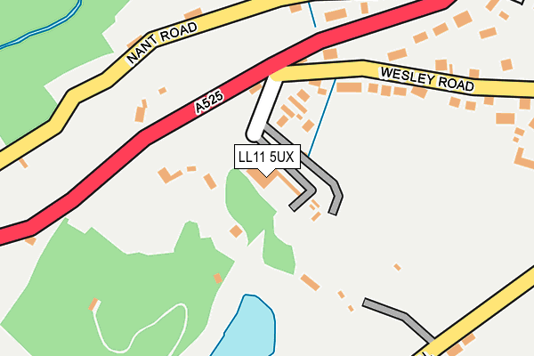
LL11 5UX is located in the Minera electoral ward, within the unitary authority of Wrexham and the Welsh Parliamentary constituency of Clwyd South. The Local Health Board is Betsi Cadwaladr University and the police force is North Wales. This postcode has been in use since June 2017.


GetTheData
Source: OS OpenMap – Local (Ordnance Survey)
Source: OS VectorMap District (Ordnance Survey)
Licence: Open Government Licence (requires attribution)
| Easting | 326898 |
| Northing | 353373 |
| Latitude | 53.072582 |
| Longitude | -3.092549 |
GetTheData
Source: Open Postcode Geo
Licence: Open Government Licence
| Country | Wales |
| Postcode District | LL11 |
➜ See where LL11 is on a map ➜ Where is Bwlchgwyn? | |
GetTheData
Source: Land Registry Price Paid Data
Licence: Open Government Licence
| Ward | Minera |
| Constituency | Clwyd South |
GetTheData
Source: ONS Postcode Database
Licence: Open Government Licence
2, YR HENDY, BWLCHGWYN, WREXHAM, LL11 5UX 2017 24 NOV £170,000 |
1, YR HENDY, BWLCHGWYN, WREXHAM, LL11 5UX 2017 18 JUL £185,000 |
3, YR HENDY, BWLCHGWYN, WREXHAM, LL11 5UX 2017 14 JUL £239,950 |
GetTheData
Source: HM Land Registry Price Paid Data
Licence: Contains HM Land Registry data © Crown copyright and database right 2025. This data is licensed under the Open Government Licence v3.0.
| Ffynnon Nephal (Ruthin Road) | Bwlchgwyn | 341m |
| Ffynnon Nephal (Ruthin Road) | Bwlchgwyn | 359m |
| Kings Head Inn (Ruthin Road) | Bwlchgwyn | 390m |
| Kings Head Inn (Ruthin Road) | Bwlchgwyn | 405m |
| Post Office (Ruthin Road) | Bwlchgwyn | 505m |
| Cefn-y-Bedd Station | 5km |
| Caergwrle Station | 5.6km |
| Hope (Flintshire) Station | 6.2km |
GetTheData
Source: NaPTAN
Licence: Open Government Licence
| Percentage of properties with Next Generation Access | 100.0% |
| Percentage of properties with Superfast Broadband | 100.0% |
| Percentage of properties with Ultrafast Broadband | 0.0% |
| Percentage of properties with Full Fibre Broadband | 0.0% |
Superfast Broadband is between 30Mbps and 300Mbps
Ultrafast Broadband is > 300Mbps
| Percentage of properties unable to receive 2Mbps | 0.0% |
| Percentage of properties unable to receive 5Mbps | 0.0% |
| Percentage of properties unable to receive 10Mbps | 0.0% |
| Percentage of properties unable to receive 30Mbps | 0.0% |
GetTheData
Source: Ofcom
Licence: Ofcom Terms of Use (requires attribution)
GetTheData
Source: ONS Postcode Database
Licence: Open Government Licence


➜ Get more ratings from the Food Standards Agency
GetTheData
Source: Food Standards Agency
Licence: FSA terms & conditions
| Last Collection | |||
|---|---|---|---|
| Location | Mon-Fri | Sat | Distance |
| Maes Y Ffynnon | 09:00 | 08:15 | 1,607m |
| Ffrith | 17:00 | 10:30 | 2,465m |
| Southsea Post Office | 17:15 | 10:00 | 2,861m |
GetTheData
Source: Dracos
Licence: Creative Commons Attribution-ShareAlike
The below table lists the International Territorial Level (ITL) codes (formerly Nomenclature of Territorial Units for Statistics (NUTS) codes) and Local Administrative Units (LAU) codes for LL11 5UX:
| ITL 1 Code | Name |
|---|---|
| TLL | Wales |
| ITL 2 Code | Name |
| TLL2 | East Wales |
| ITL 3 Code | Name |
| TLL23 | Flintshire and Wrexham |
| LAU 1 Code | Name |
| W06000006 | Wrexham |
GetTheData
Source: ONS Postcode Directory
Licence: Open Government Licence
The below table lists the Census Output Area (OA), Lower Layer Super Output Area (LSOA), and Middle Layer Super Output Area (MSOA) for LL11 5UX:
| Code | Name | |
|---|---|---|
| OA | W00002117 | |
| LSOA | W01000399 | Wrexham 013B |
| MSOA | W02000090 | Wrexham 013 |
GetTheData
Source: ONS Postcode Directory
Licence: Open Government Licence
| LL11 5UA | Brymbo Road | 54m |
| LL11 5YJ | Cefn Lane | 57m |
| LL11 5YE | Cefn Road | 133m |
| LL11 5YF | Arllwyn | 202m |
| LL11 5UB | Brymbo Road | 237m |
| LL11 5UJ | Whiteoaks | 323m |
| LL11 5UR | Ruthin Road | 359m |
| LL11 5YT | Caer Efail | 446m |
| LL11 5YX | The Belvedere | 515m |
| LL11 5UT | Ruthin Road | 523m |
GetTheData
Source: Open Postcode Geo; Land Registry Price Paid Data
Licence: Open Government Licence