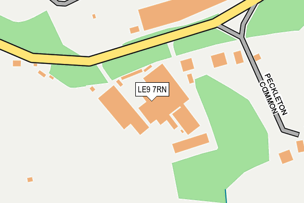
LE9 7RN is located in the Newbold Verdon with Desford and Peckleton electoral ward, within the local authority district of Hinckley and Bosworth and the English Parliamentary constituency of Bosworth. The Sub Integrated Care Board (ICB) Location is NHS Leicester, Leicestershire and Rutland ICB - 04V and the police force is Leicestershire. This postcode has been in use since July 1990.


GetTheData
Source: OS OpenMap – Local (Ordnance Survey)
Source: OS VectorMap District (Ordnance Survey)
Licence: Open Government Licence (requires attribution)
| Easting | 448245 |
| Northing | 301212 |
| Latitude | 52.606556 |
| Longitude | -1.289019 |
GetTheData
Source: Open Postcode Geo
Licence: Open Government Licence
| Country | England |
| Postcode District | LE9 |
➜ See where LE9 is on a map ➜ Where is Peckleton Common? | |
GetTheData
Source: Land Registry Price Paid Data
Licence: Open Government Licence
Elevation or altitude of LE9 7RN as distance above sea level:
| Metres | Feet | |
|---|---|---|
| Elevation | 120m | 394ft |
Elevation is measured from the approximate centre of the postcode, to the nearest point on an OS contour line from OS Terrain 50, which has contour spacing of ten vertical metres.
➜ How high above sea level am I? Find the elevation of your current position using your device's GPS.
GetTheData
Source: Open Postcode Elevation
Licence: Open Government Licence
| Ward | Newbold Verdon With Desford And Peckleton |
| Constituency | Bosworth |
GetTheData
Source: ONS Postcode Database
Licence: Open Government Licence
| Thurlaston Turn (Hinckley Road) | Leicester Forest West | 1,108m |
| Thurlaston Turn (Hinckley Road) | Leicester Forest West | 1,126m |
GetTheData
Source: NaPTAN
Licence: Open Government Licence
| Median download speed | 51.6Mbps |
| Average download speed | 40.8Mbps |
| Maximum download speed | 78.51Mbps |
| Median upload speed | 12.9Mbps |
| Average upload speed | 10.9Mbps |
| Maximum upload speed | 20.00Mbps |
GetTheData
Source: Ofcom
Licence: Ofcom Terms of Use (requires attribution)
GetTheData
Source: ONS Postcode Database
Licence: Open Government Licence

➜ Get more ratings from the Food Standards Agency
GetTheData
Source: Food Standards Agency
Licence: FSA terms & conditions
| Last Collection | |||
|---|---|---|---|
| Location | Mon-Fri | Sat | Distance |
| Parkstone Road | 16:45 | 09:45 | 1,925m |
| Maple Way | 16:45 | 09:45 | 2,286m |
| Lindridge Lane | 16:50 | 10:00 | 2,483m |
GetTheData
Source: Dracos
Licence: Creative Commons Attribution-ShareAlike
The below table lists the International Territorial Level (ITL) codes (formerly Nomenclature of Territorial Units for Statistics (NUTS) codes) and Local Administrative Units (LAU) codes for LE9 7RN:
| ITL 1 Code | Name |
|---|---|
| TLF | East Midlands (England) |
| ITL 2 Code | Name |
| TLF2 | Leicestershire, Rutland and Northamptonshire |
| ITL 3 Code | Name |
| TLF22 | Leicestershire CC and Rutland |
| LAU 1 Code | Name |
| E07000132 | Hinckley and Bosworth |
GetTheData
Source: ONS Postcode Directory
Licence: Open Government Licence
The below table lists the Census Output Area (OA), Lower Layer Super Output Area (LSOA), and Middle Layer Super Output Area (MSOA) for LE9 7RN:
| Code | Name | |
|---|---|---|
| OA | E00131306 | |
| LSOA | E01025873 | Hinckley and Bosworth 005B |
| MSOA | E02005381 | Hinckley and Bosworth 005 |
GetTheData
Source: ONS Postcode Directory
Licence: Open Government Licence
| LE9 7RF | Peckleton Common Road | 220m |
| LE9 7RQ | Hill Close | 1022m |
| LE9 9QU | Peckleton Lane | 1045m |
| LE9 7RE | Main Street | 1201m |
| LE9 7RB | Desford Lane | 1241m |
| LE9 7RA | Church Road | 1329m |
| LE9 7RH | Brook Lane | 1383m |
| LE9 7RJ | Manor Lane | 1606m |
| LE9 9DA | Kingfisher Close | 1651m |
| LE9 9DB | The Finches | 1679m |
GetTheData
Source: Open Postcode Geo; Land Registry Price Paid Data
Licence: Open Government Licence