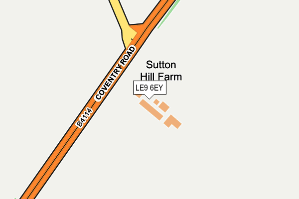
LE9 6EY is located in the Broughton Astley-Primethorpe & Sutton electoral ward, within the local authority district of Harborough and the English Parliamentary constituency of South Leicestershire. The Sub Integrated Care Board (ICB) Location is NHS Leicester, Leicestershire and Rutland ICB - 04V and the police force is Leicestershire. This postcode has been in use since May 2017.


GetTheData
Source: OS OpenMap – Local (Ordnance Survey)
Source: OS VectorMap District (Ordnance Survey)
Licence: Open Government Licence (requires attribution)
| Easting | 451557 |
| Northing | 294541 |
| Latitude | 52.546305 |
| Longitude | -1.241142 |
GetTheData
Source: Open Postcode Geo
Licence: Open Government Licence
| Country | England |
| Postcode District | LE9 |
➜ See where LE9 is on a map | |
GetTheData
Source: Land Registry Price Paid Data
Licence: Open Government Licence
| Ward | Broughton Astley-primethorpe & Sutton |
| Constituency | South Leicestershire |
GetTheData
Source: ONS Postcode Database
Licence: Open Government Licence
| Arbor Road (Coventry Road) | Croft | 890m |
| Warwick Road (Broughton Way) | Broughton Astley | 894m |
| Warwick Road (Broughton Way) | Broughton Astley | 895m |
| Leicester Road (Broughton Way) | Sutton-in-the-elms | 999m |
| Arbor Road (Coventry Road) | Croft | 1,016m |
| Narborough Station | 3.8km |
GetTheData
Source: NaPTAN
Licence: Open Government Licence
GetTheData
Source: ONS Postcode Database
Licence: Open Government Licence


➜ Get more ratings from the Food Standards Agency
GetTheData
Source: Food Standards Agency
Licence: FSA terms & conditions
| Last Collection | |||
|---|---|---|---|
| Location | Mon-Fri | Sat | Distance |
| Sutton In The Elms | 16:00 | 09:15 | 754m |
| Sparkenhoe | 16:30 | 10:00 | 824m |
| Pochin Drive | 17:10 | 10:00 | 1,088m |
GetTheData
Source: Dracos
Licence: Creative Commons Attribution-ShareAlike
The below table lists the International Territorial Level (ITL) codes (formerly Nomenclature of Territorial Units for Statistics (NUTS) codes) and Local Administrative Units (LAU) codes for LE9 6EY:
| ITL 1 Code | Name |
|---|---|
| TLF | East Midlands (England) |
| ITL 2 Code | Name |
| TLF2 | Leicestershire, Rutland and Northamptonshire |
| ITL 3 Code | Name |
| TLF22 | Leicestershire CC and Rutland |
| LAU 1 Code | Name |
| E07000131 | Harborough |
GetTheData
Source: ONS Postcode Directory
Licence: Open Government Licence
The below table lists the Census Output Area (OA), Lower Layer Super Output Area (LSOA), and Middle Layer Super Output Area (MSOA) for LE9 6EY:
| Code | Name | |
|---|---|---|
| OA | E00130779 | |
| LSOA | E01025776 | Harborough 004E |
| MSOA | E02005370 | Harborough 004 |
GetTheData
Source: ONS Postcode Directory
Licence: Open Government Licence
| LE9 6QF | Sutton Lane | 710m |
| LE9 3EN | Sopers Road | 792m |
| LE9 3EB | Broughton Road | 844m |
| LE9 3EP | Sparkenhoe | 855m |
| LE9 3GJ | Brookes Avenue | 865m |
| LE9 3HB | School Close | 876m |
| LE9 3GA | Ash Road | 891m |
| LE9 6SH | Grantham Avenue | 907m |
| LE9 3GL | Brookes Avenue | 949m |
| LE9 6SG | Uppingham Drive | 953m |
GetTheData
Source: Open Postcode Geo; Land Registry Price Paid Data
Licence: Open Government Licence