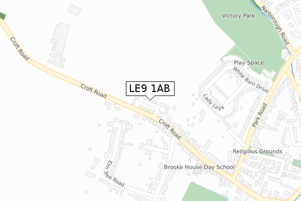
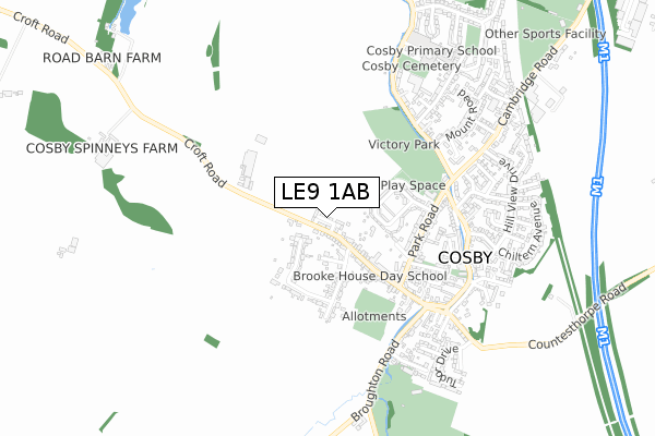
LE9 1AB is located in the Cosby & South Whetstone electoral ward, within the local authority district of Blaby and the English Parliamentary constituency of South Leicestershire. The Sub Integrated Care Board (ICB) Location is NHS Leicester, Leicestershire and Rutland ICB - 03W and the police force is Leicestershire. This postcode has been in use since August 2019.


GetTheData
Source: OS Open Zoomstack (Ordnance Survey)
Licence: Open Government Licence (requires attribution)
Attribution: Contains OS data © Crown copyright and database right 2025
Source: Open Postcode Geo
Licence: Open Government Licence (requires attribution)
Attribution: Contains OS data © Crown copyright and database right 2025; Contains Royal Mail data © Royal Mail copyright and database right 2025; Source: Office for National Statistics licensed under the Open Government Licence v.3.0
| Easting | 454281 |
| Northing | 295074 |
| Latitude | 52.550832 |
| Longitude | -1.200890 |
GetTheData
Source: Open Postcode Geo
Licence: Open Government Licence
| Country | England |
| Postcode District | LE9 |
➜ See where LE9 is on a map | |
GetTheData
Source: Land Registry Price Paid Data
Licence: Open Government Licence
| Ward | Cosby & South Whetstone |
| Constituency | South Leicestershire |
GetTheData
Source: ONS Postcode Database
Licence: Open Government Licence
| Park Close (Park Road) | Cosby | 348m |
| Park Close (Park Road) | Cosby | 363m |
| The Nook (Croft Road) | Cosby | 414m |
| Victory Park (Park Road) | Cosby | 424m |
| Victory Park (Park Road) | Cosby | 461m |
| Narborough Station | 2.3km |
| South Wigston Station | 5.7km |
GetTheData
Source: NaPTAN
Licence: Open Government Licence
GetTheData
Source: ONS Postcode Database
Licence: Open Government Licence


➜ Get more ratings from the Food Standards Agency
GetTheData
Source: Food Standards Agency
Licence: FSA terms & conditions
| Last Collection | |||
|---|---|---|---|
| Location | Mon-Fri | Sat | Distance |
| Ashtree Road | 17:00 | 08:45 | 1,440m |
| Springwell Lane | 17:00 | 09:00 | 1,699m |
| Cambridge Road | 17:00 | 09:00 | 1,706m |
GetTheData
Source: Dracos
Licence: Creative Commons Attribution-ShareAlike
The below table lists the International Territorial Level (ITL) codes (formerly Nomenclature of Territorial Units for Statistics (NUTS) codes) and Local Administrative Units (LAU) codes for LE9 1AB:
| ITL 1 Code | Name |
|---|---|
| TLF | East Midlands (England) |
| ITL 2 Code | Name |
| TLF2 | Leicestershire, Rutland and Northamptonshire |
| ITL 3 Code | Name |
| TLF22 | Leicestershire CC and Rutland |
| LAU 1 Code | Name |
| E07000129 | Blaby |
GetTheData
Source: ONS Postcode Directory
Licence: Open Government Licence
The below table lists the Census Output Area (OA), Lower Layer Super Output Area (LSOA), and Middle Layer Super Output Area (MSOA) for LE9 1AB:
| Code | Name | |
|---|---|---|
| OA | E00129988 | |
| LSOA | E01025613 | Blaby 010A |
| MSOA | E02005342 | Blaby 010 |
GetTheData
Source: ONS Postcode Directory
Licence: Open Government Licence
| LE9 1TH | Richmond Close | 139m |
| LE9 1SE | Croft Road | 170m |
| LE9 1SF | Croft Road | 189m |
| LE9 1RJ | Lady Leys | 239m |
| LE9 1SR | Elm Tree Road | 240m |
| LE9 1RU | Rose Close | 271m |
| LE9 1SW | Kingsfield Road | 312m |
| LE9 1RL | Park Road | 328m |
| LE9 1RR | White Barn Drive | 329m |
| LE9 1RE | Croft Road | 369m |
GetTheData
Source: Open Postcode Geo; Land Registry Price Paid Data
Licence: Open Government Licence