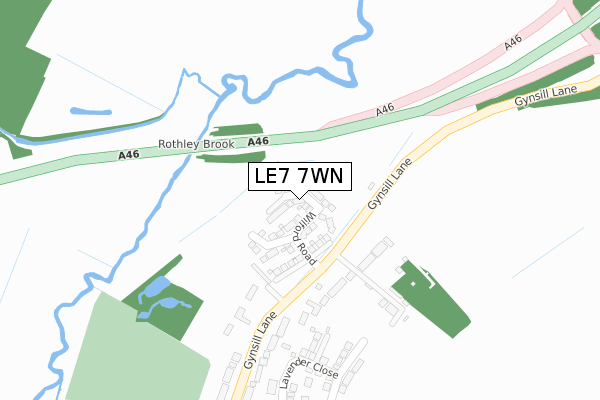
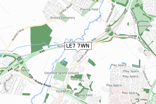
LE7 7WN is located in the Anstey electoral ward, within the local authority district of Charnwood and the English Parliamentary constituency of Charnwood. The Sub Integrated Care Board (ICB) Location is NHS Leicester, Leicestershire and Rutland ICB - 04V and the police force is Leicestershire. This postcode has been in use since August 2019.


GetTheData
Source: OS Open Zoomstack (Ordnance Survey)
Licence: Open Government Licence (requires attribution)
Attribution: Contains OS data © Crown copyright and database right 2025
Source: Open Postcode Geo
Licence: Open Government Licence (requires attribution)
Attribution: Contains OS data © Crown copyright and database right 2025; Contains Royal Mail data © Royal Mail copyright and database right 2025; Source: Office for National Statistics licensed under the Open Government Licence v.3.0
| Easting | 454818 |
| Northing | 307545 |
| Latitude | 52.662879 |
| Longitude | -1.190912 |
GetTheData
Source: Open Postcode Geo
Licence: Open Government Licence
| Country | England |
| Postcode District | LE7 |
➜ See where LE7 is on a map ➜ Where is Leicester? | |
GetTheData
Source: Land Registry Price Paid Data
Licence: Open Government Licence
| Ward | Anstey |
| Constituency | Charnwood |
GetTheData
Source: ONS Postcode Database
Licence: Open Government Licence
6, RAWLINS DRIVE, ANSTEY, LEICESTER, LE7 7WN 2020 18 DEC £241,995 |
8, RAWLINS DRIVE, ANSTEY, LEICESTER, LE7 7WN 2020 31 JUL £262,995 |
3, RAWLINS DRIVE, ANSTEY, LEICESTER, LE7 7WN 2020 24 JUL £359,995 |
2, RAWLINS DRIVE, ANSTEY, LEICESTER, LE7 7WN 2020 26 JUN £334,995 |
33, RAWLINS DRIVE, ANSTEY, LEICESTER, LE7 7WN 2020 27 MAR £289,995 |
7, RAWLINS DRIVE, ANSTEY, LEICESTER, LE7 7WN 2020 28 FEB £345,995 |
1, RAWLINS DRIVE, ANSTEY, LEICESTER, LE7 7WN 2020 28 FEB £319,995 |
15, RAWLINS DRIVE, ANSTEY, LEICESTER, LE7 7WN 2020 28 FEB £299,995 |
5, RAWLINS DRIVE, ANSTEY, LEICESTER, LE7 7WN 2020 14 FEB £319,995 |
11, RAWLINS DRIVE, ANSTEY, LEICESTER, LE7 7WN 2019 19 DEC £344,995 |
GetTheData
Source: HM Land Registry Price Paid Data
Licence: Contains HM Land Registry data © Crown copyright and database right 2025. This data is licensed under the Open Government Licence v3.0.
| Nursery (Gynsill Lane) | Glenfield | 85m |
| Nursery (Gynsill Lane) | Glenfield | 177m |
| Stelle Way (Gynsill Lane) | Glenfield | 483m |
| Stelle Way (Gynsill Lane) | Glenfield | 527m |
| Gynsill Lane (Leicester Road) | Glenfield | 686m |
| Leicester Station | 5.7km |
GetTheData
Source: NaPTAN
Licence: Open Government Licence
GetTheData
Source: ONS Postcode Database
Licence: Open Government Licence


➜ Get more ratings from the Food Standards Agency
GetTheData
Source: Food Standards Agency
Licence: FSA terms & conditions
| Last Collection | |||
|---|---|---|---|
| Location | Mon-Fri | Sat | Distance |
| Boston Road | 18:30 | 12:00 | 1,179m |
| Boston Road | 18:30 | 1,180m | |
| Bennion Road | 17:30 | 12:00 | 1,539m |
GetTheData
Source: Dracos
Licence: Creative Commons Attribution-ShareAlike
The below table lists the International Territorial Level (ITL) codes (formerly Nomenclature of Territorial Units for Statistics (NUTS) codes) and Local Administrative Units (LAU) codes for LE7 7WN:
| ITL 1 Code | Name |
|---|---|
| TLF | East Midlands (England) |
| ITL 2 Code | Name |
| TLF2 | Leicestershire, Rutland and Northamptonshire |
| ITL 3 Code | Name |
| TLF22 | Leicestershire CC and Rutland |
| LAU 1 Code | Name |
| E07000130 | Charnwood |
GetTheData
Source: ONS Postcode Directory
Licence: Open Government Licence
The below table lists the Census Output Area (OA), Lower Layer Super Output Area (LSOA), and Middle Layer Super Output Area (MSOA) for LE7 7WN:
| Code | Name | |
|---|---|---|
| OA | E00130266 | |
| LSOA | E01025673 | Charnwood 022D |
| MSOA | E02005366 | Charnwood 022 |
GetTheData
Source: ONS Postcode Directory
Licence: Open Government Licence
| LE7 7AJ | Gynsill Lane | 195m |
| LE7 7AL | Gynsill Lane | 234m |
| LE7 7AG | Gynsill Lane | 434m |
| LE3 8HN | Stelle Way | 441m |
| LE3 8HP | Stelle Way | 485m |
| LE3 9SQ | Martinshaw Close | 587m |
| LE3 9SN | Polebrook Close | 619m |
| LE3 8GN | Groby Road | 629m |
| LE3 9SP | Burrow Close | 649m |
| LE3 9SL | Buddon Close | 698m |
GetTheData
Source: Open Postcode Geo; Land Registry Price Paid Data
Licence: Open Government Licence