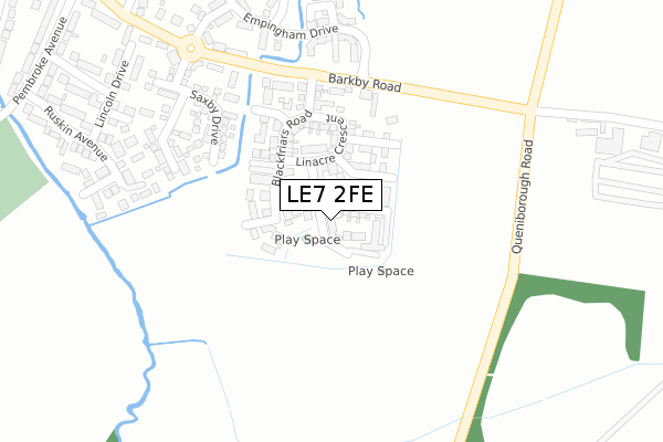
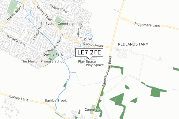
LE7 2FE is located in the Syston electoral ward, within the local authority district of Charnwood and the English Parliamentary constituency of Charnwood. The Sub Integrated Care Board (ICB) Location is NHS Leicester, Leicestershire and Rutland ICB - 03W and the police force is Leicestershire. This postcode has been in use since January 2018.


GetTheData
Source: OS Open Zoomstack (Ordnance Survey)
Licence: Open Government Licence (requires attribution)
Attribution: Contains OS data © Crown copyright and database right 2025
Source: Open Postcode Geo
Licence: Open Government Licence (requires attribution)
Attribution: Contains OS data © Crown copyright and database right 2025; Contains Royal Mail data © Royal Mail copyright and database right 2025; Source: Office for National Statistics licensed under the Open Government Licence v.3.0
| Easting | 463576 |
| Northing | 310760 |
| Latitude | 52.690823 |
| Longitude | -1.060817 |
GetTheData
Source: Open Postcode Geo
Licence: Open Government Licence
| Country | England |
| Postcode District | LE7 |
➜ See where LE7 is on a map ➜ Where is Syston? | |
GetTheData
Source: Land Registry Price Paid Data
Licence: Open Government Licence
| Ward | Syston |
| Constituency | Charnwood |
GetTheData
Source: ONS Postcode Database
Licence: Open Government Licence
2021 12 FEB £265,000 |
16, SOMERVILLE CLOSE, SYSTON, LEICESTER, LE7 2FE 2018 9 NOV £370,000 |
18, SOMERVILLE CLOSE, SYSTON, LEICESTER, LE7 2FE 2018 2 NOV £365,000 |
14, SOMERVILLE CLOSE, SYSTON, LEICESTER, LE7 2FE 2018 22 OCT £355,000 |
22, SOMERVILLE CLOSE, SYSTON, LEICESTER, LE7 2FE 2018 15 OCT £350,000 |
20, SOMERVILLE CLOSE, SYSTON, LEICESTER, LE7 2FE 2018 13 SEP £332,500 |
10, SOMERVILLE CLOSE, SYSTON, LEICESTER, LE7 2FE 2018 3 JUL £315,000 |
2018 23 FEB £237,000 |
11, SOMERVILLE CLOSE, SYSTON, LEICESTER, LE7 2FE 2018 26 JAN £345,000 |
GetTheData
Source: HM Land Registry Price Paid Data
Licence: Contains HM Land Registry data © Crown copyright and database right 2025. This data is licensed under the Open Government Licence v3.0.
| Greetham Way (Barkby Road) | Syston | 270m |
| Greetham Way (Barkby Road) | Syston | 281m |
| Ruskin Ave (Pembroke Avenue) | Syston | 531m |
| Quenby Crescent (Barkby Road) | Syston | 573m |
| Quenby Crescent (Barkby Road) | Syston | 592m |
| Syston Station | 1.5km |
| Sileby Station | 5.6km |
GetTheData
Source: NaPTAN
Licence: Open Government Licence
| Percentage of properties with Next Generation Access | 100.0% |
| Percentage of properties with Superfast Broadband | 100.0% |
| Percentage of properties with Ultrafast Broadband | 100.0% |
| Percentage of properties with Full Fibre Broadband | 0.0% |
Superfast Broadband is between 30Mbps and 300Mbps
Ultrafast Broadband is > 300Mbps
| Median download speed | 100.0Mbps |
| Average download speed | 137.8Mbps |
| Maximum download speed | 350.00Mbps |
| Median upload speed | 9.8Mbps |
| Average upload speed | 6.9Mbps |
| Maximum upload speed | 9.76Mbps |
| Percentage of properties unable to receive 2Mbps | 0.0% |
| Percentage of properties unable to receive 5Mbps | 0.0% |
| Percentage of properties unable to receive 10Mbps | 0.0% |
| Percentage of properties unable to receive 30Mbps | 0.0% |
GetTheData
Source: Ofcom
Licence: Ofcom Terms of Use (requires attribution)
GetTheData
Source: ONS Postcode Database
Licence: Open Government Licence


➜ Get more ratings from the Food Standards Agency
GetTheData
Source: Food Standards Agency
Licence: FSA terms & conditions
| Last Collection | |||
|---|---|---|---|
| Location | Mon-Fri | Sat | Distance |
| Barkby Turn | 16:40 | 09:15 | 880m |
| Tentercroft Avenue | 17:00 | 09:00 | 970m |
| Ilston On The Hill | 15:40 | 08:45 | 998m |
GetTheData
Source: Dracos
Licence: Creative Commons Attribution-ShareAlike
The below table lists the International Territorial Level (ITL) codes (formerly Nomenclature of Territorial Units for Statistics (NUTS) codes) and Local Administrative Units (LAU) codes for LE7 2FE:
| ITL 1 Code | Name |
|---|---|
| TLF | East Midlands (England) |
| ITL 2 Code | Name |
| TLF2 | Leicestershire, Rutland and Northamptonshire |
| ITL 3 Code | Name |
| TLF22 | Leicestershire CC and Rutland |
| LAU 1 Code | Name |
| E07000130 | Charnwood |
GetTheData
Source: ONS Postcode Directory
Licence: Open Government Licence
The below table lists the Census Output Area (OA), Lower Layer Super Output Area (LSOA), and Middle Layer Super Output Area (MSOA) for LE7 2FE:
| Code | Name | |
|---|---|---|
| OA | E00173343 | |
| LSOA | E01025752 | Charnwood 018A |
| MSOA | E02005362 | Charnwood 018 |
GetTheData
Source: ONS Postcode Directory
Licence: Open Government Licence
| LE7 2DS | Blackfriars Road | 131m |
| LE7 2DT | Exeter Close | 206m |
| LE7 2HJ | Manton Way | 237m |
| LE7 2HH | Saxby Drive | 269m |
| LE7 2HL | Whissendine Way | 270m |
| LE7 2HG | Exton Close | 283m |
| LE7 2AJ | Barkby Road | 317m |
| LE7 2DA | Greetham Way | 339m |
| LE7 2JR | St Annes Close | 343m |
| LE7 2DB | Greetham Way | 370m |
GetTheData
Source: Open Postcode Geo; Land Registry Price Paid Data
Licence: Open Government Licence