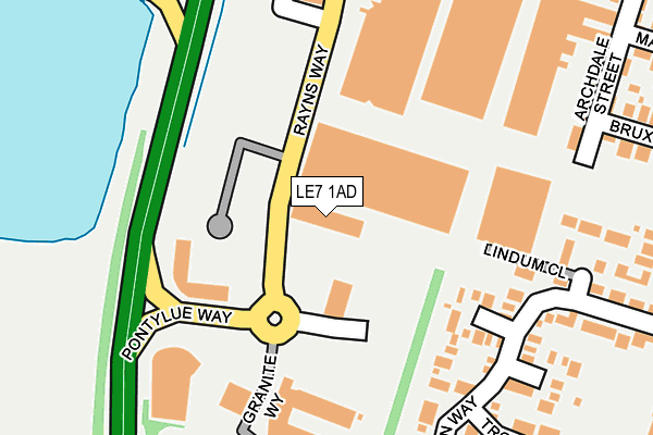
LE7 1AD is located in the Syston electoral ward, within the local authority district of Charnwood and the English Parliamentary constituency of Charnwood. The Sub Integrated Care Board (ICB) Location is NHS Leicester, Leicestershire and Rutland ICB - 03W and the police force is Leicestershire. This postcode has been in use since September 2011.


GetTheData
Source: OS OpenMap – Local (Ordnance Survey)
Source: OS VectorMap District (Ordnance Survey)
Licence: Open Government Licence (requires attribution)
| Easting | 461301 |
| Northing | 310961 |
| Latitude | 52.692891 |
| Longitude | -1.094434 |
GetTheData
Source: Open Postcode Geo
Licence: Open Government Licence
| Country | England |
| Postcode District | LE7 |
➜ See where LE7 is on a map ➜ Where is Syston? | |
GetTheData
Source: Land Registry Price Paid Data
Licence: Open Government Licence
Elevation or altitude of LE7 1AD as distance above sea level:
| Metres | Feet | |
|---|---|---|
| Elevation | 50m | 164ft |
Elevation is measured from the approximate centre of the postcode, to the nearest point on an OS contour line from OS Terrain 50, which has contour spacing of ten vertical metres.
➜ How high above sea level am I? Find the elevation of your current position using your device's GPS.
GetTheData
Source: Open Postcode Elevation
Licence: Open Government Licence
| Ward | Syston |
| Constituency | Charnwood |
GetTheData
Source: ONS Postcode Database
Licence: Open Government Licence
| Archdale Street (Wanlip Road) | Syston | 355m |
| Bruxby Street (Fosse Way) | Syston | 369m |
| Roman Way (Fosse Way) | Syston | 376m |
| Bruxby Street (Fosse Way) | Syston | 381m |
| Roman Way (Fosse Way) | Syston | 382m |
| Syston Station | 0.8km |
| Sileby Station | 4.4km |
GetTheData
Source: NaPTAN
Licence: Open Government Licence
GetTheData
Source: ONS Postcode Database
Licence: Open Government Licence


➜ Get more ratings from the Food Standards Agency
GetTheData
Source: Food Standards Agency
Licence: FSA terms & conditions
| Last Collection | |||
|---|---|---|---|
| Location | Mon-Fri | Sat | Distance |
| Wolsey Way | 17:30 | 07:00 | 715m |
| Broad Street | 17:30 | 07:00 | 1,178m |
| The Halfcroft | 17:30 | 09:00 | 1,221m |
GetTheData
Source: Dracos
Licence: Creative Commons Attribution-ShareAlike
The below table lists the International Territorial Level (ITL) codes (formerly Nomenclature of Territorial Units for Statistics (NUTS) codes) and Local Administrative Units (LAU) codes for LE7 1AD:
| ITL 1 Code | Name |
|---|---|
| TLF | East Midlands (England) |
| ITL 2 Code | Name |
| TLF2 | Leicestershire, Rutland and Northamptonshire |
| ITL 3 Code | Name |
| TLF22 | Leicestershire CC and Rutland |
| LAU 1 Code | Name |
| E07000130 | Charnwood |
GetTheData
Source: ONS Postcode Directory
Licence: Open Government Licence
The below table lists the Census Output Area (OA), Lower Layer Super Output Area (LSOA), and Middle Layer Super Output Area (MSOA) for LE7 1AD:
| Code | Name | |
|---|---|---|
| OA | E00130677 | |
| LSOA | E01025758 | Charnwood 017C |
| MSOA | E02005361 | Charnwood 017 |
GetTheData
Source: ONS Postcode Directory
Licence: Open Government Licence
| LE7 1ZF | Hadrian Close | 165m |
| LE7 1ZG | Marcus Close | 190m |
| LE7 1GE | Roman Way | 232m |
| LE7 1ZA | Lindum Close | 255m |
| LE7 1ZE | Augustus Close | 262m |
| LE7 1ZD | Trojan Way | 275m |
| LE7 1NA | Archdale Street | 280m |
| LE7 1NB | Bruxby Street | 310m |
| LE7 1NF | Fosse Way | 342m |
| LE7 1NQ | Maiden Street | 350m |
GetTheData
Source: Open Postcode Geo; Land Registry Price Paid Data
Licence: Open Government Licence