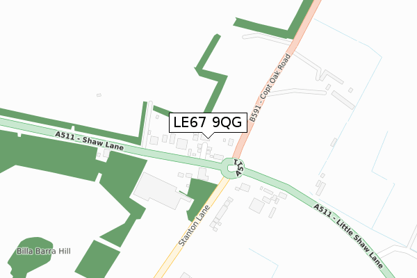
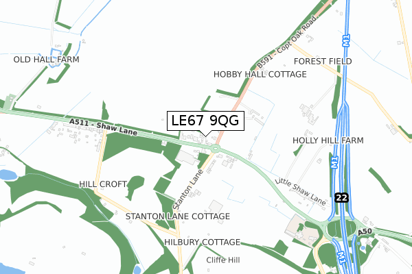
LE67 9QG is located in the Markfield, Stanton and Fieldhead electoral ward, within the local authority district of Hinckley and Bosworth and the English Parliamentary constituency of Bosworth. The Sub Integrated Care Board (ICB) Location is NHS Leicester, Leicestershire and Rutland ICB - 04V and the police force is Leicestershire. This postcode has been in use since October 2019.


GetTheData
Source: OS Open Zoomstack (Ordnance Survey)
Licence: Open Government Licence (requires attribution)
Attribution: Contains OS data © Crown copyright and database right 2025
Source: Open Postcode Geo
Licence: Open Government Licence (requires attribution)
Attribution: Contains OS data © Crown copyright and database right 2025; Contains Royal Mail data © Royal Mail copyright and database right 2025; Source: Office for National Statistics licensed under the Open Government Licence v.3.0
| Easting | 447087 |
| Northing | 311705 |
| Latitude | 52.700998 |
| Longitude | -1.304614 |
GetTheData
Source: Open Postcode Geo
Licence: Open Government Licence
| Country | England |
| Postcode District | LE67 |
➜ See where LE67 is on a map ➜ Where is Markfield? | |
GetTheData
Source: Land Registry Price Paid Data
Licence: Open Government Licence
| Ward | Markfield, Stanton And Fieldhead |
| Constituency | Bosworth |
GetTheData
Source: ONS Postcode Database
Licence: Open Government Licence
6, BROWNS BLUE CLOSE, MARKFIELD, LE67 9QG 2021 26 FEB £322,500 |
7, BROWNS BLUE CLOSE, MARKFIELD, LE67 9QG 2021 23 FEB £322,500 |
5, BROWNS BLUE CLOSE, MARKFIELD, LE67 9QG 2020 22 DEC £325,000 |
14, BROWNS BLUE CLOSE, MARKFIELD, LE67 9QG 2020 28 AUG £321,000 |
12, BROWNS BLUE CLOSE, MARKFIELD, LE67 9QG 2020 31 JAN £220,000 |
1, BROWNS BLUE CLOSE, MARKFIELD, LE67 9QG 2020 2 JAN £328,950 |
2, BROWNS BLUE CLOSE, MARKFIELD, LE67 9QG 2019 20 DEC £235,000 |
2002 28 JUN £150,000 |
GetTheData
Source: HM Land Registry Price Paid Data
Licence: Contains HM Land Registry data © Crown copyright and database right 2025. This data is licensed under the Open Government Licence v3.0.
| Flying Horse (Little Shaw Lane) | Billa Barra | 143m |
| Flying Horse (Little Shaw Lane) | Billa Barra | 145m |
| Upton & Sons (Shaw Lane) | Billa Barra | 266m |
| Billa Barra Lane (Shaw Lane) | Billa Barra | 731m |
| Billa Barra Lane (Shaw Lane) | Billa Barra | 749m |
GetTheData
Source: NaPTAN
Licence: Open Government Licence
GetTheData
Source: ONS Postcode Database
Licence: Open Government Licence


➜ Get more ratings from the Food Standards Agency
GetTheData
Source: Food Standards Agency
Licence: FSA terms & conditions
| Last Collection | |||
|---|---|---|---|
| Location | Mon-Fri | Sat | Distance |
| Forest Road | 16:15 | 08:15 | 2,315m |
| Newtown Lane | 16:00 | 07:45 | 3,342m |
| Central Road | 17:00 | 12:00 | 4,670m |
GetTheData
Source: Dracos
Licence: Creative Commons Attribution-ShareAlike
The below table lists the International Territorial Level (ITL) codes (formerly Nomenclature of Territorial Units for Statistics (NUTS) codes) and Local Administrative Units (LAU) codes for LE67 9QG:
| ITL 1 Code | Name |
|---|---|
| TLF | East Midlands (England) |
| ITL 2 Code | Name |
| TLF2 | Leicestershire, Rutland and Northamptonshire |
| ITL 3 Code | Name |
| TLF22 | Leicestershire CC and Rutland |
| LAU 1 Code | Name |
| E07000132 | Hinckley and Bosworth |
GetTheData
Source: ONS Postcode Directory
Licence: Open Government Licence
The below table lists the Census Output Area (OA), Lower Layer Super Output Area (LSOA), and Middle Layer Super Output Area (MSOA) for LE67 9QG:
| Code | Name | |
|---|---|---|
| OA | E00131271 | |
| LSOA | E01025871 | Hinckley and Bosworth 001D |
| MSOA | E02005377 | Hinckley and Bosworth 001 |
GetTheData
Source: ONS Postcode Directory
Licence: Open Government Licence
| LE67 9PU | Shaw Lane | 56m |
| LE67 9QA | Stanton Lane | 174m |
| LE67 9TT | Stanton Lane | 369m |
| LE67 9PP | Little Shaw Lane | 609m |
| LE67 9PD | Billa Barra Lane | 656m |
| LE67 9PE | Old House Lane | 666m |
| LE67 9TA | Billa Barra Lane | 720m |
| LE67 9PW | Shaw Lane | 763m |
| LE67 9TD | Main Street | 1021m |
| LE67 9TN | Main Street | 1026m |
GetTheData
Source: Open Postcode Geo; Land Registry Price Paid Data
Licence: Open Government Licence