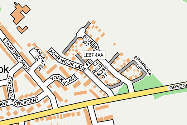
LE67 4AA is located in the Castle Rock electoral ward, within the local authority district of North West Leicestershire and the English Parliamentary constituency of North West Leicestershire. The Sub Integrated Care Board (ICB) Location is NHS Leicester, Leicestershire and Rutland ICB - 04V and the police force is Leicestershire. This postcode has been in use since March 2017.


GetTheData
Source: OS OpenMap – Local (Ordnance Survey)
Source: OS VectorMap District (Ordnance Survey)
Licence: Open Government Licence (requires attribution)
| Easting | 445802 |
| Northing | 314420 |
| Latitude | 52.725513 |
| Longitude | -1.323251 |
GetTheData
Source: Open Postcode Geo
Licence: Open Government Licence
| Country | England |
| Postcode District | LE67 |
➜ See where LE67 is on a map ➜ Where is Coalville? | |
GetTheData
Source: Land Registry Price Paid Data
Licence: Open Government Licence
| Ward | Castle Rock |
| Constituency | North West Leicestershire |
GetTheData
Source: ONS Postcode Database
Licence: Open Government Licence
2024 29 JUL £347,500 |
2024 24 MAY £360,000 |
2021 7 DEC £367,000 |
2019 27 JUN £314,000 |
2017 15 DEC £315,995 |
2017 14 DEC £315,995 |
2017 24 NOV £304,995 |
10, FERN CLOSE, COALVILLE, LE67 4AA 2017 10 NOV £394,995 |
2017 29 SEP £322,955 |
2, FERN CLOSE, COALVILLE, LE67 4AA 2017 30 JUN £345,995 |
GetTheData
Source: HM Land Registry Price Paid Data
Licence: Contains HM Land Registry data © Crown copyright and database right 2025. This data is licensed under the Open Government Licence v3.0.
| York Place (Stamford Drive) | Coalville | 155m |
| Lancaster Close (Stamford Drive) | Coalville | 233m |
| Kenmore Crescent (Greenhill Road) | Coalville | 370m |
| Oakham Drive (Stamford Drive) | Coalville | 397m |
| Belton Close (Oakham Drive) | Coalville | 440m |
GetTheData
Source: NaPTAN
Licence: Open Government Licence
| Percentage of properties with Next Generation Access | 100.0% |
| Percentage of properties with Superfast Broadband | 100.0% |
| Percentage of properties with Ultrafast Broadband | 88.9% |
| Percentage of properties with Full Fibre Broadband | 0.0% |
Superfast Broadband is between 30Mbps and 300Mbps
Ultrafast Broadband is > 300Mbps
| Median download speed | 200.0Mbps |
| Average download speed | 146.4Mbps |
| Maximum download speed | 200.00Mbps |
| Median upload speed | 10.4Mbps |
| Average upload speed | 10.4Mbps |
| Maximum upload speed | 10.70Mbps |
| Percentage of properties unable to receive 2Mbps | 0.0% |
| Percentage of properties unable to receive 5Mbps | 0.0% |
| Percentage of properties unable to receive 10Mbps | 0.0% |
| Percentage of properties unable to receive 30Mbps | 0.0% |
GetTheData
Source: Ofcom
Licence: Ofcom Terms of Use (requires attribution)
GetTheData
Source: ONS Postcode Database
Licence: Open Government Licence


➜ Get more ratings from the Food Standards Agency
GetTheData
Source: Food Standards Agency
Licence: FSA terms & conditions
| Last Collection | |||
|---|---|---|---|
| Location | Mon-Fri | Sat | Distance |
| New Swannington | 16:45 | 11:30 | 3,487m |
| Thornborough Road | 16:45 | 11:30 | 3,547m |
| Central Road | 17:00 | 12:00 | 3,578m |
GetTheData
Source: Dracos
Licence: Creative Commons Attribution-ShareAlike
The below table lists the International Territorial Level (ITL) codes (formerly Nomenclature of Territorial Units for Statistics (NUTS) codes) and Local Administrative Units (LAU) codes for LE67 4AA:
| ITL 1 Code | Name |
|---|---|
| TLF | East Midlands (England) |
| ITL 2 Code | Name |
| TLF2 | Leicestershire, Rutland and Northamptonshire |
| ITL 3 Code | Name |
| TLF22 | Leicestershire CC and Rutland |
| LAU 1 Code | Name |
| E07000134 | North West Leicestershire |
GetTheData
Source: ONS Postcode Directory
Licence: Open Government Licence
The below table lists the Census Output Area (OA), Lower Layer Super Output Area (LSOA), and Middle Layer Super Output Area (MSOA) for LE67 4AA:
| Code | Name | |
|---|---|---|
| OA | E00131600 | |
| LSOA | E01025934 | North West Leicestershire 009C |
| MSOA | E02005405 | North West Leicestershire 009 |
GetTheData
Source: ONS Postcode Directory
Licence: Open Government Licence
| LE67 4TH | York Place | 77m |
| LE67 4UB | Agar Nook Lane | 110m |
| LE67 4UF | Greenhill Road | 142m |
| LE67 4TF | Stamford Drive | 186m |
| LE67 4TG | Lancaster Close | 189m |
| LE67 4TJ | Rochdale Crescent | 234m |
| LE67 4QU | Romans Crescent | 234m |
| LE67 4QP | Jacquemart Close | 234m |
| LE67 4QQ | Dauphine Close | 314m |
| LE67 4QS | Vercor Close | 316m |
GetTheData
Source: Open Postcode Geo; Land Registry Price Paid Data
Licence: Open Government Licence