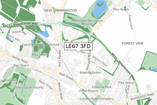
LE67 3FD is located in the Coalville West electoral ward, within the local authority district of North West Leicestershire and the English Parliamentary constituency of North West Leicestershire. The Sub Integrated Care Board (ICB) Location is NHS Leicester, Leicestershire and Rutland ICB - 04V and the police force is Leicestershire. This postcode has been in use since February 2020.


GetTheData
Source: OS Open Zoomstack (Ordnance Survey)
Licence: Open Government Licence (requires attribution)
Attribution: Contains OS data © Crown copyright and database right 2025
Source: Open Postcode Geo
Licence: Open Government Licence (requires attribution)
Attribution: Contains OS data © Crown copyright and database right 2025; Contains Royal Mail data © Royal Mail copyright and database right 2025; Source: Office for National Statistics licensed under the Open Government Licence v.3.0
| Easting | 442584 |
| Northing | 314701 |
| Latitude | 52.728301 |
| Longitude | -1.370859 |
GetTheData
Source: Open Postcode Geo
Licence: Open Government Licence
| Country | England |
| Postcode District | LE67 |
➜ See where LE67 is on a map ➜ Where is Coalville? | |
GetTheData
Source: Land Registry Price Paid Data
Licence: Open Government Licence
| Ward | Coalville West |
| Constituency | North West Leicestershire |
GetTheData
Source: ONS Postcode Database
Licence: Open Government Licence
| Albert Road (Whitwick Road) | Coalville | 265m |
| Comet Way (Thornborough Road) | Coalville | 303m |
| Albert Road (Whitwick Road) | Coalville | 305m |
| Morrisons (Whitwick Road) | Coalville | 312m |
| Comet Way (Thornborough Road) | Coalville | 350m |
GetTheData
Source: NaPTAN
Licence: Open Government Licence
GetTheData
Source: ONS Postcode Database
Licence: Open Government Licence


➜ Get more ratings from the Food Standards Agency
GetTheData
Source: Food Standards Agency
Licence: FSA terms & conditions
| Last Collection | |||
|---|---|---|---|
| Location | Mon-Fri | Sat | Distance |
| Thornborough Road | 16:45 | 11:30 | 698m |
| Belvoir Road | 18:30 | 11:30 | 714m |
| New Swannington | 16:45 | 11:30 | 1,231m |
GetTheData
Source: Dracos
Licence: Creative Commons Attribution-ShareAlike
The below table lists the International Territorial Level (ITL) codes (formerly Nomenclature of Territorial Units for Statistics (NUTS) codes) and Local Administrative Units (LAU) codes for LE67 3FD:
| ITL 1 Code | Name |
|---|---|
| TLF | East Midlands (England) |
| ITL 2 Code | Name |
| TLF2 | Leicestershire, Rutland and Northamptonshire |
| ITL 3 Code | Name |
| TLF22 | Leicestershire CC and Rutland |
| LAU 1 Code | Name |
| E07000134 | North West Leicestershire |
GetTheData
Source: ONS Postcode Directory
Licence: Open Government Licence
The below table lists the Census Output Area (OA), Lower Layer Super Output Area (LSOA), and Middle Layer Super Output Area (MSOA) for LE67 3FD:
| Code | Name | |
|---|---|---|
| OA | E00131588 | |
| LSOA | E01025930 | North West Leicestershire 010B |
| MSOA | E02005406 | North West Leicestershire 010 |
GetTheData
Source: ONS Postcode Directory
Licence: Open Government Licence
| LE67 3FS | Comet Way | 240m |
| LE67 3TH | Thornborough Road | 278m |
| LE67 3FA | Whitwick Road | 290m |
| LE67 3FP | Samson Road | 296m |
| LE67 3FH | Old Station Close | 303m |
| LE67 3ED | High Street | 383m |
| LE67 3EE | High Street | 394m |
| LE67 3EQ | Hotel Street | 410m |
| LE67 3PE | Belvoir Road | 449m |
| LE67 3DX | Market Street | 455m |
GetTheData
Source: Open Postcode Geo; Land Registry Price Paid Data
Licence: Open Government Licence