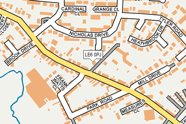
LE6 0PJ is located in the Ratby, Bagworth and Thornton electoral ward, within the local authority district of Hinckley and Bosworth and the English Parliamentary constituency of Bosworth. The Sub Integrated Care Board (ICB) Location is NHS Leicester, Leicestershire and Rutland ICB - 04V and the police force is Leicestershire. This postcode has been in use since March 2017.


GetTheData
Source: OS OpenMap – Local (Ordnance Survey)
Source: OS VectorMap District (Ordnance Survey)
Licence: Open Government Licence (requires attribution)
| Easting | 451597 |
| Northing | 305495 |
| Latitude | 52.644767 |
| Longitude | -1.238851 |
GetTheData
Source: Open Postcode Geo
Licence: Open Government Licence
| Country | England |
| Postcode District | LE6 |
➜ See where LE6 is on a map ➜ Where is Ratby? | |
GetTheData
Source: Land Registry Price Paid Data
Licence: Open Government Licence
| Ward | Ratby, Bagworth And Thornton |
| Constituency | Bosworth |
GetTheData
Source: ONS Postcode Database
Licence: Open Government Licence
| Mill Drive (Station Road) | Ratby | 107m |
| Park Road (Station Road) | Ratby | 109m |
| Park Road (Station Road) | Ratby | 112m |
| Mill Drive (Station Road) | Ratby | 159m |
| Meadow Close (Nicholas Drive) | Ratby | 263m |
GetTheData
Source: NaPTAN
Licence: Open Government Licence
GetTheData
Source: ONS Postcode Database
Licence: Open Government Licence


➜ Get more ratings from the Food Standards Agency
GetTheData
Source: Food Standards Agency
Licence: FSA terms & conditions
| Last Collection | |||
|---|---|---|---|
| Location | Mon-Fri | Sat | Distance |
| Ratby Post Office | 16:00 | 11:30 | 543m |
| Laundon Way | 16:00 | 08:45 | 1,619m |
| Highfield Road | 16:00 | 08:30 | 1,792m |
GetTheData
Source: Dracos
Licence: Creative Commons Attribution-ShareAlike
The below table lists the International Territorial Level (ITL) codes (formerly Nomenclature of Territorial Units for Statistics (NUTS) codes) and Local Administrative Units (LAU) codes for LE6 0PJ:
| ITL 1 Code | Name |
|---|---|
| TLF | East Midlands (England) |
| ITL 2 Code | Name |
| TLF2 | Leicestershire, Rutland and Northamptonshire |
| ITL 3 Code | Name |
| TLF22 | Leicestershire CC and Rutland |
| LAU 1 Code | Name |
| E07000132 | Hinckley and Bosworth |
GetTheData
Source: ONS Postcode Directory
Licence: Open Government Licence
The below table lists the Census Output Area (OA), Lower Layer Super Output Area (LSOA), and Middle Layer Super Output Area (MSOA) for LE6 0PJ:
| Code | Name | |
|---|---|---|
| OA | E00131318 | |
| LSOA | E01025877 | Hinckley and Bosworth 003B |
| MSOA | E02005379 | Hinckley and Bosworth 003 |
GetTheData
Source: ONS Postcode Directory
Licence: Open Government Licence
| LE6 0NP | Cufflin Close | 45m |
| LE6 0NJ | Nicholas Drive | 110m |
| LE6 0JP | Station Road | 118m |
| LE6 0JR | Station Road | 127m |
| LE6 0JJ | Park Road | 141m |
| LE6 0HU | Park Road | 144m |
| LE6 0PD | Frank Watts Close | 146m |
| LE6 0JL | Park Road | 160m |
| LE6 0NR | Grange Close | 163m |
| LE6 0XB | Heathbrook Drive | 172m |
GetTheData
Source: Open Postcode Geo; Land Registry Price Paid Data
Licence: Open Government Licence