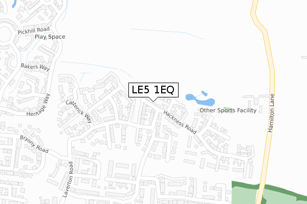
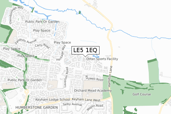
LE5 1EQ is located in the South Charnwood electoral ward, within the local authority district of Charnwood and the English Parliamentary constituency of Charnwood. The Sub Integrated Care Board (ICB) Location is NHS Leicester, Leicestershire and Rutland ICB - 03W and the police force is Leicestershire. This postcode has been in use since April 2018.


GetTheData
Source: OS Open Zoomstack (Ordnance Survey)
Licence: Open Government Licence (requires attribution)
Attribution: Contains OS data © Crown copyright and database right 2025
Source: Open Postcode Geo
Licence: Open Government Licence (requires attribution)
Attribution: Contains OS data © Crown copyright and database right 2025; Contains Royal Mail data © Royal Mail copyright and database right 2025; Source: Office for National Statistics licensed under the Open Government Licence v.3.0
| Easting | 464089 |
| Northing | 307061 |
| Latitude | 52.657514 |
| Longitude | -1.053946 |
GetTheData
Source: Open Postcode Geo
Licence: Open Government Licence
| Country | England |
| Postcode District | LE5 |
➜ See where LE5 is on a map ➜ Where is Leicester? | |
GetTheData
Source: Land Registry Price Paid Data
Licence: Open Government Licence
| Ward | South Charnwood |
| Constituency | Charnwood |
GetTheData
Source: ONS Postcode Database
Licence: Open Government Licence
7, CORNHOLME DRIVE, HAMILTON, LEICESTER, LE5 1EQ 2023 30 JUN £450,000 |
5, CORNHOLME DRIVE, HAMILTON, LEICESTER, LE5 1EQ 2022 23 SEP £410,000 |
1, CORNHOLME DRIVE, HAMILTON, LEICESTER, LE5 1EQ 2018 11 OCT £315,000 |
5, CORNHOLME DRIVE, HAMILTON, LEICESTER, LE5 1EQ 2018 29 JUN £300,000 |
9, CORNHOLME DRIVE, HAMILTON, LEICESTER, LE5 1EQ 2018 29 JUN £330,000 |
3, CORNHOLME DRIVE, HAMILTON, LEICESTER, LE5 1EQ 2018 29 JUN £333,000 |
2, CORNHOLME DRIVE, HAMILTON, LEICESTER, LE5 1EQ 2018 25 MAY £280,000 |
7, CORNHOLM DRIVE, HAMILTON, LEICESTER, LE5 1EQ 2018 14 MAY £340,000 |
8, CORNHOLM DRIVE, HAMILTON, LEICESTER, LE5 1EQ 2018 25 APR £315,000 |
4, CORNHOLME DRIVE, HAMILTON, LEICESTER, LE5 1EQ 2018 29 MAR £280,000 |
GetTheData
Source: HM Land Registry Price Paid Data
Licence: Contains HM Land Registry data © Crown copyright and database right 2025. This data is licensed under the Open Government Licence v3.0.
| Bakers Way (Maidenhead Avnue) | Hamilton | 448m |
| Bakers Way (Maidenwell Avenue) | Hamilton | 472m |
| Celandine Road (Maidenwell Avenue) | Hamilton | 554m |
| Celandine Road (Maidenwell Avenue) | Hamilton | 565m |
| Hazeldene Road (Maidenwell Avenue) | Hamilton | 615m |
| Syston Station | 4.5km |
| Leicester Station | 5.6km |
GetTheData
Source: NaPTAN
Licence: Open Government Licence
| Percentage of properties with Next Generation Access | 88.9% |
| Percentage of properties with Superfast Broadband | 88.9% |
| Percentage of properties with Ultrafast Broadband | 88.9% |
| Percentage of properties with Full Fibre Broadband | 0.0% |
Superfast Broadband is between 30Mbps and 300Mbps
Ultrafast Broadband is > 300Mbps
| Percentage of properties unable to receive 2Mbps | 0.0% |
| Percentage of properties unable to receive 5Mbps | 0.0% |
| Percentage of properties unable to receive 10Mbps | 11.1% |
| Percentage of properties unable to receive 30Mbps | 11.1% |
GetTheData
Source: Ofcom
Licence: Ofcom Terms of Use (requires attribution)
GetTheData
Source: ONS Postcode Database
Licence: Open Government Licence


➜ Get more ratings from the Food Standards Agency
GetTheData
Source: Food Standards Agency
Licence: FSA terms & conditions
| Last Collection | |||
|---|---|---|---|
| Location | Mon-Fri | Sat | Distance |
| Grantham Road | 17:00 | 12:00 | 1,112m |
| Maidenhead Avenue | 16:30 | 11:00 | 1,329m |
| Main Street | 16:45 | 09:30 | 1,390m |
GetTheData
Source: Dracos
Licence: Creative Commons Attribution-ShareAlike
The below table lists the International Territorial Level (ITL) codes (formerly Nomenclature of Territorial Units for Statistics (NUTS) codes) and Local Administrative Units (LAU) codes for LE5 1EQ:
| ITL 1 Code | Name |
|---|---|
| TLF | East Midlands (England) |
| ITL 2 Code | Name |
| TLF2 | Leicestershire, Rutland and Northamptonshire |
| ITL 3 Code | Name |
| TLF22 | Leicestershire CC and Rutland |
| LAU 1 Code | Name |
| E07000130 | Charnwood |
GetTheData
Source: ONS Postcode Directory
Licence: Open Government Licence
The below table lists the Census Output Area (OA), Lower Layer Super Output Area (LSOA), and Middle Layer Super Output Area (MSOA) for LE5 1EQ:
| Code | Name | |
|---|---|---|
| OA | E00130544 | |
| LSOA | E01025730 | Charnwood 015C |
| MSOA | E02005359 | Charnwood 015 |
GetTheData
Source: ONS Postcode Directory
Licence: Open Government Licence
| LE5 1WG | Laverton Road | 194m |
| LE5 1ER | Catterick Way | 266m |
| LE5 1EL | Carnaby Close | 288m |
| LE5 1QF | Heritage Way | 362m |
| LE5 1PZ | Bakers Way | 402m |
| LE5 1QE | Mason Row | 404m |
| LE5 1SZ | Bryony Road | 406m |
| LE5 1QH | The Maltings | 413m |
| LE5 1UJ | Burdock Close | 445m |
| LE5 1WJ | Laverton Road | 453m |
GetTheData
Source: Open Postcode Geo; Land Registry Price Paid Data
Licence: Open Government Licence