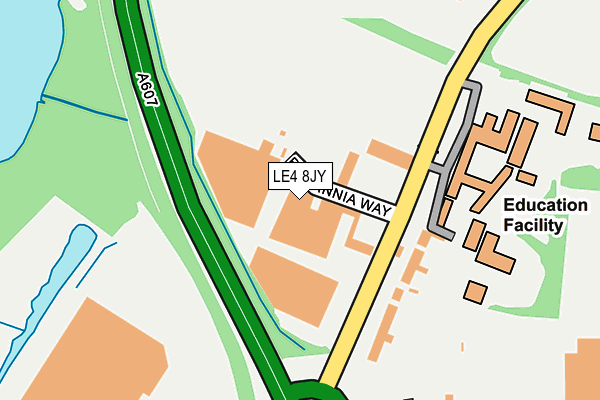
LE4 8JY is located in the Thurmaston electoral ward, within the local authority district of Charnwood and the English Parliamentary constituency of Charnwood. The Sub Integrated Care Board (ICB) Location is NHS Leicester, Leicestershire and Rutland ICB - 04V and the police force is Leicestershire. This postcode has been in use since February 1990.


GetTheData
Source: OS OpenMap – Local (Ordnance Survey)
Source: OS VectorMap District (Ordnance Survey)
Licence: Open Government Licence (requires attribution)
| Easting | 461306 |
| Northing | 310315 |
| Latitude | 52.687065 |
| Longitude | -1.094487 |
GetTheData
Source: Open Postcode Geo
Licence: Open Government Licence
| Country | England |
| Postcode District | LE4 |
➜ See where LE4 is on a map ➜ Where is Thurmaston? | |
GetTheData
Source: Land Registry Price Paid Data
Licence: Open Government Licence
Elevation or altitude of LE4 8JY as distance above sea level:
| Metres | Feet | |
|---|---|---|
| Elevation | 50m | 164ft |
Elevation is measured from the approximate centre of the postcode, to the nearest point on an OS contour line from OS Terrain 50, which has contour spacing of ten vertical metres.
➜ How high above sea level am I? Find the elevation of your current position using your device's GPS.
GetTheData
Source: Open Postcode Elevation
Licence: Open Government Licence
| Ward | Thurmaston |
| Constituency | Charnwood |
GetTheData
Source: ONS Postcode Database
Licence: Open Government Licence
| Roundhill College (Melton Road) | Thurmaston | 112m |
| Roundhill College (Melton Road) | Thurmaston | 121m |
| Pizza Hut (Barkby Thorpe Lane) | Thurmaston | 323m |
| Costco (Melton Road) | Thurmaston | 345m |
| Costco (Melton Road) | Thurmaston | 384m |
| Syston Station | 1.1km |
| Sileby Station | 5.1km |
GetTheData
Source: NaPTAN
Licence: Open Government Licence
GetTheData
Source: ONS Postcode Database
Licence: Open Government Licence

➜ Get more ratings from the Food Standards Agency
GetTheData
Source: Food Standards Agency
Licence: FSA terms & conditions
| Last Collection | |||
|---|---|---|---|
| Location | Mon-Fri | Sat | Distance |
| Wolsey Way | 17:30 | 07:00 | 1,246m |
| Dorothy Avenue | 17:30 | 11:30 | 1,477m |
| Broad Street | 17:30 | 07:00 | 1,570m |
GetTheData
Source: Dracos
Licence: Creative Commons Attribution-ShareAlike
The below table lists the International Territorial Level (ITL) codes (formerly Nomenclature of Territorial Units for Statistics (NUTS) codes) and Local Administrative Units (LAU) codes for LE4 8JY:
| ITL 1 Code | Name |
|---|---|
| TLF | East Midlands (England) |
| ITL 2 Code | Name |
| TLF2 | Leicestershire, Rutland and Northamptonshire |
| ITL 3 Code | Name |
| TLF22 | Leicestershire CC and Rutland |
| LAU 1 Code | Name |
| E07000130 | Charnwood |
GetTheData
Source: ONS Postcode Directory
Licence: Open Government Licence
The below table lists the Census Output Area (OA), Lower Layer Super Output Area (LSOA), and Middle Layer Super Output Area (MSOA) for LE4 8JY:
| Code | Name | |
|---|---|---|
| OA | E00130726 | |
| LSOA | E01025766 | Charnwood 021E |
| MSOA | E02005365 | Charnwood 021 |
GetTheData
Source: ONS Postcode Directory
Licence: Open Government Licence
| LE4 8GR | Melton Road | 47m |
| LE4 8GQ | Melton Road | 128m |
| LE7 2BJ | Simpson Close | 279m |
| LE7 1JA | Anthony Close | 356m |
| LE7 2NR | Oliver Close | 361m |
| LE4 8EF | Melton Road | 405m |
| LE7 2NL | Melton Road | 441m |
| LE7 1ZD | Trojan Way | 451m |
| LE4 8GP | Barkby Thorpe Lane | 476m |
| LE4 8NZ | Checkland Road | 489m |
GetTheData
Source: Open Postcode Geo; Land Registry Price Paid Data
Licence: Open Government Licence