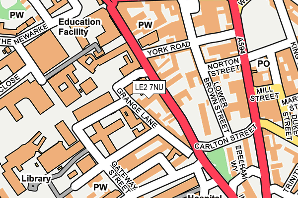
LE2 7NU is located in the Castle electoral ward, within the unitary authority of Leicester and the English Parliamentary constituency of Leicester South. The Sub Integrated Care Board (ICB) Location is NHS Leicester, Leicestershire and Rutland ICB - 04C and the police force is Leicestershire. This postcode has been in use since May 2017.


GetTheData
Source: OS OpenMap – Local (Ordnance Survey)
Source: OS VectorMap District (Ordnance Survey)
Licence: Open Government Licence (requires attribution)
| Easting | 458546 |
| Northing | 303922 |
| Latitude | 52.629923 |
| Longitude | -1.136438 |
GetTheData
Source: Open Postcode Geo
Licence: Open Government Licence
| Country | England |
| Postcode District | LE2 |
➜ See where LE2 is on a map ➜ Where is Leicester? | |
GetTheData
Source: Land Registry Price Paid Data
Licence: Open Government Licence
| Ward | Castle |
| Constituency | Leicester South |
GetTheData
Source: ONS Postcode Database
Licence: Open Government Licence
| Bonners Lane (Oxford Street) | Leicester | 39m |
| Grange Lane (Bonners Lane) | Leicester | 76m |
| Henshaw Street (Gateway Street) | Leicester | 158m |
| Gateway Street (Mill Lane) | Leicester | 166m |
| Henshaw Street (Jarrom Street) | Leicester | 172m |
| Leicester Station | 0.8km |
GetTheData
Source: NaPTAN
Licence: Open Government Licence
GetTheData
Source: ONS Postcode Database
Licence: Open Government Licence


➜ Get more ratings from the Food Standards Agency
GetTheData
Source: Food Standards Agency
Licence: FSA terms & conditions
| Last Collection | |||
|---|---|---|---|
| Location | Mon-Fri | Sat | Distance |
| Welford Place | 18:30 | 12:00 | 209m |
| The Newarke | 18:30 | 12:00 | 237m |
| King Street | 18:30 | 12:00 | 318m |
GetTheData
Source: Dracos
Licence: Creative Commons Attribution-ShareAlike
The below table lists the International Territorial Level (ITL) codes (formerly Nomenclature of Territorial Units for Statistics (NUTS) codes) and Local Administrative Units (LAU) codes for LE2 7NU:
| ITL 1 Code | Name |
|---|---|
| TLF | East Midlands (England) |
| ITL 2 Code | Name |
| TLF2 | Leicestershire, Rutland and Northamptonshire |
| ITL 3 Code | Name |
| TLF21 | Leicester |
| LAU 1 Code | Name |
| E06000016 | Leicester |
GetTheData
Source: ONS Postcode Directory
Licence: Open Government Licence
The below table lists the Census Output Area (OA), Lower Layer Super Output Area (LSOA), and Middle Layer Super Output Area (MSOA) for LE2 7NU:
| Code | Name | |
|---|---|---|
| OA | E00169488 | |
| LSOA | E01032868 | Leicester 041B |
| MSOA | E02006851 | Leicester 041 |
GetTheData
Source: ONS Postcode Directory
Licence: Open Government Licence
| LE1 5XY | Oxford Street | 49m |
| LE2 7EE | Grange Lane | 72m |
| LE1 5TT | York Road | 84m |
| LE1 5TN | Norton Street | 132m |
| LE1 5TH | Lower Brown Street | 148m |
| LE1 5TS | York Road | 156m |
| LE1 5TE | Upper Brown Street | 166m |
| LE2 7AE | Welford Road | 184m |
| LE2 7AD | Welford Road | 211m |
| LE2 7AA | Welford Road | 218m |
GetTheData
Source: Open Postcode Geo; Land Registry Price Paid Data
Licence: Open Government Licence