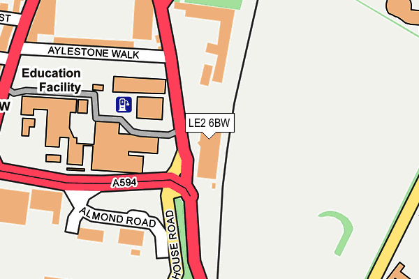
LE2 6BW is located in the Castle electoral ward, within the unitary authority of Leicester and the English Parliamentary constituency of Leicester South. The Sub Integrated Care Board (ICB) Location is NHS Leicester, Leicestershire and Rutland ICB - 04C and the police force is Leicestershire. This postcode has been in use since July 1990.


GetTheData
Source: OS OpenMap – Local (Ordnance Survey)
Source: OS VectorMap District (Ordnance Survey)
Licence: Open Government Licence (requires attribution)
| Easting | 458955 |
| Northing | 303088 |
| Latitude | 52.622364 |
| Longitude | -1.130552 |
GetTheData
Source: Open Postcode Geo
Licence: Open Government Licence
| Country | England |
| Postcode District | LE2 |
➜ See where LE2 is on a map ➜ Where is Leicester? | |
GetTheData
Source: Land Registry Price Paid Data
Licence: Open Government Licence
Elevation or altitude of LE2 6BW as distance above sea level:
| Metres | Feet | |
|---|---|---|
| Elevation | 70m | 230ft |
Elevation is measured from the approximate centre of the postcode, to the nearest point on an OS contour line from OS Terrain 50, which has contour spacing of ten vertical metres.
➜ How high above sea level am I? Find the elevation of your current position using your device's GPS.
GetTheData
Source: Open Postcode Elevation
Licence: Open Government Licence
| Ward | Castle |
| Constituency | Leicester South |
GetTheData
Source: ONS Postcode Database
Licence: Open Government Licence
| Tigers Way (Welford Road) | Leicester | 95m |
| Vauxhall Dealership (Almond Road) | Leicester | 248m |
| Wyggeston Qe College (University Road) | Leicester | 295m |
| Welford Road Cemetery (Welford Road) | Southfields | 298m |
| Sawday Street (Aylestone Road) | Leicester | 315m |
| Leicester Station | 1.1km |
| South Wigston Station | 4.5km |
GetTheData
Source: NaPTAN
Licence: Open Government Licence
GetTheData
Source: ONS Postcode Database
Licence: Open Government Licence


➜ Get more ratings from the Food Standards Agency
GetTheData
Source: Food Standards Agency
Licence: FSA terms & conditions
| Last Collection | |||
|---|---|---|---|
| Location | Mon-Fri | Sat | Distance |
| Hazel Street | 17:45 | 12:00 | 313m |
| University Road | 18:30 | 12:00 | 313m |
| Walnut Street | 18:30 | 12:00 | 646m |
GetTheData
Source: Dracos
Licence: Creative Commons Attribution-ShareAlike
The below table lists the International Territorial Level (ITL) codes (formerly Nomenclature of Territorial Units for Statistics (NUTS) codes) and Local Administrative Units (LAU) codes for LE2 6BW:
| ITL 1 Code | Name |
|---|---|
| TLF | East Midlands (England) |
| ITL 2 Code | Name |
| TLF2 | Leicestershire, Rutland and Northamptonshire |
| ITL 3 Code | Name |
| TLF21 | Leicester |
| LAU 1 Code | Name |
| E06000016 | Leicester |
GetTheData
Source: ONS Postcode Directory
Licence: Open Government Licence
The below table lists the Census Output Area (OA), Lower Layer Super Output Area (LSOA), and Middle Layer Super Output Area (MSOA) for LE2 6BW:
| Code | Name | |
|---|---|---|
| OA | E00068890 | |
| LSOA | E01013649 | Leicester 030C |
| MSOA | E02002856 | Leicester 030 |
GetTheData
Source: ONS Postcode Directory
Licence: Open Government Licence
| LE2 7LN | Aylestone Road | 324m |
| LE1 7HB | Lancaster Place | 332m |
| LE2 7LL | Aylestone Road | 333m |
| LE2 7JG | Filbert Street East | 384m |
| LE2 7JN | Hazel Street | 385m |
| LE2 7LD | Walnut Street | 402m |
| LE2 7JE | Filbert Street East | 403m |
| LE2 7JQ | Pavilion Close | 407m |
| LE2 7JA | Brazil Street | 426m |
| LE2 7JW | Sawday Street | 426m |
GetTheData
Source: Open Postcode Geo; Land Registry Price Paid Data
Licence: Open Government Licence