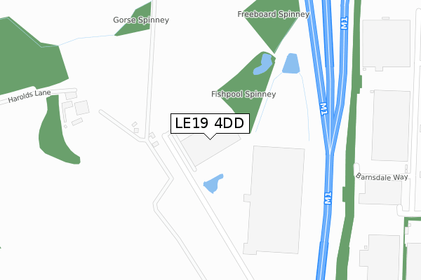
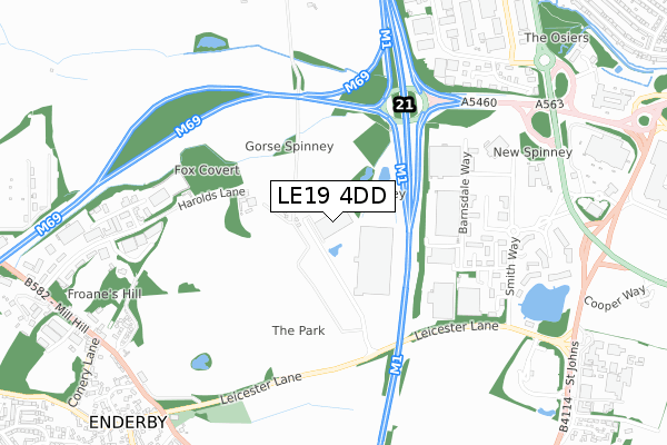
LE19 4DD is located in the Leicester Forest & Lubbesthorpe electoral ward, within the local authority district of Blaby and the English Parliamentary constituency of South Leicestershire. The Sub Integrated Care Board (ICB) Location is NHS Leicester, Leicestershire and Rutland ICB - 03W and the police force is Leicestershire. This postcode has been in use since August 2019.


GetTheData
Source: OS Open Zoomstack (Ordnance Survey)
Licence: Open Government Licence (requires attribution)
Attribution: Contains OS data © Crown copyright and database right 2025
Source: Open Postcode Geo
Licence: Open Government Licence (requires attribution)
Attribution: Contains OS data © Crown copyright and database right 2025; Contains Royal Mail data © Royal Mail copyright and database right 2025; Source: Office for National Statistics licensed under the Open Government Licence v.3.0
| Easting | 452882 |
| Northing | 302046 |
| Latitude | 52.613640 |
| Longitude | -1.220412 |
GetTheData
Source: Open Postcode Geo
Licence: Open Government Licence
| Country | England |
| Postcode District | LE19 |
➜ See where LE19 is on a map ➜ Where is Leicester Forest East? | |
GetTheData
Source: Land Registry Price Paid Data
Licence: Open Government Licence
| Ward | Leicester Forest & Lubbesthorpe |
| Constituency | South Leicestershire |
GetTheData
Source: ONS Postcode Database
Licence: Open Government Licence
| Lowland Avenue (Rushmere Walk) | Leicester Forest East | 915m |
| Beggars Lane (Hinckley Road) | Leicester Forest East | 932m |
| Hinckley Road | Leicester Forest East | 968m |
| Hinckley Road | Leicester Forest East | 983m |
| Boyers Walk (Stafford Leys) | Leicester Forest East | 989m |
| Narborough Station | 4.8km |
GetTheData
Source: NaPTAN
Licence: Open Government Licence
GetTheData
Source: ONS Postcode Database
Licence: Open Government Licence


➜ Get more ratings from the Food Standards Agency
GetTheData
Source: Food Standards Agency
Licence: FSA terms & conditions
| Last Collection | |||
|---|---|---|---|
| Location | Mon-Fri | Sat | Distance |
| Somerfield Way | 17:00 | 12:00 | 630m |
| Warren Lane | 17:00 | 12:00 | 838m |
| Maytree Drive | 17:00 | 12:00 | 1,237m |
GetTheData
Source: Dracos
Licence: Creative Commons Attribution-ShareAlike
The below table lists the International Territorial Level (ITL) codes (formerly Nomenclature of Territorial Units for Statistics (NUTS) codes) and Local Administrative Units (LAU) codes for LE19 4DD:
| ITL 1 Code | Name |
|---|---|
| TLF | East Midlands (England) |
| ITL 2 Code | Name |
| TLF2 | Leicestershire, Rutland and Northamptonshire |
| ITL 3 Code | Name |
| TLF22 | Leicestershire CC and Rutland |
| LAU 1 Code | Name |
| E07000129 | Blaby |
GetTheData
Source: ONS Postcode Directory
Licence: Open Government Licence
The below table lists the Census Output Area (OA), Lower Layer Super Output Area (LSOA), and Middle Layer Super Output Area (MSOA) for LE19 4DD:
| Code | Name | |
|---|---|---|
| OA | E00130047 | |
| LSOA | E01025626 | Blaby 006B |
| MSOA | E02005338 | Blaby 006 |
GetTheData
Source: ONS Postcode Directory
Licence: Open Government Licence
| LE3 3QT | Harrow Close | 385m |
| LE3 3AR | Yew Close | 422m |
| LE3 3NU | Forest House Lane | 443m |
| LE3 3QR | Plough Close | 458m |
| LE3 3NZ | Copse Close | 496m |
| LE3 3QS | Harvester Close | 514m |
| LE3 3QY | Begonia Close | 553m |
| LE3 3QZ | Petunia Close | 570m |
| LE3 3NX | Lark Close | 571m |
| LE3 3NY | Swallow Close | 584m |
GetTheData
Source: Open Postcode Geo; Land Registry Price Paid Data
Licence: Open Government Licence