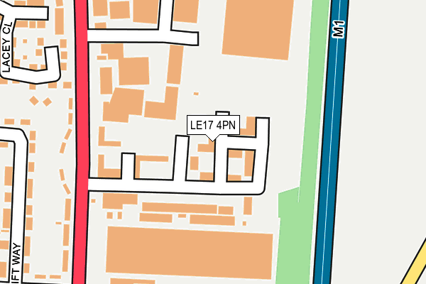
LE17 4PN lies on Central Park in Lutterworth. LE17 4PN is located in the Lutterworth East electoral ward, within the local authority district of Harborough and the English Parliamentary constituency of South Leicestershire. The Sub Integrated Care Board (ICB) Location is NHS Leicester, Leicestershire and Rutland ICB - 03W and the police force is Leicestershire. This postcode has been in use since January 1992.


GetTheData
Source: OS OpenMap – Local (Ordnance Survey)
Source: OS VectorMap District (Ordnance Survey)
Licence: Open Government Licence (requires attribution)
| Easting | 454760 |
| Northing | 285558 |
| Latitude | 52.465244 |
| Longitude | -1.195388 |
GetTheData
Source: Open Postcode Geo
Licence: Open Government Licence
| Street | Central Park |
| Town/City | Lutterworth |
| Country | England |
| Postcode District | LE17 |
➜ See where LE17 is on a map ➜ Where is Lutterworth? | |
GetTheData
Source: Land Registry Price Paid Data
Licence: Open Government Licence
Elevation or altitude of LE17 4PN as distance above sea level:
| Metres | Feet | |
|---|---|---|
| Elevation | 130m | 427ft |
Elevation is measured from the approximate centre of the postcode, to the nearest point on an OS contour line from OS Terrain 50, which has contour spacing of ten vertical metres.
➜ How high above sea level am I? Find the elevation of your current position using your device's GPS.
GetTheData
Source: Open Postcode Elevation
Licence: Open Government Licence
| Ward | Lutterworth East |
| Constituency | South Leicestershire |
GetTheData
Source: ONS Postcode Database
Licence: Open Government Licence
| Elizabethan Way (Leicester Road) | Lutterworth | 230m |
| Elizabethan Way (Leicester Road) | Lutterworth | 240m |
| Oakberry Road (Leicester Road) | Lutterworth | 290m |
| Oakberry Road (Leicester Road) | Lutterworth | 362m |
| Crescent Road (Leicester Road) | Lutterworth | 602m |
GetTheData
Source: NaPTAN
Licence: Open Government Licence
| Median download speed | 74.6Mbps |
| Average download speed | 66.9Mbps |
| Maximum download speed | 80.00Mbps |
| Median upload speed | 16.1Mbps |
| Average upload speed | 14.9Mbps |
| Maximum upload speed | 20.00Mbps |
GetTheData
Source: Ofcom
Licence: Ofcom Terms of Use (requires attribution)
GetTheData
Source: ONS Postcode Database
Licence: Open Government Licence


➜ Get more ratings from the Food Standards Agency
GetTheData
Source: Food Standards Agency
Licence: FSA terms & conditions
| Last Collection | |||
|---|---|---|---|
| Location | Mon-Fri | Sat | Distance |
| Leicester Road | 17:30 | 11:30 | 289m |
| Macauley Road | 17:30 | 11:30 | 1,084m |
| Ashby Parva | 17:00 | 10:30 | 3,453m |
GetTheData
Source: Dracos
Licence: Creative Commons Attribution-ShareAlike
The below table lists the International Territorial Level (ITL) codes (formerly Nomenclature of Territorial Units for Statistics (NUTS) codes) and Local Administrative Units (LAU) codes for LE17 4PN:
| ITL 1 Code | Name |
|---|---|
| TLF | East Midlands (England) |
| ITL 2 Code | Name |
| TLF2 | Leicestershire, Rutland and Northamptonshire |
| ITL 3 Code | Name |
| TLF22 | Leicestershire CC and Rutland |
| LAU 1 Code | Name |
| E07000131 | Harborough |
GetTheData
Source: ONS Postcode Directory
Licence: Open Government Licence
The below table lists the Census Output Area (OA), Lower Layer Super Output Area (LSOA), and Middle Layer Super Output Area (MSOA) for LE17 4PN:
| Code | Name | |
|---|---|---|
| OA | E00130871 | |
| LSOA | E01025793 | Harborough 010D |
| MSOA | E02005376 | Harborough 010 |
GetTheData
Source: ONS Postcode Directory
Licence: Open Government Licence
| LE17 4PR | Drage Close | 111m |
| LE17 4PH | Central Park | 153m |
| LE17 4NN | Leicester Road | 220m |
| LE17 4JA | Bilton Way | 224m |
| LE17 4GX | Lacey Close | 284m |
| LE17 4PA | Swiftway | 310m |
| LE17 4NZ | Central Avenue | 333m |
| LE17 4GQ | Page Close | 366m |
| LE17 4NW | Sherrier Way | 369m |
| LE17 4NH | Leicester Road | 376m |
GetTheData
Source: Open Postcode Geo; Land Registry Price Paid Data
Licence: Open Government Licence