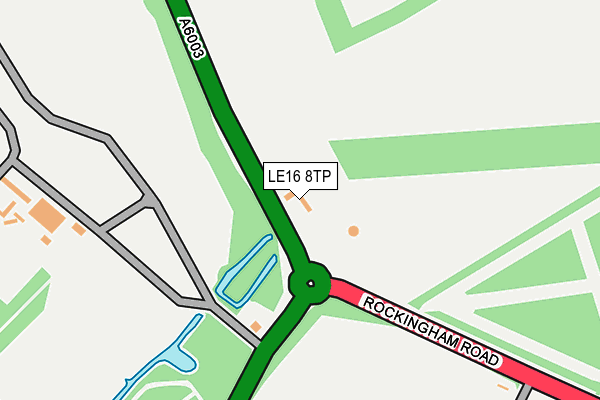
LE16 8TP is located in the Corby Rural electoral ward, within the unitary authority of North Northamptonshire and the English Parliamentary constituency of Corby. The Sub Integrated Care Board (ICB) Location is NHS Northamptonshire ICB - 78H and the police force is Northamptonshire. This postcode has been in use since September 2013.


GetTheData
Source: OS OpenMap – Local (Ordnance Survey)
Source: OS VectorMap District (Ordnance Survey)
Licence: Open Government Licence (requires attribution)
| Easting | 487140 |
| Northing | 291100 |
| Latitude | 52.510853 |
| Longitude | -0.717433 |
GetTheData
Source: Open Postcode Geo
Licence: Open Government Licence
| Country | England |
| Postcode District | LE16 |
➜ See where LE16 is on a map ➜ Where is Corby? | |
GetTheData
Source: Land Registry Price Paid Data
Licence: Open Government Licence
Elevation or altitude of LE16 8TP as distance above sea level:
| Metres | Feet | |
|---|---|---|
| Elevation | 120m | 394ft |
Elevation is measured from the approximate centre of the postcode, to the nearest point on an OS contour line from OS Terrain 50, which has contour spacing of ten vertical metres.
➜ How high above sea level am I? Find the elevation of your current position using your device's GPS.
GetTheData
Source: Open Postcode Elevation
Licence: Open Government Licence
| Ward | Corby Rural |
| Constituency | Corby |
GetTheData
Source: ONS Postcode Database
Licence: Open Government Licence
| Cam Close (Shire Road) | Shire Lodge | 752m |
| Cam Close (Shire Road) | Shire Lodge | 759m |
| Nevis Close (Shire Road) | Shire Lodge | 761m |
| Nevis Close (Shire Road) | Shire Lodge | 775m |
| Carron Close (Shire Road) | Shire Lodge | 797m |
| Corby Station | 3.1km |
GetTheData
Source: NaPTAN
Licence: Open Government Licence
GetTheData
Source: ONS Postcode Database
Licence: Open Government Licence


➜ Get more ratings from the Food Standards Agency
GetTheData
Source: Food Standards Agency
Licence: FSA terms & conditions
| Last Collection | |||
|---|---|---|---|
| Location | Mon-Fri | Sat | Distance |
| Shire Road | 17:00 | 11:15 | 758m |
| Tanfield Grove | 17:00 | 11:15 | 1,703m |
| Occupation Road Tso | 17:00 | 11:15 | 1,925m |
GetTheData
Source: Dracos
Licence: Creative Commons Attribution-ShareAlike
The below table lists the International Territorial Level (ITL) codes (formerly Nomenclature of Territorial Units for Statistics (NUTS) codes) and Local Administrative Units (LAU) codes for LE16 8TP:
| ITL 1 Code | Name |
|---|---|
| TLF | East Midlands (England) |
| ITL 2 Code | Name |
| TLF2 | Leicestershire, Rutland and Northamptonshire |
| ITL 3 Code | Name |
| TLF25 | North Northamptonshire |
| LAU 1 Code | Name |
| E07000150 | Corby |
GetTheData
Source: ONS Postcode Directory
Licence: Open Government Licence
The below table lists the Census Output Area (OA), Lower Layer Super Output Area (LSOA), and Middle Layer Super Output Area (MSOA) for LE16 8TP:
| Code | Name | |
|---|---|---|
| OA | E00137218 | |
| LSOA | E01026979 | Corby 001B |
| MSOA | E02005612 | Corby 001 |
GetTheData
Source: ONS Postcode Directory
Licence: Open Government Licence
| NN17 2LJ | Cam Close | 665m |
| NN17 2LN | Clwyd Walk | 684m |
| NN17 2LL | Cresswell Walk | 698m |
| NN17 2LH | Rannoch Way | 709m |
| NN17 2LW | Clun Walk | 709m |
| NN17 2JU | Humber Walk | 709m |
| NN17 2HN | Shire Road | 727m |
| NN17 2LB | Carron Close | 731m |
| NN17 2JP | Shire Road | 733m |
| NN17 2LD | Cherwell Walk | 742m |
GetTheData
Source: Open Postcode Geo; Land Registry Price Paid Data
Licence: Open Government Licence