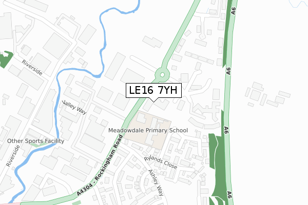
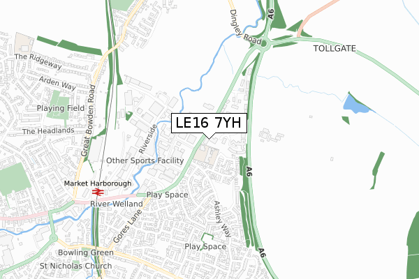
LE16 7YH is located in the Market Harborough-Little Bowden electoral ward, within the local authority district of Harborough and the English Parliamentary constituency of Harborough. The Sub Integrated Care Board (ICB) Location is NHS Leicester, Leicestershire and Rutland ICB - 03W and the police force is Leicestershire. This postcode has been in use since June 2019.


GetTheData
Source: OS Open Zoomstack (Ordnance Survey)
Licence: Open Government Licence (requires attribution)
Attribution: Contains OS data © Crown copyright and database right 2024
Source: Open Postcode Geo
Licence: Open Government Licence (requires attribution)
Attribution: Contains OS data © Crown copyright and database right 2024; Contains Royal Mail data © Royal Mail copyright and database right 2024; Source: Office for National Statistics licensed under the Open Government Licence v.3.0
| Easting | 474834 |
| Northing | 287698 |
| Latitude | 52.482100 |
| Longitude | -0.899483 |
GetTheData
Source: Open Postcode Geo
Licence: Open Government Licence
| Country | England |
| Postcode District | LE16 |
➜ See where LE16 is on a map ➜ Where is Market Harborough? | |
GetTheData
Source: Land Registry Price Paid Data
Licence: Open Government Licence
| Ward | Market Harborough-little Bowden |
| Constituency | Harborough |
GetTheData
Source: ONS Postcode Database
Licence: Open Government Licence
| Valley Way (Rockingham Road) | Little Bowden | 27m |
| Valley Way (Rockingham Road) | Little Bowden | 48m |
| Ashley Way (Rockingham Road) | Little Bowden | 212m |
| Stinford Leys (Ashley Way) | Little Bowden | 617m |
| Hartland Drive (Gores Lane) | Little Bowden | 658m |
| Market Harborough Station | 0.7km |
GetTheData
Source: NaPTAN
Licence: Open Government Licence
| Percentage of properties with Next Generation Access | 100.0% |
| Percentage of properties with Superfast Broadband | 100.0% |
| Percentage of properties with Ultrafast Broadband | 100.0% |
| Percentage of properties with Full Fibre Broadband | 100.0% |
Superfast Broadband is between 30Mbps and 300Mbps
Ultrafast Broadband is > 300Mbps
| Percentage of properties unable to receive 2Mbps | 0.0% |
| Percentage of properties unable to receive 5Mbps | 0.0% |
| Percentage of properties unable to receive 10Mbps | 0.0% |
| Percentage of properties unable to receive 30Mbps | 0.0% |
GetTheData
Source: Ofcom
Licence: Ofcom Terms of Use (requires attribution)
GetTheData
Source: ONS Postcode Database
Licence: Open Government Licence


➜ Get more ratings from the Food Standards Agency
GetTheData
Source: Food Standards Agency
Licence: FSA terms & conditions
| Last Collection | |||
|---|---|---|---|
| Location | Mon-Fri | Sat | Distance |
| Riverside | 449m | ||
| Riverside Industrial Estate | 18:30 | 11:30 | 622m |
| Gores Lane | 17:30 | 10:45 | 674m |
GetTheData
Source: Dracos
Licence: Creative Commons Attribution-ShareAlike
The below table lists the International Territorial Level (ITL) codes (formerly Nomenclature of Territorial Units for Statistics (NUTS) codes) and Local Administrative Units (LAU) codes for LE16 7YH:
| ITL 1 Code | Name |
|---|---|
| TLF | East Midlands (England) |
| ITL 2 Code | Name |
| TLF2 | Leicestershire, Rutland and Northamptonshire |
| ITL 3 Code | Name |
| TLF22 | Leicestershire CC and Rutland |
| LAU 1 Code | Name |
| E07000131 | Harborough |
GetTheData
Source: ONS Postcode Directory
Licence: Open Government Licence
The below table lists the Census Output Area (OA), Lower Layer Super Output Area (LSOA), and Middle Layer Super Output Area (MSOA) for LE16 7YH:
| Code | Name | |
|---|---|---|
| OA | E00170652 | |
| LSOA | E01025799 | Harborough 009B |
| MSOA | E02005375 | Harborough 009 |
GetTheData
Source: ONS Postcode Directory
Licence: Open Government Licence
| LE16 7FP | Trojan Place | 88m |
| LE16 7XW | Fernfield Close | 197m |
| LE16 7XE | Ryelands Close | 226m |
| LE16 7XF | Stockwell Close | 267m |
| LE16 7QU | The Point | 291m |
| LE16 7XH | Thatch Meadow Drive | 314m |
| LE16 7XG | Woodbreach Drive | 391m |
| LE16 7PT | Riverside | 392m |
| LE16 7XS | Simborough Way | 405m |
| LE16 7XL | The Furlongs | 455m |
GetTheData
Source: Open Postcode Geo; Land Registry Price Paid Data
Licence: Open Government Licence