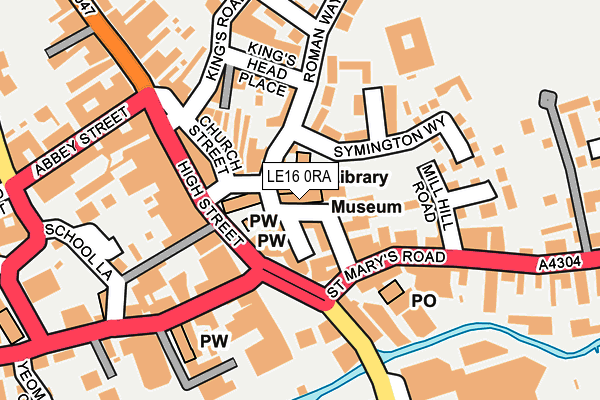
LE16 0RA is located in the Market Harborough-Great Bowden & Arden electoral ward, within the local authority district of Harborough and the English Parliamentary constituency of Harborough. The Sub Integrated Care Board (ICB) Location is NHS Leicester, Leicestershire and Rutland ICB - 03W and the police force is Leicestershire. This postcode has been in use since February 2017.


GetTheData
Source: OS OpenMap – Local (Ordnance Survey)
Source: OS VectorMap District (Ordnance Survey)
Licence: Open Government Licence (requires attribution)
| Easting | 473416 |
| Northing | 287285 |
| Latitude | 52.478580 |
| Longitude | -0.920450 |
GetTheData
Source: Open Postcode Geo
Licence: Open Government Licence
| Country | England |
| Postcode District | LE16 |
➜ See where LE16 is on a map | |
GetTheData
Source: Land Registry Price Paid Data
Licence: Open Government Licence
| Ward | Market Harborough-great Bowden & Arden |
| Constituency | Harborough |
GetTheData
Source: ONS Postcode Database
Licence: Open Government Licence
| The Square | Market Harborough | 69m |
| The Square | Market Harborough | 76m |
| The Square | Market Harborough | 91m |
| The Square | Market Harborough | 95m |
| Doddridge Road (Roman Way) | Market Harborough | 168m |
| Market Harborough Station | 0.8km |
GetTheData
Source: NaPTAN
Licence: Open Government Licence
GetTheData
Source: ONS Postcode Database
Licence: Open Government Licence


➜ Get more ratings from the Food Standards Agency
GetTheData
Source: Food Standards Agency
Licence: FSA terms & conditions
| Last Collection | |||
|---|---|---|---|
| Location | Mon-Fri | Sat | Distance |
| Adam & Eve Street | 18:30 | 11:15 | 28m |
| High Street | 18:30 | 11:15 | 131m |
| North End-high Street | 18:30 | 11:15 | 301m |
GetTheData
Source: Dracos
Licence: Creative Commons Attribution-ShareAlike
The below table lists the International Territorial Level (ITL) codes (formerly Nomenclature of Territorial Units for Statistics (NUTS) codes) and Local Administrative Units (LAU) codes for LE16 0RA:
| ITL 1 Code | Name |
|---|---|
| TLF | East Midlands (England) |
| ITL 2 Code | Name |
| TLF2 | Leicestershire, Rutland and Northamptonshire |
| ITL 3 Code | Name |
| TLF22 | Leicestershire CC and Rutland |
| LAU 1 Code | Name |
| E07000131 | Harborough |
GetTheData
Source: ONS Postcode Directory
Licence: Open Government Licence
The below table lists the Census Output Area (OA), Lower Layer Super Output Area (LSOA), and Middle Layer Super Output Area (MSOA) for LE16 0RA:
| Code | Name | |
|---|---|---|
| OA | E00130876 | |
| LSOA | E01025795 | Harborough 008A |
| MSOA | E02005374 | Harborough 008 |
GetTheData
Source: ONS Postcode Directory
Licence: Open Government Licence
| LE16 7LT | Adam & Eve Street | 41m |
| LE16 7PA | The Square | 74m |
| LE16 7PW | Millers Yard | 93m |
| LE16 7AL | Aldwinckles Yard | 107m |
| LE16 7AA | Church Street | 112m |
| LE16 7BF | Blackfriars Place | 112m |
| LE16 7XA | Symington Way | 120m |
| LE16 7NJ | High Street | 121m |
| LE16 7JT | Kings Head Place | 127m |
| LE16 7NP | Talbot Yard | 144m |
GetTheData
Source: Open Postcode Geo; Land Registry Price Paid Data
Licence: Open Government Licence