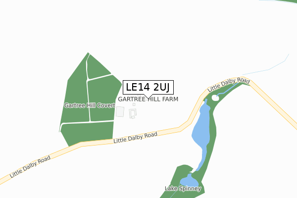
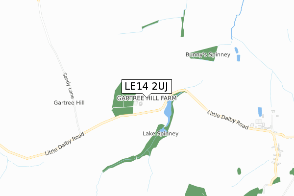
LE14 2UJ is located in the Gaddesby electoral ward, within the local authority district of Melton and the English Parliamentary constituency of Rutland and Melton. The Sub Integrated Care Board (ICB) Location is NHS Leicester, Leicestershire and Rutland ICB - 03W and the police force is Leicestershire. This postcode has been in use since October 2018.


GetTheData
Source: OS Open Zoomstack (Ordnance Survey)
Licence: Open Government Licence (requires attribution)
Attribution: Contains OS data © Crown copyright and database right 2025
Source: Open Postcode Geo
Licence: Open Government Licence (requires attribution)
Attribution: Contains OS data © Crown copyright and database right 2025; Contains Royal Mail data © Royal Mail copyright and database right 2025; Source: Office for National Statistics licensed under the Open Government Licence v.3.0
| Easting | 476522 |
| Northing | 314500 |
| Latitude | 52.722767 |
| Longitude | -0.868448 |
GetTheData
Source: Open Postcode Geo
Licence: Open Government Licence
| Country | England |
| Postcode District | LE14 |
➜ See where LE14 is on a map | |
GetTheData
Source: Land Registry Price Paid Data
Licence: Open Government Licence
| Ward | Gaddesby |
| Constituency | Rutland And Melton |
GetTheData
Source: ONS Postcode Database
Licence: Open Government Licence
| Wheathill Farm (Pickwell Lane) | Little Dalby | 1,389m |
| Wheathill Farm (Pickwell Lane) | Little Dalby | 1,402m |
| Melton Mowbray Station | 4.4km |
GetTheData
Source: NaPTAN
Licence: Open Government Licence
| Percentage of properties with Next Generation Access | 100.0% |
| Percentage of properties with Superfast Broadband | 0.0% |
| Percentage of properties with Ultrafast Broadband | 0.0% |
| Percentage of properties with Full Fibre Broadband | 0.0% |
Superfast Broadband is between 30Mbps and 300Mbps
Ultrafast Broadband is > 300Mbps
| Percentage of properties unable to receive 2Mbps | 66.7% |
| Percentage of properties unable to receive 5Mbps | 66.7% |
| Percentage of properties unable to receive 10Mbps | 66.7% |
| Percentage of properties unable to receive 30Mbps | 100.0% |
GetTheData
Source: Ofcom
Licence: Ofcom Terms of Use (requires attribution)
GetTheData
Source: ONS Postcode Database
Licence: Open Government Licence
| Last Collection | |||
|---|---|---|---|
| Location | Mon-Fri | Sat | Distance |
| Pickwell | 16:15 | 10:00 | 2,650m |
| Somerby Road | 16:30 | 08:30 | 2,706m |
| Norfolk Drive | 17:00 | 11:45 | 3,090m |
GetTheData
Source: Dracos
Licence: Creative Commons Attribution-ShareAlike
The below table lists the International Territorial Level (ITL) codes (formerly Nomenclature of Territorial Units for Statistics (NUTS) codes) and Local Administrative Units (LAU) codes for LE14 2UJ:
| ITL 1 Code | Name |
|---|---|
| TLF | East Midlands (England) |
| ITL 2 Code | Name |
| TLF2 | Leicestershire, Rutland and Northamptonshire |
| ITL 3 Code | Name |
| TLF22 | Leicestershire CC and Rutland |
| LAU 1 Code | Name |
| E07000133 | Melton |
GetTheData
Source: ONS Postcode Directory
Licence: Open Government Licence
The below table lists the Census Output Area (OA), Lower Layer Super Output Area (LSOA), and Middle Layer Super Output Area (MSOA) for LE14 2UJ:
| Code | Name | |
|---|---|---|
| OA | E00131374 | |
| LSOA | E01025889 | Melton 006A |
| MSOA | E02005396 | Melton 006 |
GetTheData
Source: ONS Postcode Directory
Licence: Open Government Licence
| LE14 2UL | Gartree Hill Road | 1129m |
| LE14 2ER | Crown Hill | 1705m |
| LE14 2ES | Little Dalby Road | 1727m |
| LE14 2FA | Glebe Court | 1901m |
| LE14 2EY | Nether End | 1943m |
| LE14 2UN | Hall Drive | 1953m |
| LE14 2EH | The Yews | 1979m |
| LE14 2EN | Burdetts Close | 2054m |
| LE14 2EW | Burrough End | 2121m |
| LE14 2UP | Lime Street | 2217m |
GetTheData
Source: Open Postcode Geo; Land Registry Price Paid Data
Licence: Open Government Licence