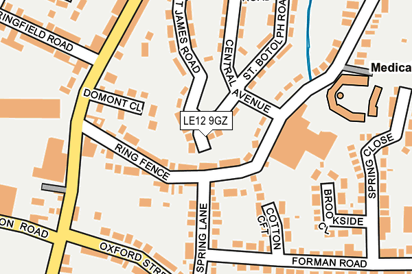
LE12 9GZ is located in the Shepshed East electoral ward, within the local authority district of Charnwood and the English Parliamentary constituency of Loughborough. The Sub Integrated Care Board (ICB) Location is NHS Leicester, Leicestershire and Rutland ICB - 04V and the police force is Leicestershire. This postcode has been in use since June 2000.


GetTheData
Source: OS OpenMap – Local (Ordnance Survey)
Source: OS VectorMap District (Ordnance Survey)
Licence: Open Government Licence (requires attribution)
| Easting | 447828 |
| Northing | 318952 |
| Latitude | 52.766057 |
| Longitude | -1.292605 |
GetTheData
Source: Open Postcode Geo
Licence: Open Government Licence
| Country | England |
| Postcode District | LE12 |
➜ See where LE12 is on a map ➜ Where is Shepshed? | |
GetTheData
Source: Land Registry Price Paid Data
Licence: Open Government Licence
Elevation or altitude of LE12 9GZ as distance above sea level:
| Metres | Feet | |
|---|---|---|
| Elevation | 80m | 262ft |
Elevation is measured from the approximate centre of the postcode, to the nearest point on an OS contour line from OS Terrain 50, which has contour spacing of ten vertical metres.
➜ How high above sea level am I? Find the elevation of your current position using your device's GPS.
GetTheData
Source: Open Postcode Elevation
Licence: Open Government Licence
| Ward | Shepshed East |
| Constituency | Loughborough |
GetTheData
Source: ONS Postcode Database
Licence: Open Government Licence
| Domont Close (Charnwood Road) | Shepshed | 187m |
| Domont Close (Charnwood Road) | Shepshed | 199m |
| Anson Road (Charnwood Road) | Shepshed | 216m |
| Spring Lane (Oxford Street) | Shepshed | 228m |
| Anson Road (Charnwood Road) | Shepshed | 295m |
GetTheData
Source: NaPTAN
Licence: Open Government Licence
| Percentage of properties with Next Generation Access | 100.0% |
| Percentage of properties with Superfast Broadband | 100.0% |
| Percentage of properties with Ultrafast Broadband | 100.0% |
| Percentage of properties with Full Fibre Broadband | 0.0% |
Superfast Broadband is between 30Mbps and 300Mbps
Ultrafast Broadband is > 300Mbps
| Percentage of properties unable to receive 2Mbps | 0.0% |
| Percentage of properties unable to receive 5Mbps | 0.0% |
| Percentage of properties unable to receive 10Mbps | 0.0% |
| Percentage of properties unable to receive 30Mbps | 0.0% |
GetTheData
Source: Ofcom
Licence: Ofcom Terms of Use (requires attribution)
GetTheData
Source: ONS Postcode Database
Licence: Open Government Licence


➜ Get more ratings from the Food Standards Agency
GetTheData
Source: Food Standards Agency
Licence: FSA terms & conditions
| Last Collection | |||
|---|---|---|---|
| Location | Mon-Fri | Sat | Distance |
| Charnwood Road Post Office | 17:30 | 09:45 | 207m |
| Leicester Road | 17:30 | 09:30 | 471m |
| The Bullring | 17:30 | 08:15 | 580m |
GetTheData
Source: Dracos
Licence: Creative Commons Attribution-ShareAlike
The below table lists the International Territorial Level (ITL) codes (formerly Nomenclature of Territorial Units for Statistics (NUTS) codes) and Local Administrative Units (LAU) codes for LE12 9GZ:
| ITL 1 Code | Name |
|---|---|
| TLF | East Midlands (England) |
| ITL 2 Code | Name |
| TLF2 | Leicestershire, Rutland and Northamptonshire |
| ITL 3 Code | Name |
| TLF22 | Leicestershire CC and Rutland |
| LAU 1 Code | Name |
| E07000130 | Charnwood |
GetTheData
Source: ONS Postcode Directory
Licence: Open Government Licence
The below table lists the Census Output Area (OA), Lower Layer Super Output Area (LSOA), and Middle Layer Super Output Area (MSOA) for LE12 9GZ:
| Code | Name | |
|---|---|---|
| OA | E00130607 | |
| LSOA | E01025742 | Charnwood 006C |
| MSOA | E02005350 | Charnwood 006 |
GetTheData
Source: ONS Postcode Directory
Licence: Open Government Licence
| LE12 9HY | Ring Fence | 71m |
| LE12 9JQ | Harley Close | 98m |
| LE12 9HX | Ring Fence | 99m |
| LE12 9JB | St James Road | 107m |
| LE12 9JL | Domont Close | 130m |
| LE12 9JE | Spring Lane | 138m |
| LE12 9HR | Cotton Croft | 168m |
| LE12 9HZ | St Botolphs Road | 195m |
| LE12 9NP | Charnwood Road | 205m |
| LE12 9HU | Oxford Street | 218m |
GetTheData
Source: Open Postcode Geo; Land Registry Price Paid Data
Licence: Open Government Licence