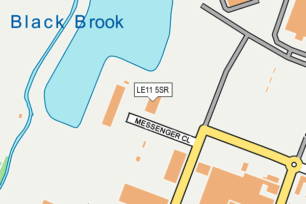
LE11 5SR is located in the Loughborough Storer electoral ward, within the local authority district of Charnwood and the English Parliamentary constituency of Loughborough. The Sub Integrated Care Board (ICB) Location is NHS Leicester, Leicestershire and Rutland ICB - 04V and the police force is Leicestershire. This postcode has been in use since June 2002.


GetTheData
Source: OS OpenMap – Local (Ordnance Survey)
Source: OS VectorMap District (Ordnance Survey)
Licence: Open Government Licence (requires attribution)
| Easting | 452114 |
| Northing | 321324 |
| Latitude | 52.787002 |
| Longitude | -1.228708 |
GetTheData
Source: Open Postcode Geo
Licence: Open Government Licence
| Country | England |
| Postcode District | LE11 |
➜ See where LE11 is on a map ➜ Where is Loughborough? | |
GetTheData
Source: Land Registry Price Paid Data
Licence: Open Government Licence
Elevation or altitude of LE11 5SR as distance above sea level:
| Metres | Feet | |
|---|---|---|
| Elevation | 40m | 131ft |
Elevation is measured from the approximate centre of the postcode, to the nearest point on an OS contour line from OS Terrain 50, which has contour spacing of ten vertical metres.
➜ How high above sea level am I? Find the elevation of your current position using your device's GPS.
GetTheData
Source: Open Postcode Elevation
Licence: Open Government Licence
| Ward | Loughborough Storer |
| Constituency | Loughborough |
GetTheData
Source: ONS Postcode Database
Licence: Open Government Licence
| Messenger Close (Weldon Road) | Loughborough | 136m |
| Astra Zeneca (Bishop Meadow Road) | Loughborough | 267m |
| Bishop Meadow Road (Derby Road) | Loughborough | 440m |
| Elaby Road (Barsby Drive) | Loughborough | 533m |
| Elaby Road (Barsby Drive) | Loughborough | 548m |
| Loughborough (Leics) Station | 2.4km |
GetTheData
Source: NaPTAN
Licence: Open Government Licence
GetTheData
Source: ONS Postcode Database
Licence: Open Government Licence


➜ Get more ratings from the Food Standards Agency
GetTheData
Source: Food Standards Agency
Licence: FSA terms & conditions
| Last Collection | |||
|---|---|---|---|
| Location | Mon-Fri | Sat | Distance |
| Weldon Road | 130m | ||
| Warwick Way | 17:30 | 11:45 | 648m |
| Cordell Road | 17:30 | 11:45 | 686m |
GetTheData
Source: Dracos
Licence: Creative Commons Attribution-ShareAlike
| Risk of LE11 5SR flooding from rivers and sea | Low |
| ➜ LE11 5SR flood map | |
GetTheData
Source: Open Flood Risk by Postcode
Licence: Open Government Licence
The below table lists the International Territorial Level (ITL) codes (formerly Nomenclature of Territorial Units for Statistics (NUTS) codes) and Local Administrative Units (LAU) codes for LE11 5SR:
| ITL 1 Code | Name |
|---|---|
| TLF | East Midlands (England) |
| ITL 2 Code | Name |
| TLF2 | Leicestershire, Rutland and Northamptonshire |
| ITL 3 Code | Name |
| TLF22 | Leicestershire CC and Rutland |
| LAU 1 Code | Name |
| E07000130 | Charnwood |
GetTheData
Source: ONS Postcode Directory
Licence: Open Government Licence
The below table lists the Census Output Area (OA), Lower Layer Super Output Area (LSOA), and Middle Layer Super Output Area (MSOA) for LE11 5SR:
| Code | Name | |
|---|---|---|
| OA | E00130425 | |
| LSOA | E01025704 | Charnwood 002E |
| MSOA | E02005346 | Charnwood 002 |
GetTheData
Source: ONS Postcode Directory
Licence: Open Government Licence
| LE11 5RJ | Aerodrome Close | 249m |
| LE11 5UX | Thorny Close | 440m |
| LE11 5UN | Clawson Close | 449m |
| LE11 5UU | Newton Close | 467m |
| LE11 5UW | Roydale Close | 479m |
| LE11 5UH | Alston Drive | 501m |
| LE11 5UT | Grafton Road | 519m |
| LE11 5UJ | Barsby Drive | 556m |
| LE11 5YH | Lyall Close | 602m |
| LE11 5YG | Leslie Close | 623m |
GetTheData
Source: Open Postcode Geo; Land Registry Price Paid Data
Licence: Open Government Licence