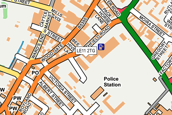
LE11 2TG is located in the Loughborough Southfields electoral ward, within the local authority district of Charnwood and the English Parliamentary constituency of Loughborough. The Sub Integrated Care Board (ICB) Location is NHS Leicester, Leicestershire and Rutland ICB - 04V and the police force is Leicestershire. This postcode has been in use since April 2012.


GetTheData
Source: OS OpenMap – Local (Ordnance Survey)
Source: OS VectorMap District (Ordnance Survey)
Licence: Open Government Licence (requires attribution)
| Easting | 453726 |
| Northing | 319312 |
| Latitude | 52.768740 |
| Longitude | -1.205143 |
GetTheData
Source: Open Postcode Geo
Licence: Open Government Licence
| Country | England |
| Postcode District | LE11 |
➜ See where LE11 is on a map ➜ Where is Loughborough? | |
GetTheData
Source: Land Registry Price Paid Data
Licence: Open Government Licence
Elevation or altitude of LE11 2TG as distance above sea level:
| Metres | Feet | |
|---|---|---|
| Elevation | 40m | 131ft |
Elevation is measured from the approximate centre of the postcode, to the nearest point on an OS contour line from OS Terrain 50, which has contour spacing of ten vertical metres.
➜ How high above sea level am I? Find the elevation of your current position using your device's GPS.
GetTheData
Source: Open Postcode Elevation
Licence: Open Government Licence
| Ward | Loughborough Southfields |
| Constituency | Loughborough |
GetTheData
Source: ONS Postcode Database
Licence: Open Government Licence
| Bee Hive Lane (Southfield Road) | Loughborough | 86m |
| Southfields Park (Leicester Road) | Loughborough | 206m |
| New Street (Wards End) | Loughborough | 207m |
| Aumberry Gap (Barrow Street) | Loughborough | 251m |
| Wards End (Browns Lane) | Loughborough | 265m |
| Loughborough Central (Great Central Railway) | Loughborough | 629m |
| Loughborough (Leics) Station | 1.3km |
| Barrow upon Soar Station | 4.6km |
GetTheData
Source: NaPTAN
Licence: Open Government Licence
GetTheData
Source: ONS Postcode Database
Licence: Open Government Licence


➜ Get more ratings from the Food Standards Agency
GetTheData
Source: Food Standards Agency
Licence: FSA terms & conditions
| Last Collection | |||
|---|---|---|---|
| Location | Mon-Fri | Sat | Distance |
| Bedford Square | 17:30 | 12:00 | 194m |
| Cattlemarket | 18:30 | 12:00 | 232m |
| High Street | 18:30 | 11:15 | 261m |
GetTheData
Source: Dracos
Licence: Creative Commons Attribution-ShareAlike
The below table lists the International Territorial Level (ITL) codes (formerly Nomenclature of Territorial Units for Statistics (NUTS) codes) and Local Administrative Units (LAU) codes for LE11 2TG:
| ITL 1 Code | Name |
|---|---|
| TLF | East Midlands (England) |
| ITL 2 Code | Name |
| TLF2 | Leicestershire, Rutland and Northamptonshire |
| ITL 3 Code | Name |
| TLF22 | Leicestershire CC and Rutland |
| LAU 1 Code | Name |
| E07000130 | Charnwood |
GetTheData
Source: ONS Postcode Directory
Licence: Open Government Licence
The below table lists the Census Output Area (OA), Lower Layer Super Output Area (LSOA), and Middle Layer Super Output Area (MSOA) for LE11 2TG:
| Code | Name | |
|---|---|---|
| OA | E00173294 | |
| LSOA | E01025718 | Charnwood 009E |
| MSOA | E02005353 | Charnwood 009 |
GetTheData
Source: ONS Postcode Directory
Licence: Open Government Licence
| LE11 2TS | Southfield Road | 79m |
| LE11 2TZ | Woodgate | 105m |
| LE11 2TL | Victoria Street | 121m |
| LE11 2EW | Victoria Street | 125m |
| LE11 2TJ | Coach House Court | 143m |
| LE11 2EN | Victoria Street | 159m |
| LE11 2DW | Albert Street | 185m |
| LE11 2DS | Bedford Street | 186m |
| LE11 2AE | Leicester Road | 187m |
| LE11 2EP | Victoria Street | 192m |
GetTheData
Source: Open Postcode Geo; Land Registry Price Paid Data
Licence: Open Government Licence