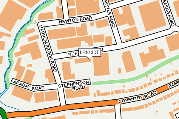
LE10 3DT is located in the Hinckley Clarendon electoral ward, within the local authority district of Hinckley and Bosworth and the English Parliamentary constituency of Bosworth. The Sub Integrated Care Board (ICB) Location is NHS Leicester, Leicestershire and Rutland ICB - 04V and the police force is Leicestershire. This postcode has been in use since December 1996.


GetTheData
Source: OS OpenMap – Local (Ordnance Survey)
Source: OS VectorMap District (Ordnance Survey)
Licence: Open Government Licence (requires attribution)
| Easting | 440279 |
| Northing | 293283 |
| Latitude | 52.535927 |
| Longitude | -1.407603 |
GetTheData
Source: Open Postcode Geo
Licence: Open Government Licence
| Country | England |
| Postcode District | LE10 |
➜ See where LE10 is on a map ➜ Where is Hinckley? | |
GetTheData
Source: Land Registry Price Paid Data
Licence: Open Government Licence
Elevation or altitude of LE10 3DT as distance above sea level:
| Metres | Feet | |
|---|---|---|
| Elevation | 90m | 295ft |
Elevation is measured from the approximate centre of the postcode, to the nearest point on an OS contour line from OS Terrain 50, which has contour spacing of ten vertical metres.
➜ How high above sea level am I? Find the elevation of your current position using your device's GPS.
GetTheData
Source: Open Postcode Elevation
Licence: Open Government Licence
| Ward | Hinckley Clarendon |
| Constituency | Bosworth |
GetTheData
Source: ONS Postcode Database
Licence: Open Government Licence
| Harrowbrook Road (Coventry Road) | Hinckley | 153m |
| Harrowbrook Road (Coventry Road) | Hinckley | 166m |
| Maple Drive (Coventry Road) | Hinckley | 282m |
| Paddock Way Cycleway (Paddock Way) | Hinckley | 313m |
| Maple Drive (Coventry Road) | Hinckley | 326m |
| Hinckley Station | 2.4km |
| Nuneaton Station | 4km |
| Bermuda Park Station | 5.8km |
GetTheData
Source: NaPTAN
Licence: Open Government Licence
GetTheData
Source: ONS Postcode Database
Licence: Open Government Licence


➜ Get more ratings from the Food Standards Agency
GetTheData
Source: Food Standards Agency
Licence: FSA terms & conditions
| Last Collection | |||
|---|---|---|---|
| Location | Mon-Fri | Sat | Distance |
| Brindley Road | 424m | ||
| Langdale Road | 17:30 | 11:30 | 786m |
| Coventry Road Post Office | 17:30 | 12:00 | 944m |
GetTheData
Source: Dracos
Licence: Creative Commons Attribution-ShareAlike
The below table lists the International Territorial Level (ITL) codes (formerly Nomenclature of Territorial Units for Statistics (NUTS) codes) and Local Administrative Units (LAU) codes for LE10 3DT:
| ITL 1 Code | Name |
|---|---|
| TLF | East Midlands (England) |
| ITL 2 Code | Name |
| TLF2 | Leicestershire, Rutland and Northamptonshire |
| ITL 3 Code | Name |
| TLF22 | Leicestershire CC and Rutland |
| LAU 1 Code | Name |
| E07000132 | Hinckley and Bosworth |
GetTheData
Source: ONS Postcode Directory
Licence: Open Government Licence
The below table lists the Census Output Area (OA), Lower Layer Super Output Area (LSOA), and Middle Layer Super Output Area (MSOA) for LE10 3DT:
| Code | Name | |
|---|---|---|
| OA | E00170663 | |
| LSOA | E01025853 | Hinckley and Bosworth 011A |
| MSOA | E02005387 | Hinckley and Bosworth 011 |
GetTheData
Source: ONS Postcode Directory
Licence: Open Government Licence
| LE10 0NJ | Coventry Road | 175m |
| LE10 3DZ | Whittle Road | 176m |
| LE10 3DJ | Harrowbrook Road | 182m |
| LE10 3DU | Fleming Road | 255m |
| LE10 0NF | Coventry Road | 267m |
| LE10 3BZ | Dodwells Road | 307m |
| LE10 3ED | Watling Street | 320m |
| LE10 0FG | Merry Hurst Place | 338m |
| LE10 0NH | Coventry Road | 367m |
| LE10 0FH | West Hyde | 372m |
GetTheData
Source: Open Postcode Geo; Land Registry Price Paid Data
Licence: Open Government Licence