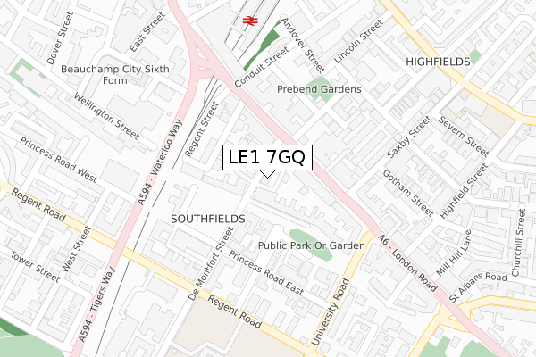
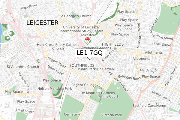
LE1 7GQ is located in the Castle electoral ward, within the unitary authority of Leicester and the English Parliamentary constituency of Leicester South. The Sub Integrated Care Board (ICB) Location is NHS Leicester, Leicestershire and Rutland ICB - 04C and the police force is Leicestershire. This postcode has been in use since October 2019.


GetTheData
Source: OS Open Zoomstack (Ordnance Survey)
Licence: Open Government Licence (requires attribution)
Attribution: Contains OS data © Crown copyright and database right 2025
Source: Open Postcode Geo
Licence: Open Government Licence (requires attribution)
Attribution: Contains OS data © Crown copyright and database right 2025; Contains Royal Mail data © Royal Mail copyright and database right 2025; Source: Office for National Statistics licensed under the Open Government Licence v.3.0
| Easting | 459404 |
| Northing | 303816 |
| Latitude | 52.628878 |
| Longitude | -1.123782 |
GetTheData
Source: Open Postcode Geo
Licence: Open Government Licence
| Country | England |
| Postcode District | LE1 |
➜ See where LE1 is on a map ➜ Where is Leicester? | |
GetTheData
Source: Land Registry Price Paid Data
Licence: Open Government Licence
| Ward | Castle |
| Constituency | Leicester South |
GetTheData
Source: ONS Postcode Database
Licence: Open Government Licence
| Prebend Street (London Road) | Leicester | 94m |
| Prebend Street (London Road) | Leicester | 120m |
| Saxby Street (London Road) | Leicester | 167m |
| Saxby Street (London Road) | Leicester | 176m |
| Saxby Street (London Road) | Leicester | 192m |
| Leicester Station | 0.3km |
GetTheData
Source: NaPTAN
Licence: Open Government Licence
GetTheData
Source: ONS Postcode Database
Licence: Open Government Licence


➜ Get more ratings from the Food Standards Agency
GetTheData
Source: Food Standards Agency
Licence: FSA terms & conditions
| Last Collection | |||
|---|---|---|---|
| Location | Mon-Fri | Sat | Distance |
| De Montfort Street | 18:30 | 12:00 | 66m |
| De Montfort Street | 18:30 | 12:00 | 68m |
| London Road P.o. | 18:30 | 12:00 | 77m |
GetTheData
Source: Dracos
Licence: Creative Commons Attribution-ShareAlike
The below table lists the International Territorial Level (ITL) codes (formerly Nomenclature of Territorial Units for Statistics (NUTS) codes) and Local Administrative Units (LAU) codes for LE1 7GQ:
| ITL 1 Code | Name |
|---|---|
| TLF | East Midlands (England) |
| ITL 2 Code | Name |
| TLF2 | Leicestershire, Rutland and Northamptonshire |
| ITL 3 Code | Name |
| TLF21 | Leicester |
| LAU 1 Code | Name |
| E06000016 | Leicester |
GetTheData
Source: ONS Postcode Directory
Licence: Open Government Licence
The below table lists the Census Output Area (OA), Lower Layer Super Output Area (LSOA), and Middle Layer Super Output Area (MSOA) for LE1 7GQ:
| Code | Name | |
|---|---|---|
| OA | E00168093 | |
| LSOA | E01013646 | Leicester 040A |
| MSOA | E02006850 | Leicester 040 |
GetTheData
Source: ONS Postcode Directory
Licence: Open Government Licence
| LE1 7GG | De Montfort Street | 11m |
| LE1 7GL | De Montfort Street | 14m |
| LE1 7GE | De Montfort Street | 47m |
| LE2 0PF | London Road | 69m |
| LE1 7NA | West Walk | 108m |
| LE2 0PE | London Road | 111m |
| LE1 7GB | De Montfort Street | 115m |
| LE1 7EA | New Walk | 120m |
| LE1 7NP | West Walk | 131m |
| LE2 0QD | London Road | 133m |
GetTheData
Source: Open Postcode Geo; Land Registry Price Paid Data
Licence: Open Government Licence