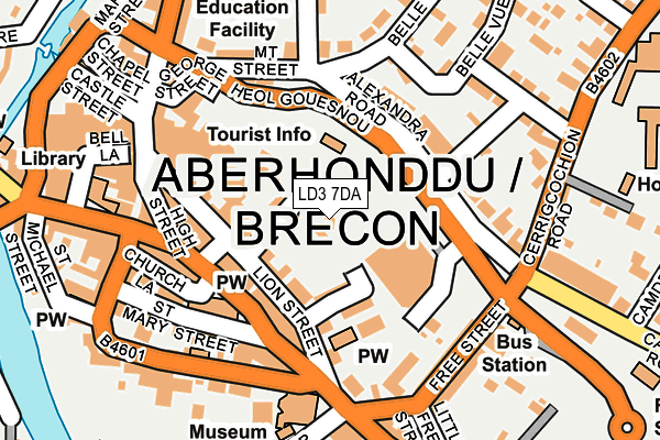
LD3 7DA is located in the Brecon East electoral ward, within the unitary authority of Powys and the Welsh Parliamentary constituency of Brecon and Radnorshire. The Local Health Board is Powys Teaching and the police force is Dyfed-Powys. This postcode has been in use since March 2022.


GetTheData
Source: OS OpenMap – Local (Ordnance Survey)
Source: OS VectorMap District (Ordnance Survey)
Licence: Open Government Licence (requires attribution)
| Easting | 305230 |
| Northing | 228350 |
| Latitude | 51.945553 |
| Longitude | -3.380207 |
GetTheData
Source: Open Postcode Geo
Licence: Open Government Licence
| Country | Wales |
| Postcode District | LD3 |
➜ See where LD3 is on a map | |
GetTheData
Source: Land Registry Price Paid Data
Licence: Open Government Licence
Elevation or altitude of LD3 7DA as distance above sea level:
| Metres | Feet | |
|---|---|---|
| Elevation | 140m | 459ft |
Elevation is measured from the approximate centre of the postcode, to the nearest point on an OS contour line from OS Terrain 50, which has contour spacing of ten vertical metres.
➜ How high above sea level am I? Find the elevation of your current position using your device's GPS.
GetTheData
Source: Open Postcode Elevation
Licence: Open Government Licence
| Ward | Brecon East |
| Constituency | Brecon And Radnorshire |
GetTheData
Source: ONS Postcode Database
Licence: Open Government Licence
| Dol-glas Estate (Brynlas) | Brecon | 25m |
| Plas Y Ffynnon (Camden Road) | Brecon | 264m |
| Driving Test Centre (Camden Road) | Brecon | 282m |
| Barracks (Watton) | Brecon | 283m |
| Barracks (Watton) | Brecon | 321m |
GetTheData
Source: NaPTAN
Licence: Open Government Licence
GetTheData
Source: ONS Postcode Database
Licence: Open Government Licence


➜ Get more ratings from the Food Standards Agency
GetTheData
Source: Food Standards Agency
Licence: FSA terms & conditions
| Last Collection | |||
|---|---|---|---|
| Location | Mon-Fri | Sat | Distance |
| St Marys Street | 17:15 | 12:15 | 777m |
| Struet | 16:45 | 11:45 | 864m |
| Castle Hotel | 16:45 | 11:30 | 1,046m |
GetTheData
Source: Dracos
Licence: Creative Commons Attribution-ShareAlike
The below table lists the International Territorial Level (ITL) codes (formerly Nomenclature of Territorial Units for Statistics (NUTS) codes) and Local Administrative Units (LAU) codes for LD3 7DA:
| ITL 1 Code | Name |
|---|---|
| TLL | Wales |
| ITL 2 Code | Name |
| TLL2 | East Wales |
| ITL 3 Code | Name |
| TLL24 | Powys |
| LAU 1 Code | Name |
| W06000023 | Powys |
GetTheData
Source: ONS Postcode Directory
Licence: Open Government Licence
The below table lists the Census Output Area (OA), Lower Layer Super Output Area (LSOA), and Middle Layer Super Output Area (MSOA) for LD3 7DA:
| Code | Name | |
|---|---|---|
| OA | W00002627 | |
| LSOA | W01000493 | Powys 017E |
| MSOA | W02000113 | Powys 017 |
GetTheData
Source: ONS Postcode Directory
Licence: Open Government Licence
| LD3 7RT | Camden Road | 96m |
| LD3 7FB | Eluneds Drive | 121m |
| LD3 7SA | Brynglas | 160m |
| LD3 7BY | Camden Crescent | 237m |
| LD3 7RS | Camden Road | 265m |
| LD3 7EE | Gwenllian Morgan Court | 312m |
| LD3 7EN | Watton | 312m |
| LD3 7RR | Cwrt Y Camden | 339m |
| LD3 7EP | Watton | 347m |
| LD3 7ET | Heol Gouesnou | 358m |
GetTheData
Source: Open Postcode Geo; Land Registry Price Paid Data
Licence: Open Government Licence