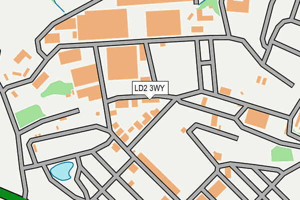
LD2 3WY is located in the Llanelwedd electoral ward, within the unitary authority of Powys and the Welsh Parliamentary constituency of Brecon and Radnorshire. The Local Health Board is Powys Teaching and the police force is Dyfed-Powys. This postcode has been in use since August 1993.


GetTheData
Source: OS OpenMap – Local (Ordnance Survey)
Source: OS VectorMap District (Ordnance Survey)
Licence: Open Government Licence (requires attribution)
| Easting | 303916 |
| Northing | 252018 |
| Latitude | 52.158047 |
| Longitude | -3.405972 |
GetTheData
Source: Open Postcode Geo
Licence: Open Government Licence
| Country | Wales |
| Postcode District | LD2 |
➜ See where LD2 is on a map ➜ Where is Llanelwedd? | |
GetTheData
Source: Land Registry Price Paid Data
Licence: Open Government Licence
Elevation or altitude of LD2 3WY as distance above sea level:
| Metres | Feet | |
|---|---|---|
| Elevation | 130m | 427ft |
Elevation is measured from the approximate centre of the postcode, to the nearest point on an OS contour line from OS Terrain 50, which has contour spacing of ten vertical metres.
➜ How high above sea level am I? Find the elevation of your current position using your device's GPS.
GetTheData
Source: Open Postcode Elevation
Licence: Open Government Licence
| Ward | Llanelwedd |
| Constituency | Brecon And Radnorshire |
GetTheData
Source: ONS Postcode Database
Licence: Open Government Licence
| St Matthew`s Church (A483) | Llanelwedd | 784m |
| St Matthew`s Church (A483) | Llanelwedd | 793m |
| Parc-yr-irfon | Builth Wells | 889m |
| Brynhyfryd (Pendre) | Builth Wells | 900m |
| Broadway | Builth Wells | 910m |
| Builth Road Station | 1.9km |
| Cilmeri Station | 3.6km |
GetTheData
Source: NaPTAN
Licence: Open Government Licence
GetTheData
Source: ONS Postcode Database
Licence: Open Government Licence


➜ Get more ratings from the Food Standards Agency
GetTheData
Source: Food Standards Agency
Licence: FSA terms & conditions
| Last Collection | |||
|---|---|---|---|
| Location | Mon-Fri | Sat | Distance |
| Station Road | 17:00 | 12:00 | 716m |
| The Groe | 17:00 | 10:00 | 765m |
| Llanelwydd Vicarage | 15:00 | 12:15 | 777m |
GetTheData
Source: Dracos
Licence: Creative Commons Attribution-ShareAlike
The below table lists the International Territorial Level (ITL) codes (formerly Nomenclature of Territorial Units for Statistics (NUTS) codes) and Local Administrative Units (LAU) codes for LD2 3WY:
| ITL 1 Code | Name |
|---|---|
| TLL | Wales |
| ITL 2 Code | Name |
| TLL2 | East Wales |
| ITL 3 Code | Name |
| TLL24 | Powys |
| LAU 1 Code | Name |
| W06000023 | Powys |
GetTheData
Source: ONS Postcode Directory
Licence: Open Government Licence
The below table lists the Census Output Area (OA), Lower Layer Super Output Area (LSOA), and Middle Layer Super Output Area (MSOA) for LD2 3WY:
| Code | Name | |
|---|---|---|
| OA | W00002451 | |
| LSOA | W01000459 | Powys 014D |
| MSOA | W02000110 | Powys 014 |
GetTheData
Source: ONS Postcode Directory
Licence: Open Government Licence
| LD2 3SS | Station Road | 664m |
| LD2 3TR | The Crescent | 697m |
| LD2 3SR | Llanelwedd Terrace | 714m |
| LD2 3BU | North Road | 732m |
| LD2 3TY | 788m | |
| LD2 3NF | Golf Links Road | 822m |
| LD2 3NG | Parc Yr Irfon | 837m |
| LD2 3BT | North Road | 890m |
| LD2 3DB | Broadway | 893m |
| LD2 3AU | Park Road | 900m |
GetTheData
Source: Open Postcode Geo; Land Registry Price Paid Data
Licence: Open Government Licence