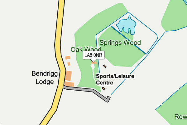
LA8 0NR is located in the Sedbergh and Kirkby Lonsdale electoral ward, within the unitary authority of Westmorland and Furness and the English Parliamentary constituency of Westmorland and Lonsdale. The Sub Integrated Care Board (ICB) Location is NHS Lancashire and South Cumbria ICB - 01K and the police force is Cumbria. This postcode has been in use since January 1980.


GetTheData
Source: OS OpenMap – Local (Ordnance Survey)
Source: OS VectorMap District (Ordnance Survey)
Licence: Open Government Licence (requires attribution)
| Easting | 358207 |
| Northing | 489283 |
| Latitude | 54.297451 |
| Longitude | -2.643655 |
GetTheData
Source: Open Postcode Geo
Licence: Open Government Licence
| Country | England |
| Postcode District | LA8 |
➜ See where LA8 is on a map | |
GetTheData
Source: Land Registry Price Paid Data
Licence: Open Government Licence
Elevation or altitude of LA8 0NR as distance above sea level:
| Metres | Feet | |
|---|---|---|
| Elevation | 200m | 656ft |
Elevation is measured from the approximate centre of the postcode, to the nearest point on an OS contour line from OS Terrain 50, which has contour spacing of ten vertical metres.
➜ How high above sea level am I? Find the elevation of your current position using your device's GPS.
GetTheData
Source: Open Postcode Elevation
Licence: Open Government Licence
| Ward | Sedbergh And Kirkby Lonsdale |
| Constituency | Westmorland And Lonsdale |
GetTheData
Source: ONS Postcode Database
Licence: Open Government Licence
GetTheData
Source: ONS Postcode Database
Licence: Open Government Licence


➜ Get more ratings from the Food Standards Agency
GetTheData
Source: Food Standards Agency
Licence: FSA terms & conditions
| Last Collection | |||
|---|---|---|---|
| Location | Mon-Fri | Sat | Distance |
| Old Hutton | 12:00 | 11:00 | 1,935m |
| Mill Holme Cotts, New Hutton | 12:00 | 09:00 | 2,152m |
| Middleshaw Bridge | 12:00 | 09:00 | 2,653m |
GetTheData
Source: Dracos
Licence: Creative Commons Attribution-ShareAlike
The below table lists the International Territorial Level (ITL) codes (formerly Nomenclature of Territorial Units for Statistics (NUTS) codes) and Local Administrative Units (LAU) codes for LA8 0NR:
| ITL 1 Code | Name |
|---|---|
| TLD | North West (England) |
| ITL 2 Code | Name |
| TLD1 | Cumbria |
| ITL 3 Code | Name |
| TLD12 | East Cumbria |
| LAU 1 Code | Name |
| E07000031 | South Lakeland |
GetTheData
Source: ONS Postcode Directory
Licence: Open Government Licence
The below table lists the Census Output Area (OA), Lower Layer Super Output Area (LSOA), and Middle Layer Super Output Area (MSOA) for LA8 0NR:
| Code | Name | |
|---|---|---|
| OA | E00098078 | |
| LSOA | E01019394 | South Lakeland 005D |
| MSOA | E02004019 | South Lakeland 005 |
GetTheData
Source: ONS Postcode Directory
Licence: Open Government Licence
| LA8 0NP | 768m | |
| LA8 0NU | 1276m | |
| LA8 0NS | 1459m | |
| LA8 0AU | 1465m | |
| LA8 0NT | 1479m | |
| LA8 0NW | 1870m | |
| LA8 0NL | 1883m | |
| LA8 0NJ | The Fold | 1900m |
| LA6 2HB | 1915m | |
| LA8 0NH | 1930m |
GetTheData
Source: Open Postcode Geo; Land Registry Price Paid Data
Licence: Open Government Licence