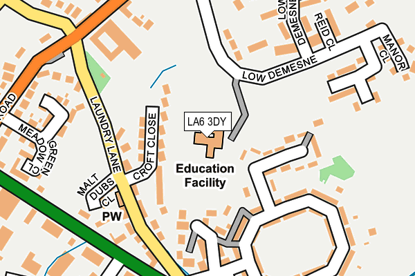
LA6 3DY is located in the Bentham & Ingleton electoral ward, within the unitary authority of North Yorkshire and the English Parliamentary constituency of Skipton and Ripon. The Sub Integrated Care Board (ICB) Location is NHS Lancashire and South Cumbria ICB - 01K and the police force is North Yorkshire. This postcode has been in use since January 1980.


GetTheData
Source: OS OpenMap – Local (Ordnance Survey)
Source: OS VectorMap District (Ordnance Survey)
Licence: Open Government Licence (requires attribution)
| Easting | 369470 |
| Northing | 472618 |
| Latitude | 54.148472 |
| Longitude | -2.468903 |
GetTheData
Source: Open Postcode Geo
Licence: Open Government Licence
| Country | England |
| Postcode District | LA6 |
➜ See where LA6 is on a map ➜ Where is Ingleton? | |
GetTheData
Source: Land Registry Price Paid Data
Licence: Open Government Licence
Elevation or altitude of LA6 3DY as distance above sea level:
| Metres | Feet | |
|---|---|---|
| Elevation | 120m | 394ft |
Elevation is measured from the approximate centre of the postcode, to the nearest point on an OS contour line from OS Terrain 50, which has contour spacing of ten vertical metres.
➜ How high above sea level am I? Find the elevation of your current position using your device's GPS.
GetTheData
Source: Open Postcode Elevation
Licence: Open Government Licence
| Ward | Bentham & Ingleton |
| Constituency | Skipton And Ripon |
GetTheData
Source: ONS Postcode Database
Licence: Open Government Licence
| Garage (Laundry Lane) | Ingleton | 192m |
| Garage (Laundry Lane) | Ingleton | 198m |
| Community Centre (Bank Top) | Ingleton | 454m |
| The Bridge Inn (New Road) | Ingleton | 466m |
| The Bridge Inn (Bentham Road) | Ingleton | 489m |
| Bentham Station | 4.6km |
| Clapham (N Yorks) Station | 6.1km |
GetTheData
Source: NaPTAN
Licence: Open Government Licence
GetTheData
Source: ONS Postcode Database
Licence: Open Government Licence


➜ Get more ratings from the Food Standards Agency
GetTheData
Source: Food Standards Agency
Licence: FSA terms & conditions
| Last Collection | |||
|---|---|---|---|
| Location | Mon-Fri | Sat | Distance |
| Laundry Lane | 16:15 | 11:30 | 130m |
| Backgate, Lowdemesne | 16:30 | 11:45 | 231m |
| Hollin Tree | 16:30 | 11:45 | 324m |
GetTheData
Source: Dracos
Licence: Creative Commons Attribution-ShareAlike
The below table lists the International Territorial Level (ITL) codes (formerly Nomenclature of Territorial Units for Statistics (NUTS) codes) and Local Administrative Units (LAU) codes for LA6 3DY:
| ITL 1 Code | Name |
|---|---|
| TLE | Yorkshire and The Humber |
| ITL 2 Code | Name |
| TLE2 | North Yorkshire |
| ITL 3 Code | Name |
| TLE22 | North Yorkshire CC |
| LAU 1 Code | Name |
| E07000163 | Craven |
GetTheData
Source: ONS Postcode Directory
Licence: Open Government Licence
The below table lists the Census Output Area (OA), Lower Layer Super Output Area (LSOA), and Middle Layer Super Output Area (MSOA) for LA6 3DY:
| Code | Name | |
|---|---|---|
| OA | E00140344 | |
| LSOA | E01027570 | Craven 001D |
| MSOA | E02005742 | Craven 001 |
GetTheData
Source: ONS Postcode Directory
Licence: Open Government Licence
| LA6 3DB | Croft Close | 67m |
| LA6 3FG | The Orchard | 108m |
| LA6 3DJ | New Village | 115m |
| LA6 3DA | Laundry Lane | 126m |
| LA6 3GH | Old Laundry Mews | 136m |
| LA6 3BA | Low Demesne | 141m |
| LA6 3DQ | New Village | 144m |
| LA6 3DE | 151m | |
| LA6 3DH | New Village | 158m |
| LA6 3DZ | Malt Dubs Close | 177m |
GetTheData
Source: Open Postcode Geo; Land Registry Price Paid Data
Licence: Open Government Licence