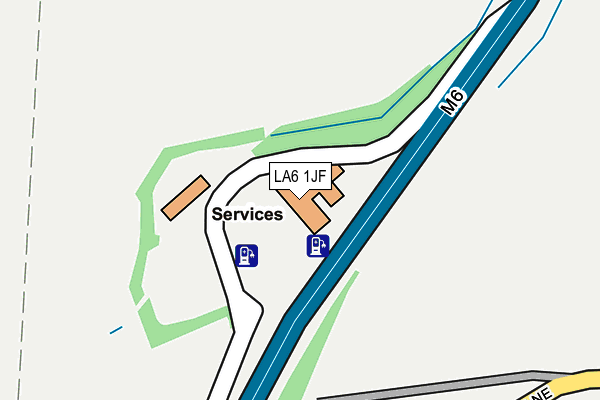
LA6 1JF is located in the Burton and Holme electoral ward, within the unitary authority of Westmorland and Furness and the English Parliamentary constituency of Westmorland and Lonsdale. The Sub Integrated Care Board (ICB) Location is NHS Lancashire and South Cumbria ICB - 01K and the police force is Cumbria. This postcode has been in use since January 1980.


GetTheData
Source: OS OpenMap – Local (Ordnance Survey)
Source: OS VectorMap District (Ordnance Survey)
Licence: Open Government Licence (requires attribution)
| Easting | 352209 |
| Northing | 476178 |
| Latitude | 54.179156 |
| Longitude | -2.733711 |
GetTheData
Source: Open Postcode Geo
Licence: Open Government Licence
| Country | England |
| Postcode District | LA6 |
➜ See where LA6 is on a map | |
GetTheData
Source: Land Registry Price Paid Data
Licence: Open Government Licence
Elevation or altitude of LA6 1JF as distance above sea level:
| Metres | Feet | |
|---|---|---|
| Elevation | 60m | 197ft |
Elevation is measured from the approximate centre of the postcode, to the nearest point on an OS contour line from OS Terrain 50, which has contour spacing of ten vertical metres.
➜ How high above sea level am I? Find the elevation of your current position using your device's GPS.
GetTheData
Source: Open Postcode Elevation
Licence: Open Government Licence
| Ward | Burton And Holme |
| Constituency | Westmorland And Lonsdale |
GetTheData
Source: ONS Postcode Database
Licence: Open Government Licence
| Green Dragon Farm (A6070) | Burton-in-kendal | 727m |
| Green Dragon Farm (A6070) | Burton-in-kendal | 743m |
| The Square (Main Street) | Burton-in-kendal | 836m |
| The Square (Main Street) | Burton-in-kendal | 849m |
| Tanpits Lane (Main Street) | Burton-in-kendal | 1,040m |
| Silverdale Station | 4.7km |
GetTheData
Source: NaPTAN
Licence: Open Government Licence
GetTheData
Source: ONS Postcode Database
Licence: Open Government Licence


➜ Get more ratings from the Food Standards Agency
GetTheData
Source: Food Standards Agency
Licence: FSA terms & conditions
| Last Collection | |||
|---|---|---|---|
| Location | Mon-Fri | Sat | Distance |
| Burton Post Office | 16:45 | 11:00 | 892m |
| Holme Station | 16:00 | 08:30 | 1,115m |
| Holme Mill | 16:00 | 10:30 | 1,912m |
GetTheData
Source: Dracos
Licence: Creative Commons Attribution-ShareAlike
The below table lists the International Territorial Level (ITL) codes (formerly Nomenclature of Territorial Units for Statistics (NUTS) codes) and Local Administrative Units (LAU) codes for LA6 1JF:
| ITL 1 Code | Name |
|---|---|
| TLD | North West (England) |
| ITL 2 Code | Name |
| TLD1 | Cumbria |
| ITL 3 Code | Name |
| TLD12 | East Cumbria |
| LAU 1 Code | Name |
| E07000031 | South Lakeland |
GetTheData
Source: ONS Postcode Directory
Licence: Open Government Licence
The below table lists the Census Output Area (OA), Lower Layer Super Output Area (LSOA), and Middle Layer Super Output Area (MSOA) for LA6 1JF:
| Code | Name | |
|---|---|---|
| OA | E00097780 | |
| LSOA | E01019348 | South Lakeland 010A |
| MSOA | E02004024 | South Lakeland 010 |
GetTheData
Source: ONS Postcode Directory
Licence: Open Government Licence
| LA6 1HS | Station Lane | 678m |
| LA6 1HT | Station Lane | 724m |
| LA6 1HU | Drovers Way | 726m |
| LA6 1LG | 737m | |
| LA6 1LD | Toll Bar Court | 750m |
| LA6 1LQ | Main Street | 754m |
| LA6 1LL | Barton Row | 766m |
| LA6 1HX | Tanpits Lane | 772m |
| LA6 1LW | Main Street | 782m |
| LA6 1LP | Joness Yard | 783m |
GetTheData
Source: Open Postcode Geo; Land Registry Price Paid Data
Licence: Open Government Licence