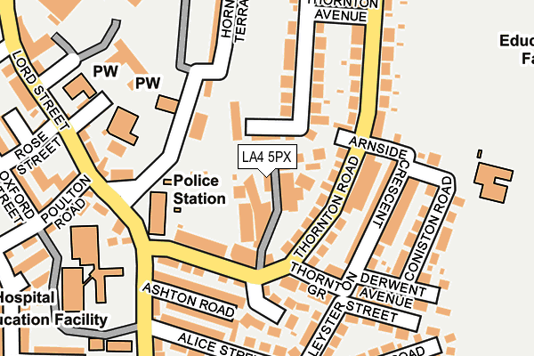
LA4 5PX lies on Birketts Place in Morecambe. LA4 5PX is located in the Poulton electoral ward, within the local authority district of Lancaster and the English Parliamentary constituency of Morecambe and Lunesdale. The Sub Integrated Care Board (ICB) Location is NHS Lancashire and South Cumbria ICB - 01K and the police force is Lancashire. This postcode has been in use since January 1980.


GetTheData
Source: OS OpenMap – Local (Ordnance Survey)
Source: OS VectorMap District (Ordnance Survey)
Licence: Open Government Licence (requires attribution)
| Easting | 344118 |
| Northing | 464542 |
| Latitude | 54.073771 |
| Longitude | -2.855501 |
GetTheData
Source: Open Postcode Geo
Licence: Open Government Licence
| Street | Birketts Place |
| Town/City | Morecambe |
| Country | England |
| Postcode District | LA4 |
➜ See where LA4 is on a map ➜ Where is Morecambe? | |
GetTheData
Source: Land Registry Price Paid Data
Licence: Open Government Licence
Elevation or altitude of LA4 5PX as distance above sea level:
| Metres | Feet | |
|---|---|---|
| Elevation | 10m | 33ft |
Elevation is measured from the approximate centre of the postcode, to the nearest point on an OS contour line from OS Terrain 50, which has contour spacing of ten vertical metres.
➜ How high above sea level am I? Find the elevation of your current position using your device's GPS.
GetTheData
Source: Open Postcode Elevation
Licence: Open Government Licence
| Ward | Poulton |
| Constituency | Morecambe And Lunesdale |
GetTheData
Source: ONS Postcode Database
Licence: Open Government Licence
7, BIRKETTS PLACE, MORECAMBE, LA4 5PX 2011 24 MAR £100,000 |
6, BIRKETTS PLACE, MORECAMBE, LA4 5PX 1997 7 NOV £33,000 |
GetTheData
Source: HM Land Registry Price Paid Data
Licence: Contains HM Land Registry data © Crown copyright and database right 2025. This data is licensed under the Open Government Licence v3.0.
| Health Centre (Raby Street) | Morecambe | 166m |
| Health Centre (Thornton Road) | Morecambe | 188m |
| Poulton Le Sands Ceps (Church Lane) | Morecambe | 215m |
| Lord Street | Morecambe | 368m |
| High School (Dallam Avenue) | Morecambe | 370m |
| Morecambe Station | 1km |
| Bare Lane Station | 1.3km |
| Lancaster Station | 4.2km |
GetTheData
Source: NaPTAN
Licence: Open Government Licence
GetTheData
Source: ONS Postcode Database
Licence: Open Government Licence


➜ Get more ratings from the Food Standards Agency
GetTheData
Source: Food Standards Agency
Licence: FSA terms & conditions
| Last Collection | |||
|---|---|---|---|
| Location | Mon-Fri | Sat | Distance |
| 68 Thornton Road | 17:00 | 11:15 | 112m |
| Euston Road | 16:30 | 12:15 | 320m |
| Poulton Road | 16:30 | 11:45 | 348m |
GetTheData
Source: Dracos
Licence: Creative Commons Attribution-ShareAlike
The below table lists the International Territorial Level (ITL) codes (formerly Nomenclature of Territorial Units for Statistics (NUTS) codes) and Local Administrative Units (LAU) codes for LA4 5PX:
| ITL 1 Code | Name |
|---|---|
| TLD | North West (England) |
| ITL 2 Code | Name |
| TLD4 | Lancashire |
| ITL 3 Code | Name |
| TLD44 | Lancaster and Wyre |
| LAU 1 Code | Name |
| E07000121 | Lancaster |
GetTheData
Source: ONS Postcode Directory
Licence: Open Government Licence
The below table lists the Census Output Area (OA), Lower Layer Super Output Area (LSOA), and Middle Layer Super Output Area (MSOA) for LA4 5PX:
| Code | Name | |
|---|---|---|
| OA | E00127590 | |
| LSOA | E01025140 | Lancaster 006E |
| MSOA | E02005226 | Lancaster 006 |
GetTheData
Source: ONS Postcode Directory
Licence: Open Government Licence
| LA4 5PR | Church Walk | 35m |
| LA4 5PG | Thornton Road | 43m |
| LA4 5QD | Victoria Mews | 67m |
| LA4 5PJ | Thornton Road | 83m |
| LA4 5PW | Arnside Crescent | 101m |
| LA4 5PH | Thornton Road | 107m |
| LA4 5PY | Thornton Crescent | 124m |
| LA4 5PU | Thornton Grove | 125m |
| LA4 5PP | Arnside Crescent | 132m |
| LA4 5PL | Thornton Road | 133m |
GetTheData
Source: Open Postcode Geo; Land Registry Price Paid Data
Licence: Open Government Licence