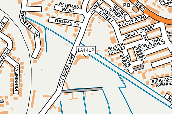
LA4 4UP is located in the Poulton electoral ward, within the local authority district of Lancaster and the English Parliamentary constituency of Morecambe and Lunesdale. The Sub Integrated Care Board (ICB) Location is NHS Lancashire and South Cumbria ICB - 01K and the police force is Lancashire. This postcode has been in use since January 1980.


GetTheData
Source: OS OpenMap – Local (Ordnance Survey)
Source: OS VectorMap District (Ordnance Survey)
Licence: Open Government Licence (requires attribution)
| Easting | 344036 |
| Northing | 464007 |
| Latitude | 54.068954 |
| Longitude | -2.856655 |
GetTheData
Source: Open Postcode Geo
Licence: Open Government Licence
| Country | England |
| Postcode District | LA4 |
➜ See where LA4 is on a map ➜ Where is Morecambe? | |
GetTheData
Source: Land Registry Price Paid Data
Licence: Open Government Licence
Elevation or altitude of LA4 4UP as distance above sea level:
| Metres | Feet | |
|---|---|---|
| Elevation | 10m | 33ft |
Elevation is measured from the approximate centre of the postcode, to the nearest point on an OS contour line from OS Terrain 50, which has contour spacing of ten vertical metres.
➜ How high above sea level am I? Find the elevation of your current position using your device's GPS.
GetTheData
Source: Open Postcode Elevation
Licence: Open Government Licence
| Ward | Poulton |
| Constituency | Morecambe And Lunesdale |
GetTheData
Source: ONS Postcode Database
Licence: Open Government Licence
| County Garage (Lancaster Road) | Morecambe | 194m |
| County Garage (Lancaster Road) | Morecambe | 199m |
| Euston Road School (Euston Road) | Morecambe | 388m |
| Euston Road School (Queen Street) | Morecambe | 403m |
| Euston Road School (Euston Road) | Morecambe | 406m |
| Morecambe Station | 0.8km |
| Bare Lane Station | 1.5km |
| Lancaster Station | 3.9km |
GetTheData
Source: NaPTAN
Licence: Open Government Licence
GetTheData
Source: ONS Postcode Database
Licence: Open Government Licence


➜ Get more ratings from the Food Standards Agency
GetTheData
Source: Food Standards Agency
Licence: FSA terms & conditions
| Last Collection | |||
|---|---|---|---|
| Location | Mon-Fri | Sat | Distance |
| Lancaster Road Post Office | 16:30 | 12:00 | 193m |
| Euston Road | 16:30 | 12:15 | 308m |
| 12 Lowlands Road | 16:30 | 11:15 | 340m |
GetTheData
Source: Dracos
Licence: Creative Commons Attribution-ShareAlike
The below table lists the International Territorial Level (ITL) codes (formerly Nomenclature of Territorial Units for Statistics (NUTS) codes) and Local Administrative Units (LAU) codes for LA4 4UP:
| ITL 1 Code | Name |
|---|---|
| TLD | North West (England) |
| ITL 2 Code | Name |
| TLD4 | Lancashire |
| ITL 3 Code | Name |
| TLD44 | Lancaster and Wyre |
| LAU 1 Code | Name |
| E07000121 | Lancaster |
GetTheData
Source: ONS Postcode Directory
Licence: Open Government Licence
The below table lists the Census Output Area (OA), Lower Layer Super Output Area (LSOA), and Middle Layer Super Output Area (MSOA) for LA4 4UP:
| Code | Name | |
|---|---|---|
| OA | E00127588 | |
| LSOA | E01025138 | Lancaster 006C |
| MSOA | E02005226 | Lancaster 006 |
GetTheData
Source: ONS Postcode Directory
Licence: Open Government Licence
| LA4 5SY | James Street | 49m |
| LA4 5SZ | Out Moss Lane | 76m |
| LA4 5SX | Charles Street | 100m |
| LA4 5TA | Bateman Road | 108m |
| LA4 5TF | Thomas Grove | 112m |
| LA4 5SU | George Street | 120m |
| LA4 5TE | James Street | 121m |
| LA4 5SR | Buxton Street | 131m |
| LA4 5SP | Bristol Street | 135m |
| LA4 5ST | Whitby Road | 153m |
GetTheData
Source: Open Postcode Geo; Land Registry Price Paid Data
Licence: Open Government Licence