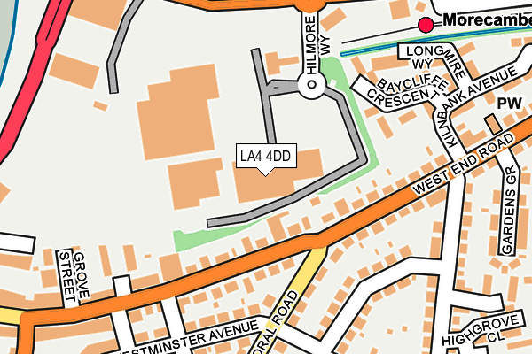
LA4 4DD is located in the West End electoral ward, within the local authority district of Lancaster and the English Parliamentary constituency of Morecambe and Lunesdale. The Sub Integrated Care Board (ICB) Location is NHS Lancashire and South Cumbria ICB - 01K and the police force is Lancashire. This postcode has been in use since June 2008.


GetTheData
Source: OS OpenMap – Local (Ordnance Survey)
Source: OS VectorMap District (Ordnance Survey)
Licence: Open Government Licence (requires attribution)
| Easting | 343000 |
| Northing | 463982 |
| Latitude | 54.068605 |
| Longitude | -2.872481 |
GetTheData
Source: Open Postcode Geo
Licence: Open Government Licence
| Country | England |
| Postcode District | LA4 |
➜ See where LA4 is on a map ➜ Where is Morecambe? | |
GetTheData
Source: Land Registry Price Paid Data
Licence: Open Government Licence
Elevation or altitude of LA4 4DD as distance above sea level:
| Metres | Feet | |
|---|---|---|
| Elevation | 10m | 33ft |
Elevation is measured from the approximate centre of the postcode, to the nearest point on an OS contour line from OS Terrain 50, which has contour spacing of ten vertical metres.
➜ How high above sea level am I? Find the elevation of your current position using your device's GPS.
GetTheData
Source: Open Postcode Elevation
Licence: Open Government Licence
| Ward | West End |
| Constituency | Morecambe And Lunesdale |
GetTheData
Source: ONS Postcode Database
Licence: Open Government Licence
| Morrisons (Central Drive) | Morecambe | 198m |
| Festival Market (Central Drive) | Morecambe | 213m |
| Albany Road (Westminster Avenue) | West End | 222m |
| Bus Station (Central Drive) | Morecambe | 223m |
| Westminster Avenue | West End | 240m |
| Morecambe Station | 0.3km |
| Bare Lane Station | 2.5km |
| Heysham Port Station | 4.8km |
GetTheData
Source: NaPTAN
Licence: Open Government Licence
GetTheData
Source: ONS Postcode Database
Licence: Open Government Licence


➜ Get more ratings from the Food Standards Agency
GetTheData
Source: Food Standards Agency
Licence: FSA terms & conditions
| Last Collection | |||
|---|---|---|---|
| Location | Mon-Fri | Sat | Distance |
| Morrisons | 16:45 | 11:30 | 119m |
| West End Road | 16:45 | 12:15 | 311m |
| Woodhill Lane | 16:30 | 12:00 | 359m |
GetTheData
Source: Dracos
Licence: Creative Commons Attribution-ShareAlike
The below table lists the International Territorial Level (ITL) codes (formerly Nomenclature of Territorial Units for Statistics (NUTS) codes) and Local Administrative Units (LAU) codes for LA4 4DD:
| ITL 1 Code | Name |
|---|---|
| TLD | North West (England) |
| ITL 2 Code | Name |
| TLD4 | Lancashire |
| ITL 3 Code | Name |
| TLD44 | Lancaster and Wyre |
| LAU 1 Code | Name |
| E07000121 | Lancaster |
GetTheData
Source: ONS Postcode Directory
Licence: Open Government Licence
The below table lists the Census Output Area (OA), Lower Layer Super Output Area (LSOA), and Middle Layer Super Output Area (MSOA) for LA4 4DD:
| Code | Name | |
|---|---|---|
| OA | E00127436 | |
| LSOA | E01025112 | Lancaster 006A |
| MSOA | E02005226 | Lancaster 006 |
GetTheData
Source: ONS Postcode Directory
Licence: Open Government Licence
| LA4 4DY | West End Road | 103m |
| LA4 4DZ | West End Road | 128m |
| LA4 4JN | Balmoral Road | 135m |
| LA4 4EA | West End Road | 138m |
| LA4 4EB | West End Road | 151m |
| LA4 4DU | Westminster Avenue | 167m |
| LA4 4EQ | Baycliffe Crescent | 169m |
| LA4 4LD | Regent Park Grove | 183m |
| LA4 4DS | Cedar Street | 210m |
| LA4 4NE | Sandringham Road | 234m |
GetTheData
Source: Open Postcode Geo; Land Registry Price Paid Data
Licence: Open Government Licence