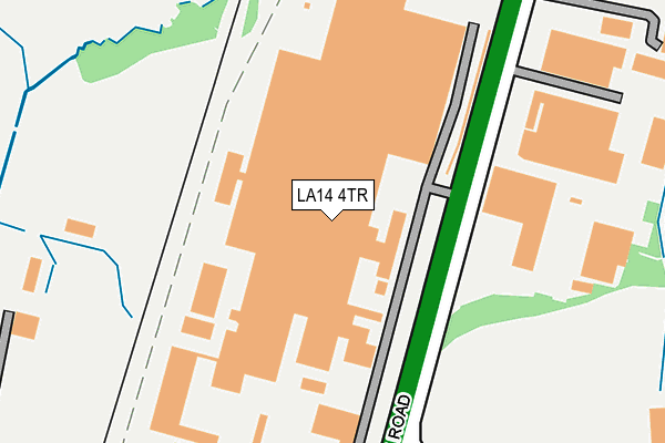
LA14 4TR is located in the Ormsgill and Parkside electoral ward, within the unitary authority of Westmorland and Furness and the English Parliamentary constituency of Barrow and Furness. The Sub Integrated Care Board (ICB) Location is NHS Lancashire and South Cumbria ICB - 01K and the police force is Cumbria. This postcode has been in use since March 2008.


GetTheData
Source: OS OpenMap – Local (Ordnance Survey)
Source: OS VectorMap District (Ordnance Survey)
Licence: Open Government Licence (requires attribution)
| Easting | 319569 |
| Northing | 472689 |
| Latitude | 54.143711 |
| Longitude | -3.232760 |
GetTheData
Source: Open Postcode Geo
Licence: Open Government Licence
| Country | England |
| Postcode District | LA14 |
➜ See where LA14 is on a map ➜ Where is Barrow-in-Furness? | |
GetTheData
Source: Land Registry Price Paid Data
Licence: Open Government Licence
Elevation or altitude of LA14 4TR as distance above sea level:
| Metres | Feet | |
|---|---|---|
| Elevation | 20m | 66ft |
Elevation is measured from the approximate centre of the postcode, to the nearest point on an OS contour line from OS Terrain 50, which has contour spacing of ten vertical metres.
➜ How high above sea level am I? Find the elevation of your current position using your device's GPS.
GetTheData
Source: Open Postcode Elevation
Licence: Open Government Licence
| Ward | Ormsgill And Parkside |
| Constituency | Barrow And Furness |
GetTheData
Source: ONS Postcode Database
Licence: Open Government Licence
| Kimberly Clark (Park Road) | Sowerby | 174m |
| Kimberly Clark (Park Road) | Sowerby | 224m |
| Turning Circle (Sikemeadow) | Ormsgill | 423m |
| Sikemeadow (Middlefield) | Ormsgill | 440m |
| Top Of Sowerby Avenue (Bank Lane) | Ormsgill | 512m |
| Barrow-in-Furness Station | 2.8km |
| Dalton Station | 3.7km |
| Roose Station | 4km |
GetTheData
Source: NaPTAN
Licence: Open Government Licence
GetTheData
Source: ONS Postcode Database
Licence: Open Government Licence


➜ Get more ratings from the Food Standards Agency
GetTheData
Source: Food Standards Agency
Licence: FSA terms & conditions
| Last Collection | |||
|---|---|---|---|
| Location | Mon-Fri | Sat | Distance |
| Lakes Parade | 17:30 | 11:15 | 904m |
| Schneider Road | 17:30 | 10:45 | 1,803m |
| Victoria Avenue | 17:30 | 11:00 | 2,473m |
GetTheData
Source: Dracos
Licence: Creative Commons Attribution-ShareAlike
The below table lists the International Territorial Level (ITL) codes (formerly Nomenclature of Territorial Units for Statistics (NUTS) codes) and Local Administrative Units (LAU) codes for LA14 4TR:
| ITL 1 Code | Name |
|---|---|
| TLD | North West (England) |
| ITL 2 Code | Name |
| TLD1 | Cumbria |
| ITL 3 Code | Name |
| TLD11 | West Cumbria |
| LAU 1 Code | Name |
| E07000027 | Barrow-in-Furness |
GetTheData
Source: ONS Postcode Directory
Licence: Open Government Licence
The below table lists the Census Output Area (OA), Lower Layer Super Output Area (LSOA), and Middle Layer Super Output Area (MSOA) for LA14 4TR:
| Code | Name | |
|---|---|---|
| OA | E00096870 | |
| LSOA | E01019164 | Barrow-in-Furness 004C |
| MSOA | E02003980 | Barrow-in-Furness 004 |
GetTheData
Source: ONS Postcode Directory
Licence: Open Government Licence
| LA14 4EE | Middle Field | 412m |
| LA14 4DR | Whinsfield Avenue | 430m |
| LA14 4DY | Sikemeadow | 439m |
| LA14 4DN | Bank Lane | 458m |
| LA14 4DX | Sandscale Terrace | 469m |
| LA14 4DZ | Sikemeadow | 481m |
| LA14 4QS | Park Road | 513m |
| LA14 4DS | Whinsfield Avenue | 520m |
| LA14 4DT | Meetings View | 535m |
| LA14 4TJ | Lodge Green | 542m |
GetTheData
Source: Open Postcode Geo; Land Registry Price Paid Data
Licence: Open Government Licence