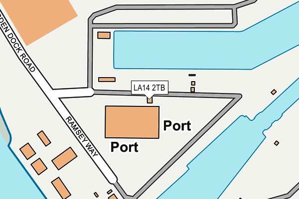
LA14 2TB is located in the Old Barrow and Hindpool electoral ward, within the unitary authority of Westmorland and Furness and the English Parliamentary constituency of Barrow and Furness. The Sub Integrated Care Board (ICB) Location is NHS Lancashire and South Cumbria ICB - 01K and the police force is Cumbria. This postcode has been in use since January 1980.


GetTheData
Source: OS OpenMap – Local (Ordnance Survey)
Source: OS VectorMap District (Ordnance Survey)
Licence: Open Government Licence (requires attribution)
| Easting | 319916 |
| Northing | 467503 |
| Latitude | 54.097175 |
| Longitude | -3.226069 |
GetTheData
Source: Open Postcode Geo
Licence: Open Government Licence
| Country | England |
| Postcode District | LA14 |
➜ See where LA14 is on a map ➜ Where is Barrow-in-Furness? | |
GetTheData
Source: Land Registry Price Paid Data
Licence: Open Government Licence
Elevation or altitude of LA14 2TB as distance above sea level:
| Metres | Feet | |
|---|---|---|
| Elevation | 10m | 33ft |
Elevation is measured from the approximate centre of the postcode, to the nearest point on an OS contour line from OS Terrain 50, which has contour spacing of ten vertical metres.
➜ How high above sea level am I? Find the elevation of your current position using your device's GPS.
GetTheData
Source: Open Postcode Elevation
Licence: Open Government Licence
| Ward | Old Barrow And Hindpool |
| Constituency | Barrow And Furness |
GetTheData
Source: ONS Postcode Database
Licence: Open Government Licence
| Tea House (Anchor Road) | Barrow Island | 602m |
| St Johns Church (Island Road) | Barrow Island | 720m |
| The Devonshire (Ramsden Dock Square) | Barrow Island | 722m |
| Coffee House (Michaelson Road) | Barrow Island | 917m |
| Coffee House (Michaelson Road) | Barrow Island | 923m |
| Barrow-in-Furness Station | 2.4km |
| Roose Station | 2.9km |
GetTheData
Source: NaPTAN
Licence: Open Government Licence
GetTheData
Source: ONS Postcode Database
Licence: Open Government Licence


➜ Get more ratings from the Food Standards Agency
GetTheData
Source: Food Standards Agency
Licence: FSA terms & conditions
| Last Collection | |||
|---|---|---|---|
| Location | Mon-Fri | Sat | Distance |
| Furness House Post Office | 18:00 | 12:30 | 1,558m |
| Town Hall | 18:00 | 11:00 | 1,676m |
| Duke Street Post Office | 17:30 | 12:15 | 1,880m |
GetTheData
Source: Dracos
Licence: Creative Commons Attribution-ShareAlike
| Risk of LA14 2TB flooding from rivers and sea | Very Low |
| ➜ LA14 2TB flood map | |
GetTheData
Source: Open Flood Risk by Postcode
Licence: Open Government Licence
The below table lists the International Territorial Level (ITL) codes (formerly Nomenclature of Territorial Units for Statistics (NUTS) codes) and Local Administrative Units (LAU) codes for LA14 2TB:
| ITL 1 Code | Name |
|---|---|
| TLD | North West (England) |
| ITL 2 Code | Name |
| TLD1 | Cumbria |
| ITL 3 Code | Name |
| TLD11 | West Cumbria |
| LAU 1 Code | Name |
| E07000027 | Barrow-in-Furness |
GetTheData
Source: ONS Postcode Directory
Licence: Open Government Licence
The below table lists the Census Output Area (OA), Lower Layer Super Output Area (LSOA), and Middle Layer Super Output Area (MSOA) for LA14 2TB:
| Code | Name | |
|---|---|---|
| OA | E00096730 | |
| LSOA | E01019138 | Barrow-in-Furness 010A |
| MSOA | E02003986 | Barrow-in-Furness 010 |
GetTheData
Source: ONS Postcode Directory
Licence: Open Government Licence
| LA14 2QX | Afton Street | 481m |
| LA14 2QY | Ayr Street | 485m |
| LA14 2QU | Annan Street | 488m |
| LA14 2ST | St Andrews Street | 496m |
| LA14 2TA | Aberdare Street | 501m |
| LA14 2TR | Ramsden Dock Road | 504m |
| LA14 2QT | Athol Street | 531m |
| LA14 2SZ | Andover Street | 540m |
| LA14 2SX | Ancaster Street | 540m |
| LA14 2QS | Abercorn Street | 558m |
GetTheData
Source: Open Postcode Geo; Land Registry Price Paid Data
Licence: Open Government Licence