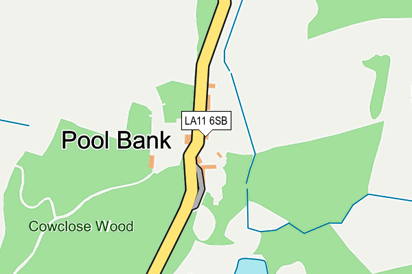
LA11 6SB is in Witherslack, Grange-over-sands. LA11 6SB is located in the Bowness and Lyth electoral ward, within the unitary authority of Westmorland and Furness and the English Parliamentary constituency of Westmorland and Lonsdale. The Sub Integrated Care Board (ICB) Location is NHS Lancashire and South Cumbria ICB - 01K and the police force is Cumbria. This postcode has been in use since January 1980.


GetTheData
Source: OS OpenMap – Local (Ordnance Survey)
Source: OS VectorMap District (Ordnance Survey)
Licence: Open Government Licence (requires attribution)
| Easting | 343023 |
| Northing | 487842 |
| Latitude | 54.283021 |
| Longitude | -2.876654 |
GetTheData
Source: Open Postcode Geo
Licence: Open Government Licence
| Locality | Witherslack |
| Town/City | Grange-over-sands |
| Country | England |
| Postcode District | LA11 |
➜ See where LA11 is on a map ➜ Where is Pool Bank? | |
GetTheData
Source: Land Registry Price Paid Data
Licence: Open Government Licence
Elevation or altitude of LA11 6SB as distance above sea level:
| Metres | Feet | |
|---|---|---|
| Elevation | 40m | 131ft |
Elevation is measured from the approximate centre of the postcode, to the nearest point on an OS contour line from OS Terrain 50, which has contour spacing of ten vertical metres.
➜ How high above sea level am I? Find the elevation of your current position using your device's GPS.
GetTheData
Source: Open Postcode Elevation
Licence: Open Government Licence
| Ward | Bowness And Lyth |
| Constituency | Westmorland And Lonsdale |
GetTheData
Source: ONS Postcode Database
Licence: Open Government Licence
| Percentage of properties with Next Generation Access | 90.0% |
| Percentage of properties with Superfast Broadband | 90.0% |
| Percentage of properties with Ultrafast Broadband | 90.0% |
| Percentage of properties with Full Fibre Broadband | 90.0% |
Superfast Broadband is between 30Mbps and 300Mbps
Ultrafast Broadband is > 300Mbps
| Percentage of properties unable to receive 2Mbps | 10.0% |
| Percentage of properties unable to receive 5Mbps | 10.0% |
| Percentage of properties unable to receive 10Mbps | 10.0% |
| Percentage of properties unable to receive 30Mbps | 10.0% |
GetTheData
Source: Ofcom
Licence: Ofcom Terms of Use (requires attribution)
GetTheData
Source: ONS Postcode Database
Licence: Open Government Licence


➜ Get more ratings from the Food Standards Agency
GetTheData
Source: Food Standards Agency
Licence: FSA terms & conditions
| Last Collection | |||
|---|---|---|---|
| Location | Mon-Fri | Sat | Distance |
| Witherslack Hall, Witherslack | 16:00 | 10:30 | 2,009m |
| Thorpinsty | 16:00 | 10:30 | 2,296m |
| Dawson Fold Farm | 11:30 | 09:00 | 2,852m |
GetTheData
Source: Dracos
Licence: Creative Commons Attribution-ShareAlike
The below table lists the International Territorial Level (ITL) codes (formerly Nomenclature of Territorial Units for Statistics (NUTS) codes) and Local Administrative Units (LAU) codes for LA11 6SB:
| ITL 1 Code | Name |
|---|---|
| TLD | North West (England) |
| ITL 2 Code | Name |
| TLD1 | Cumbria |
| ITL 3 Code | Name |
| TLD12 | East Cumbria |
| LAU 1 Code | Name |
| E07000031 | South Lakeland |
GetTheData
Source: ONS Postcode Directory
Licence: Open Government Licence
The below table lists the Census Output Area (OA), Lower Layer Super Output Area (LSOA), and Middle Layer Super Output Area (MSOA) for LA11 6SB:
| Code | Name | |
|---|---|---|
| OA | E00097985 | |
| LSOA | E01019381 | South Lakeland 007B |
| MSOA | E02004021 | South Lakeland 007 |
GetTheData
Source: ONS Postcode Directory
Licence: Open Government Licence
| LA11 6NQ | 1218m | |
| LA11 6NH | 1268m | |
| LA8 8JJ | 1453m | |
| LA11 6NT | 1511m | |
| LA8 8JL | 1525m | |
| LA11 6NU | 1739m | |
| LA11 6NL | 1793m | |
| LA11 6NS | 1811m | |
| LA11 6NN | 2145m | |
| LA8 8JH | 2218m |
GetTheData
Source: Open Postcode Geo; Land Registry Price Paid Data
Licence: Open Government Licence